


Refine your search for walks in Refuge Chaligne
Refuge Chaligne walks


 From the Chaligne Refuge to the Mont Fallere Refuge via Pointe Chaligne
 Visorando Member
 7.08 mi
 +3,432 ft
 -1,969 ft
 6h 15
6h 15
 Difficult
 Departure from Gignod (Aosta Valley)
The second stage of the Tour du Mont Fallere promises a day of stunning views. Once you’ve completed the climb up to the ridges, the path alternates between descents and ascents, offering panoramic views of the Matterhorn to begin with, followed by the entire Aosta Valley and the peaks along the border.
From Étroubles to the Chaligne refuge
 6.07 mi
+2,756 ft
-571 ft
5h 10
6.07 mi
+2,756 ft
-571 ft
5h 10
 Moderate
Departure from Étroubles (Aosta Valley)
Moderate
Departure from Étroubles (Aosta Valley)
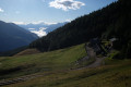
First day of the Tour du Mont Fallere. It’s a fairly quick day’s climb, mainly through woodland, to reach the Chaligne refuge. The route alternates between quiet forest tracks and some good, steeper sections of climb, with no technical difficulties.
Walks near Refuge Chaligne
From the Mont Fallère Refuge to Étroubles via Mont Vertosan
 8.25 mi
+1,371 ft
-5,056 ft
5h 00
Moderate
Departure from Saint-Pierre (Aosta Valley)
8.25 mi
+1,371 ft
-5,056 ft
5h 00
Moderate
Departure from Saint-Pierre (Aosta Valley)
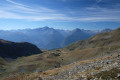
The final day of the Tour du Mont Fallere. The first part of the day involves climbing to the Col Fenêtre, followed by a bonus ascent to the summit of Monte di Vertosan (3,821 m) for an exceptional 360° panorama (Mont Blanc – Grand Combin – Matterhorn – Gran Paradiso).
This is followed by a long descent, with a fairly steep, winding first section, then a fast, rolling track through the forest to round off the circular tour.
Saint-Rhemy - Courmayeur
 Association / Club / Walk leader18.44 mi
+5,725 ft
-7,064 ft
13h 30
Association / Club / Walk leader18.44 mi
+5,725 ft
-7,064 ft
13h 30
 Very difficult
Departure from Saint-Rhémy-en-Bosses (Aosta Valley)
Very difficult
Departure from Saint-Rhémy-en-Bosses (Aosta Valley)
It’s the last day. The descent from the Col de Malatra is magnificent. It’s the last pass at almost 3,000 metres. You can see the path from afar, winding up the mountainside. After that, the solitude will be over. We rejoin the TMB from the Bonatti Refuge and its throng of hikers. The descent towards Courmayeur is superb, but once you reach the tarmac, it’s a very long way.
Saint-Rhémy-en-Bosses - Ollomont
 12.27 mi
+4,757 ft
-5,423 ft
9h 45
Very difficult
Departure from Saint-Rhémy-en-Bosses (Aosta Valley)
12.27 mi
+4,757 ft
-5,423 ft
9h 45
Very difficult
Departure from Saint-Rhémy-en-Bosses (Aosta Valley)
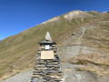
Today's stage uses the "TDC" trail, which is also a section of the Alta Via N°1 of the Aosta Valley and the Sentiero Italia Tappa 11.
Hike with a brief description, to be followed with the Visorando app.
Ollomont – Saint-Rhémy
11.82 mi
+5,410 ft
-4,649 ft
10h 10
Very difficult
Departure from Ollomont (Aosta Valley)
An average day on paper, but the fatigue is setting in. But it’s the penultimate day. The route is still clearly marked, so we don’t waste too much time getting lost. A stop at the Refuge de Champillon is a must. There’s a climb through the fields. The Col de Champillon is the last major pass before the finish.
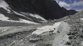
A route around the Combins massif
 46.50 mi
+18,724 ft
-19,944 ft
7 days
Difficult
Departure from Saint-Rhémy-en-Bosses (Aosta Valley)
46.50 mi
+18,724 ft
-19,944 ft
7 days
Difficult
Departure from Saint-Rhémy-en-Bosses (Aosta Valley)
This seven-stage trek around Les Combins differs in a few ways from the classic tour. It allows you to hike in complete tranquillity in a sumptuous and diverse setting between the mid- and high-mountain ranges, where you will climb to over 3,000 metres. You will encounter dozens of marmots, ibex and herds of Herens cows. A few remnants of glaciers add to the alpine atmosphere of this trek, whose highest point is the Col du Mont Gelé at 3,144 metres.
Important note.Plan for two bus journeys on this route.
Day 2: to reach Liddes on thesecond day from the Grand-Saint-Bernard Pass, see the timetable hereDay 7: for the return journey from Ollemont to Saint-Rhémy-en-Bosses, see the bus timetable here
Saint-Rhémy-en-Bosses - Grand Saint-Bernard Hospice
 3.03 mi
+2,487 ft
-36 ft
3h 35
Moderate
Departure from Saint-Rhémy-en-Bosses (Aosta Valley)
3.03 mi
+2,487 ft
-36 ft
3h 35
Moderate
Departure from Saint-Rhémy-en-Bosses (Aosta Valley)
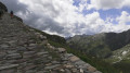
An easy warm-up walk in preparation for a 3/4 tour of Les Combins. From the car park located after Saint-Rhémy, in a hairpin bend at an altitude of 1,730 m, coming from Saint-Rhémy-en Bosses, on Route 27 of the Col du Grand Saint-Bernard. The route follows the Via Alpina Red R117.
Ollomont - Dzovennoz
 9.22 mi
+4,180 ft
-3,724 ft
7h 55
Very difficult
Departure from Ollomont (Aosta Valley)
9.22 mi
+4,180 ft
-3,724 ft
7h 55
Very difficult
Departure from Ollomont (Aosta Valley)
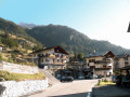
We leave the "TDC" to follow Alta Via No. 1 in the Aosta Valley until it crosses the road leading to Bionaz. In the old village, above the church and near a fountain, the trail marked Col de Breuson (Brison) begins.
Hike with a brief description, to be followed with the Visorando app.
Dzovennoz - Prarayer mountain hut
 10.55 mi
+4,554 ft
-3,136 ft
8h 50
Very difficult
Departure from Bionaz (Aosta Valley)
10.55 mi
+4,554 ft
-3,136 ft
8h 50
Very difficult
Departure from Bionaz (Aosta Valley)
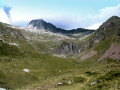
Signposting: trails No. 1, No. 2 then No. 3. High-altitude route from the Alpe de la Tsa to the Combe de Grand Chamin (fixed routes).
From the Cabane du Vélan to Bourg-Saint-Pierre
 4.57 mi
+282 ft
-3,471 ft
2h 20
Difficult
Departure from Bourg-Saint-Pierre (Valais)
4.57 mi
+282 ft
-3,471 ft
2h 20
Difficult
Departure from Bourg-Saint-Pierre (Valais)
The second stage of this hike starts at the Cabane du Vélan and follows the right bank of the Valsorey torrent.
Crête Sèche Refuge - Ollomont
7.76 mi
+2,713 ft
-6,086 ft
5h 55
Very difficult
Departure from Bionaz (Aosta Valley)
This last stage takes place in an alpine setting. It justifies the choice of this alternative to the classic Tour des Combins. Unfortunately, the consequences of climate change are evident. The glaciers mentioned on the map no longer exist. Only rock piles remain. From the Col du Mont Gelé, the highest point of this trek, you must pay close attention to the path marked by cairns to follow on the descent. The position of these cairns is sometimes erratic. The end of this stage ends with a long and very steep descent, which can be avoided by staying on the pastoral road.