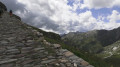
From the Mont Fallère Refuge to Étroubles via Mont Vertosan

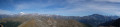
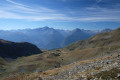
The final day of the Tour du Mont Fallere. The first part of the day involves climbing to the Col Fenêtre, followed by a bonus ascent to the summit of Monte di Vertosan (3,821 m) for an exceptional 360° panorama (Mont Blanc – Grand Combin – Matterhorn – Gran Paradiso).

This is followed by a long descent, with a fairly steep, winding first section, then a fast, rolling track through the forest to round off the circular tour.

Details

107642273
Creation:
Last update:
Last review:
  • Walking
    Activity: Walking
  • ↔
    Distance: 8.25 mi
  • ◔
    Average duration: 5h 00 
  • ▲
    Difficulty: Moderate

  • ⚐
    Back to start: No
  • ↗
    Ascent: + 1,371 ft
  • ↘
    Descent: - 5,056 ft

  • ▲
    Highest point: 9,193 ft
  • ▼
    Lowest point: 4,147 ft

Photos

Description of the walk

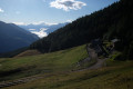
(S) Take the path that starts behind the refuge, heading towards Col Fenêtre, on the right at the barn (the other path goes there too).

(1) Continue the ascent along the path that climbs gently up the valley (north-north-west), leaving the steep, zigzagging path on the right (towards Lac Mort).

(3) Cross Col Fenêtre and continue along the ridge (west-south-west) to reach the foot of Monte di Versotan, on its northern slope.

(3) Turn left and climb to the summit, which offers a 360° panorama.

(4) Descend via the same route.

(3) Turn left to begin the descent down the north-western slope.

(5) At a junction, take the path on the right which winds its way down. You’ll reach the Tsa de Flassin mountain pasture, which you can see in the distance.

(6) Here, you’ll join a track; follow it to the right as it descends. Further down, walk alongside a forest.

(7) You’ll come out onto a road; follow it to the right.

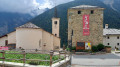
(8) At the fork in the road, turn right, passing a campsite on your left. Join a track and cross through the forest to Etroubles (E).

Waypoints

  1. S : mi 0 - alt. 7,838 ft - Rifugio Fallère
  2. 1 : mi 0.51 - alt. 8,235 ft - Junction
  3. 2 : mi 1.12 - alt. 8,970 ft - Col Fenêtre (2728 m)
  4. 3 : mi 1.31 - alt. 9,157 ft - Unnamed pass
  5. 4 : mi 1.36 - alt. 9,190 ft - Monte di Vertosan (2821 m)
  6. 5 : mi 1.55 - alt. 8,927 ft - Junction
  7. 6 : mi 2.89 - alt. 7,398 ft - Alpage – Trail junction
  8. 7 : mi 6.89 - alt. 4,406 ft - Junction with the road
  9. 8 : mi 7.14 - alt. 4,318 ft - Fourche – Campsite
  10. E : mi 8.25 - alt. 4,147 ft - Étroubles

Notes

The route is marked with TMF signs throughout the day.

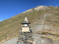
A return trip to Monte di Vertosan over rocky terrain, marked with cairns and easily visible in good weather.

There are no water points on the route before St Oyen (20 minutes from the finish).

Although it involves a significant elevation gain, the descent is fairly straightforward, with a more technical first section over rocky terrain and a fast-flowing second section on a smooth track.

Worth a visit

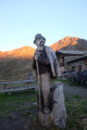
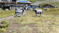
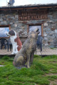
(S) Sculptures around the Mont Fallere refuge

(4) 360° panoramic view from the summit of Monte du Vertosan (3,821 m), with views including Mont Blanc, the Grand Combin, the Matterhorn, Gran Paradiso, etc.

Other walks in the area

For more walks, use our search engine .

The GPS track and description are the property of this route's author. Please do not copy them without permission.