Étroubles – Chaligne Mountain Hut

First day of the Tour du Mont Fallere. It’s a fairly quick day’s climb, mainly through woodland, to reach the Chaligne refuge. The route alternates between quiet forest tracks and some good, steeper sections of climb, with no technical difficulties.

Details

107641280
Creation:
Last update:
Last review:
  • Walking
    Activity: Walking
  • ↔
    Distance: 6.07 mi
  • ◔
    Average duration: 5h 10 
  • ▲
    Difficulty: Moderate

  • ⚐
    Back to start: No
  • ↗
    Ascent: + 2,756 ft
  • ↘
    Descent: - 571 ft

  • ▲
    Highest point: 6,440 ft
  • ▼
    Lowest point: 4,147 ft

Photos

Description of the walk

Head to the village of Étroubles, between Aosta and the Great St Bernard Pass. There is a large car park near a mini-market and the Tunnel Campsite in particular.

(S) To start, take the small road that runs past the campsite, following the signs and TMF markings. The road then turns into a forest track leading into the woods.

(1) At the junction, carry straight on along the forest track, which climbs gently.

(2) Take the path on the right, which climbs more steeply through the forest. There are numerous fallen trees in this section, but the path is generally well-cleared and well-marked. You’ll come to a forest track.

(3) Follow this track to the left along a flatter section, winding through a series of wide bends.

(4) Take the path that branches off to the right in a hairpin bend and climb more steeply again. Emerge from the forest: the view begins to open up.

(5) Continue along the track climbing to the left to go all the way round the ridge and, keeping straight ahead, you’ll soon reach the Chaligne refuge (E).

Waypoints

  1. S : mi 0 - alt. 4,147 ft - Etroubles – mini-market car park
  2. 1 : mi 0.9 - alt. 4,554 ft - Crossroads
  3. 2 : mi 1.4 - alt. 4,701 ft - Junction
  4. 3 : mi 2.12 - alt. 5,755 ft - Track
  5. 4 : mi 2.78 - alt. 5,436 ft - Junction of paths
  6. 5 : mi 3.73 - alt. 6,421 ft - Junction with track
  7. E : mi 6.07 - alt. 6,348 ft - Chaligne Refuge

Notes

(S) Easy parking at the start, with a small convenience shop, campsite and hotel nearby.

You can also start from Saint-Oyen, the village further upstream, which adds about twenty minutes to this stage (thereby shortening the final day of the walk).

TMF-marked route along the entire trail.

(E) A truly luxurious welcome at the Chaligne refuge.

The route took 3 hours 45 minutes with children (aged 7–11).

Worth a visit

Several wooden statues along the route and lovely décor at the refuge and all around it.

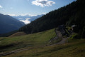
Lovely panoramic views of the Grand Combin, then of the final stretch and, from the Chaligne refuge, of the Matterhorn.

Chaligne Mountain Hut

Other walks in the area

For more walks, use our search engine .

The GPS track and description are the property of this route's author. Please do not copy them without permission.