Mont Fourchon

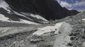
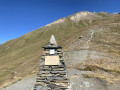
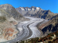
A lovely hike to an easily accessible summit. Close to the Great St Bernard Pass, Mont Fourchon lies on the ridge forming the border between Italy and Switzerland.

Details

26330280
Creation:
Last update:
Last review:
  • Walking
    Activity: Walking
  • ↔
    Distance: 2.82 mi
  • ◔
    Average duration: 2h 45 
  • ▲
    Difficulty: Moderate

  • ⚐
    Back to start: Yes
  • ↗
    Ascent: + 1,696 ft
  • ↘
    Descent: - 1,663 ft

  • ▲
    Highest point: 9,396 ft
  • ▼
    Lowest point: 7,736 ft

Photos

Description of the walk

The start and finish of this hike are on the SS27, approximately 1.2 km from the Great St Bernard Pass, on the Italian side. Car park opposite the Alpeggio lo Baou (cheese shop).

Markings: Trail no. 13c/13a (yellow)

(S/E) From the car park, cross the road and head towards the Alpeggio lo Baou. You will soon come to Trail No. 13a/13c, which branches off to the right. Begin the ascent alongside a stream and, after a flat section, you will reach a fork in the path.

(1) Take path no. 13c on the left towards Mont Fourchon and the Pain de Sucre. Climb gradually up a grassy slope until you reach another fork.

(2) Take the path on the left – the most obvious one, signposted 13c. You’ll now be walking through more rocky terrain with sections of scree, but the path remains easy to follow. You’ll reach a junction.

(3) Take the path on the right and climb to the summit of Mont Fourchon. Please note: the final fifteen metres are over rocky terrain and require you to use your hands.

(4) Enjoy the view from the summit. Head back down to the fork.

(3) Carry straight on along a lovely path leading to the Pain de Sucre and a new bivouac, recently built and inaugurated at the end of August 2022 in tribute to three people from the Aosta Valley who lost their lives in the mountains.

(5) Return to the junction.

(3) Continue the descent via the reverse route of the outward journey to the starting point (S/E).

Waypoints

  1. S/E : mi 0 - alt. 7,736 ft - Car park opposite the Alpeggio lo Baou
  2. 1 : mi 0.34 - alt. 8,182 ft - Junction with Sentiero 13c
  3. 2 : mi 1.04 - alt. 9,012 ft - Trail No. 13c
  4. 3 : mi 1.28 - alt. 9,318 ft - Junction for Bivouac and Mont Fourchon
  5. 4 : mi 1.36 - alt. 9,386 ft - Mont Fourchon (2901m)
  6. 5 : mi 1.5 - alt. 9,272 ft - New bivouac
  7. S/E : mi 2.82 - alt. 7,740 ft - Car park opposite the Alpeggio lo Baou

Notes

Hike completed by the author on 2 September 2022

A well-defined and clearly signposted path right up to the foot of the summit. Please note that the final fifteen metres are over rocky terrain and require you to use your hands.

? Good walking boots.
? No water available along the entire route.

Worth a visit

  • Grand Saint-Bernard Pass.
  • Fenêtre Lakes.
  • Fenêtre de Ferret.
  • Mont Fourchon.
  • Tête de Fenêtre.
  • Pain de Sucre.

Reviews and comments

4.3 / 5
Based on 3 reviews

Reliability of the description
4.3 / 5
Ease of following the route
4.7 / 5
Route interest
4 / 5
User 22850348

Overall rating : 4.3 / 5

Date of your route : Jul 06, 2025
Reliability of the description : ★★★★☆ Good
Ease of following the route : ★★★★★ Very good
Route interest : ★★★★☆ Good
Very busy route : No

The trail to Mt Fourchon is well marked. The last few metres to the summit are a little exposed.
There is a beautiful view from the summit.

Machine-translated

YOKE
YOKE

Overall rating : 4.7 / 5

Date of your route : Aug 07, 2024
Reliability of the description : ★★★★★ Very good
Ease of following the route : ★★★★★ Very good
Route interest : ★★★★☆ Good
Very busy route : No

A walk with no particular difficulties, apart from the end of the trail if you want to climb up to the ridge on the right.
Otherwise, the path to the left takes you to the hut overlooking the beautiful landscape, where you can leave your comments in a small guest book.

Machine-translated

henrigole
henrigole

Good evening, Serge,
For this hike, which takes place entirely in Italy and reaches a summit on the Italian-Swiss border, the Visorando subscription offers no added value. The subscription is particularly useful for hiking in France, Spain, Switzerland or the UK, where topographic maps are included.

Machine-translated

SERGE70
SERGE70

Overall rating : 4 / 5

Date of your route : Dec 04, 2023
Reliability of the description : ★★★★☆ Good
Ease of following the route : ★★★★☆ Good
Route interest : ★★★★☆ Good
Very busy route : No

It’s very reassuring to go hiking with your app; I’ll definitely be subscribing, even though I’m not exactly well off. Kind regards

Machine-translated

Other walks in the area

For more walks, use our search engine .

The GPS track and description are the property of this route's author. Please do not copy them without permission.