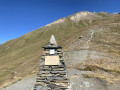
From the Chaligne Refuge to the Mont Fallere Refuge via Pointe Chaligne

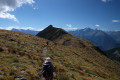
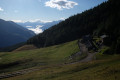
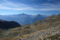
The second stage of the Tour du Mont Fallere promises a day of stunning views. Once you’ve completed the climb up to the ridges, the path alternates between descents and ascents, offering panoramic views of the Matterhorn to begin with, followed by the entire Aosta Valley and the peaks along the border.

Details

107641814
Creation:
Last update:
Last review:
  • Walking
    Activity: Walking
  • ↔
    Distance: 7.08 mi
  • ◔
    Average duration: 6h 15 
  • ▲
    Difficulty: Difficult

  • ⚐
    Back to start: No
  • ↗
    Ascent: + 3,432 ft
  • ↘
    Descent: - 1,969 ft

  • ▲
    Highest point: 8,494 ft
  • ▼
    Lowest point: 6,355 ft
  • ⚐ Country: Italy
  • ⚐
    Area: Alps
  • ⚐ City: Gignod 
  • ⚑
    Start: N 45.778242° / E 7.251314°
  • ⚑
    End: N 45.764844° / E 7.178716°
  • Hour-by-hour weather

Photos

Description of the walk

(S) From the Refuge de Chaligne, take the path heading towards Pointe Chaligne, climbing to the right (north) along the mountainside.

(1) At the junction with a track, continue along the path which climbs up to join the ridge. Follow the ridge to the left (south-south-west) as far as the Col de Tardiva.

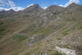
(2) Continue along the ridge, heading south-west and then south-east. This will take you to the summit of Pointe Chaligne.

(3) Descend south-eastwards to reach the Col de Metz (there is the option of making a round trip to the south to climb the Pointe de Metz, which offers a fine view of Aosta).

(4) Turn right and continue the descent towards Lac Fallère.

(5) Join a track and follow it to the left and downhill.

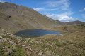
(6) Join another track and follow it to the right. Head uphill along the track, then onto a path leading to Lac Fallère. Walk along the right-hand side of the lake until you reach a junction on its southern shore.

(7) Continue straight ahead (west) along a path, first uphill and then downhill. Pass Lac des Grenouilles (Lago delle Rane) on your right and you’ll soon reach a junction.

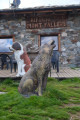
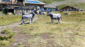
(8) Turn right and you’ll soon reach the Mont Fallère refuge, surrounded by sculptures (E).

Waypoints

  1. S : mi 0 - alt. 6,375 ft - Refuge Chaligne
  2. 1 : mi 0.76 - alt. 6,864 ft - Junction
  3. 2 : mi 1.8 - alt. 7,897 ft - Col de Tardiva (2410 m)
  4. 3 : mi 2.69 - alt. 8,494 ft - Pointe Chaligne (2607 m)
  5. 4 : mi 2.96 - alt. 8,140 ft - Col de Metz (2492 m)
  6. 5 : mi 3.65 - alt. 7,448 ft - Junction with track
  7. 6 : mi 4.08 - alt. 7,224 ft - Junction of tracks
  8. 7 : mi 5.43 - alt. 7,913 ft - Junction - Lago Fallère
  9. 8 : mi 6.67 - alt. 7,753 ft - Junction - Lago delle Rane
  10. E : mi 7.08 - alt. 7,835 ft - Rifugio Fallère

Notes

The route is signposted by the TMF throughout.

There are no water sources along the route.

The final section of the route along the ridge before Pointe Chaligne may be a little daunting for those who are very prone to vertigo, but the path is in good condition in dry weather.

Worth a visit

(2) (3) The view from the ridges and Pointe Chaligne.

(7) Lac Fallère

(E) Siro Vierin’s sculptures all around the Mont Fallère refuge, which is a veritable open-air museum. The artist and his family run the refuge. His studio is outdoors, and there is also an indoor space displaying other sculptures and a shop selling a range of useful items, merchandise (T-shirts, etc.) as well as local cheeses and cured meats!

Other walks in the area

For more walks, use our search engine .

The GPS track and description are the property of this route's author. Please do not copy them without permission.