The ‘Sentier des Merveilles’ trail from Crémaussel

Hiking trail in the commune of Lacrouzette in Sidobre & Vallées in the Tarn – Occitanie
One of the most famous trails in Sidobre.

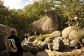
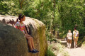
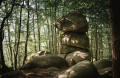
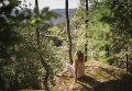
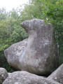
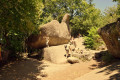
The Roc de l’Oie, the Elephant, the Three Cheeses or the Devil’s Armchair, for example. These are just a few of the rock formations, each as astonishing as the next, which you’ll discover amidst the woodland of Crémaussel. You’ll walk, explore, climb and let your imagination run wild… following the signposts in search of secret passages and other remarkable rock formations in this labyrinth of ‘invisibles’.

Details

72947429
Creation:
Last update:
Last review:
  • Walking
    Activity: Walking
  • ↔
    Distance: 1.73 mi
  • ◔
    Average duration: 1h 00 
  • ▲
    Difficulty: Easy

  • ⚐
    Back to start: Yes
  • ↗
    Ascent: + 266 ft
  • ↘
    Descent: - 276 ft

  • ▲
    Highest point: 2,182 ft
  • ▼
    Lowest point: 1,880 ft

Photos

Description of the walk

Getting to the start: See Practical Information.

(S/E) Take the path opposite the car park. You’ll come to a Fork in the road about a hundred metres further on.

(1) Leave the return path on your right and take the path on your left that climbs up at the junction. You’ll reach the Roc de l’Oie.

(2) Continue straight on. Caution: steep slope between the Roc de l’Oie and the Trois Fromages (3), followed by rock formations known as ‘bénitiers’. You can turn immediately right at the Roc de l’Oie to take the 45-minute circular route, or take the quick return route in 25 minutes.

(4) At the viewpoint overlooking the bénitiers, after the Trois Fromages, turn round and head back to the Roc de l’Oie. 

(2) You can take the alternative short circular loop for a quick return to the Crémaussel car park by turning right and rejoining the path you took on the way out.Alternatively, continue left towards the Rochers Décalés. You’ll come to a Fork in the road.

(5) There are two options:
1) For a quick return to the Crémaussel car park, turn right (path shown on OSM maps).
2) Alternatively (option shown on the map), carry on straight ahead towards the Rochers Décalés. Caution: steep slope between the Fauteuil du Diable and the Mur de la Mort. Continuing straight ahead will take you back to the junction on the outward route.

(1) Carry on straight ahead, in the opposite direction to the outward journey, towards the car park (S/E).

Waypoints

  1. S/E : mi 0 - alt. 2,146 ft - Car park at the hamlet of Crémaussel
  2. 1 : mi 0.07 - alt. 2,146 ft - Junction of the circular loop
  3. 2 : mi 0.35 - alt. 2,172 ft - Start of the steep slope - Le Roc de l'Oie
  4. 3 : mi 0.59 - alt. 1,936 ft - Les 3 Fromages
  5. 4 : mi 0.65 - alt. 1,880 ft - Bénitiers
  6. 5 : mi 1.13 - alt. 2,172 ft - Fork in the road towards the Rochers Décalés
  7. S/E : mi 1.73 - alt. 2,146 ft - Car park

Notes

Start/Finish: Car park at the hamlet of Crémaussel

Towns: Lacrouzette

Road access and car park: Via the D30, then the Crémaussel road (follow signs for Roc de l’Oie)

Parking: Car park at the hamlet of Crémaussel – GPS co-ordinates: 43.6651, 2.3932

Transport: Bus route 769, alight at Place du Théron (3.7 km from Crémaussel)

Worth a visit

Lodge (Crémaussel)

Reviews and comments

5 / 5
Based on 2 reviews

Reliability of the description
5 / 5
Ease of following the route
5 / 5
Route interest
5 / 5
MOJACK31
MOJACK31

Overall rating : 5 / 5

Date of your route : Jul 06, 2026
Reliability of the description : ★★★★★ Very good
Ease of following the route : ★★★★★ Very good
Route interest : ★★★★★ Very good
Very busy route : Yes

:i

Machine-translated

baissefrancis
baissefrancis

Overall rating : 5 / 5

Date of your route : Apr 20, 2026
Reliability of the description : ★★★★★ Very good
Ease of following the route : ★★★★★ Very good
Route interest : ★★★★★ Very good
Very busy route : Yes

A short but enjoyable walk

Machine-translated

Other walks in the area

For more walks, use our search engine .

The GPS track and description are the property of this route's author. Please do not copy them without permission.