Country:

 City:
City:


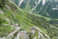
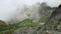
(S) Join yesterday’s path and head towards the Chalet des Nants.
(1) Depending on the flow of the streams, you may need to leave the path to find a better place to cross some of them.
(2) Once you’ve crossed all the streams, you’ll reach the junction near the Chalet des Nants; turn right to begin the climb up to the Refuge de la Valette.
(3) Once you’ve completed the longest part of this climb, you’ll reach a fork where you should turn right to reach the Refuge de la Valette. The path on the left leads directly to the Col de la Valette if you don’t wish to pass by the refuge and the ruins of the old lake refuge.
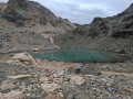
(4) Just before reaching the Refuge de la Valette, you have the option of taking a short round trip (turn right) to the lake and the ruins of the Lac refuge.
(5) Head back down to the current refuge. Pass the refuge buildings and follow the path down to a small hollow where there is a small lake, before climbing slightly again to go round the Roc du Tambour. Pass an unnamed pass and begin a short descent.
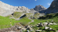
(6) You’ll reach a junction where you should ignore the path leading down to the Pas de l’Âne and take the one that climbs up, quickly opening out onto a panoramic view of the Cirque du Petit Marchet.
(7) The entrance to the Cirque du Petit Marchet is via a narrow passageway within a sort of wall that encloses the cirque.
Follow an unmarked path up the grassy slope to reach the pass between the two cirques. (Note: there are two visible paths; the higher one corresponds to the IGN route (shown here), but it seems to me that all the walkers present were taking the lower one, which leads to a pass a little further east).
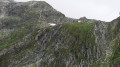
(8) From the pass, descend by following the cairns (passing over a snowfield).
(9) Continue down in this way until you reach the end of the rocky ridge.
At this point, there are two options:
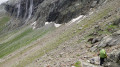
- either follow the clearly defined horizontal track that passes through the waterfalls towards the Col du Grand Marchet, or take the route described here, down the slope to the left as shown on some IGN base maps. Your choice may also depend on the season.
For the route described here, the descent requires a degree of caution to avoid slipping on the grass and stones.
(10) On the flat section, walk to the left of the stream and head towards the bridge over the Isertan to rejoin the signposted path, then turn right into the cirque.
::11: Return to the previous junction.
(10) Begin the descent towards the Pas de l’Âne. Take the paths on the right at both junctions to reach the Pas de l’Âne.
(12) For your safety, the Pas de l’Âne is strongly discouraged in wet weather.
After the Pas de l’Âne, continue the descent, turning left three times to reach theGR®55.
(13) Turn left and walk to the Gerlon bridge.
(14) Cross the bridge, first turning right then left, and follow the track uphill to Les Prioux, your destination (E) and the starting point for these four days’ walks.
 Visorando Member
 Very difficult
 Moderate