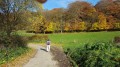
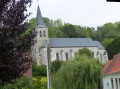
Notre-Dame du Bon Voyage and the ridges at Bomy

This route, starting from the square in Bomy, overlooks the surrounding villages and the Lys valley.

Details

n°47272285
Creation:
Last update:
Last review:
  • Walking
    Activity: Walking
  • ↔
    Distance: 7.75 mi
  • ◔
    Average duration: 3h 50 
  • ▲
    Difficulty: Moderate

  • ⚐
    Back to start: Yes
  • ↗
    Ascent: + 335 ft
  • ↘
    Descent: - 361 ft

  • ▲
    Highest point: 600 ft
  • ▼
    Lowest point: 308 ft
  • ⚐ Country: France
  • ⚐ City: Bomy (62960)
  • ⚑
    Start/End: N 50.574443° / E 2.234928°
  • ❏
    IGN map(s): Ref. 2304O, 2305O
  • Hour-by-hour weather

Description of the walk

Park near the signs showing the map of the walking routes.

(S/E) Head towards the town hall, cross the junction and turn right onto Rue des Marais.

(1) Before the farm, head up the street on the right until you reach the Hochart wayside cross.

(2) Follow the D130 to the left, then take the first track on the right and walk past the water tower.

(3) Shortly afterwards, turn onto the second dirt track on the right and join a tarmac road.

(4) Follow this tarmac road to the left, then head uphill to the Notre-Dame du Bon Voyage Chapel in Écouflans.

(5) Cross the junction and continue straight ahead along the dirt track until you reach another junction.

(6) Turn right onto theGR®127(marked in white and red) for 300 m, then leave it and continue straight on to the departmental road (view of Reclinghem), passing at the foot of three wind turbines.

(7) Head down the road to the left for about 100 m, then take the track on the right and continue straight on until you reach the next tarmac track, passing by the foot of four wind turbines.

(8) Turn left at the fourth junction, then take the first dirt track on the right. You’ll arrive at a place called Les Bruyères.

(9) Take the path that descends to the right and makes a turn to the left.

(10) At the crossroads, by a tree (view of Bomy), turn right onto the path that leads down to the tarmac road, which you follow straight on.

(11) Take the dirt track leading down to the left before reaching the cemetery and the football pitch, then continue to a junction.

(12) Head up the tarmac road to the right, pass the mill, then join the D130.

(13) Turn right towards Bomy. At the bend, take the shaded avenue opposite leading to the château.

(14) At the end of the avenue, turn right onto Rue du Château, and you’ll come back to the town hall, then the starting point (S/E).

Waypoints

  1. S/E : mi 0 - alt. 335 ft - Car park
  2. 1 : mi 0.44 - alt. 341 ft - Junction on the right
  3. 2 : mi 0.67 - alt. 387 ft - Hochart Calvary
  4. 3 : mi 1.2 - alt. 440 ft - Dirt track on the right
  5. 4 : mi 1.5 - alt. 374 ft - Tarmac road, on the left
  6. 5 : mi 2.6 - alt. 584 ft - Notre-Dame du Bon Voyage
  7. 6 : mi 3.06 - alt. 591 ft - Crossroads, junction with the GR°°®°° trail
  8. 7 : mi 3.69 - alt. 577 ft - D92, view of Reclinghem
  9. 8 : mi 4.58 - alt. 568 ft - Junction, on the left
  10. 9 : mi 5.4 - alt. 535 ft - Les Bruyères
  11. 10 : mi 5.85 - alt. 479 ft - Crossroads, view of Bomy
  12. 11 : mi 6.57 - alt. 371 ft - Cemetery and football pitch
  13. 12 : mi 6.87 - alt. 308 ft - Junction on the right
  14. 13 : mi 7.33 - alt. 312 ft - Departmental road, on the right
  15. 14 : mi 7.63 - alt. 322 ft - Listed castle
  16. S/E : mi 7.75 - alt. 338 ft - Car park

Notes

Picnic area at the Sainte-Frévisse spring, not far from (1).

Worth a visit

Always be cautious and plan ahead when you're outdoors. Visorando and the author of this route cannot be held responsible for any accidents occurring on this route.

The GR® and PR® markings are the intellectual property of the Fédération Française de Randonnée Pédestre.

Reviews and comments

5 / 5
Based on 1 review

Reliability of the description
5 / 5
Ease of following the route
5 / 5
Route interest
5 / 5
venerande
venerande

Overall rating : 5 / 5

Date of your route : Oct 31, 2024
Reliability of the description : ★★★★★ Very good
Ease of following the route : ★★★★★ Very good
Route interest : ★★★★★ Very good
Very busy route : No

Une route très intéressante
fantastic views of the surrounding area, especially on that particular day when the weather was very clear

Machine-translated

Other walks in the area

For more walks, use our search engine .

The GPS track and description are the property of this route's author. Please do not copy them without permission.