


Refine your search for walks in Col la Saume (1704m)
Col la Saume (1704m) walks


 Col la Saume
 Visorando Member
 2.15 mi
 +387 ft
 -384 ft
 1h 20
1h 20
 Easy
Easy
 Departure from Saint-Étienne-en-Dévoluy (Hautes-Alpes)
A hike accessible to all, from 7 to 77 years old! Without difficulty, it offers a breathtaking panorama of the Champsaur valley and its bocage. The Devoluard fauna can be abundant, for the enjoyment of young and old alike!
The pass road is closed during winter (check for information).
Tourneau circular loop
 12.08 mi
+2,785 ft
-2,802 ft
8h 00
12.08 mi
+2,785 ft
-2,802 ft
8h 00
 Difficult
Departure from Saint-Étienne-en-Dévoluy (Hautes-Alpes)
Difficult
Departure from Saint-Étienne-en-Dévoluy (Hautes-Alpes)
End of June 2025: A few changes!!! The GR® route between Le Barry and La Bergerie is currently being modified… it’s “more or less” marked out, on the right bank of the (dry) stream, but not signposted.Before La Bergerie, at the wooden post, where there are no markings, take the small path leading off to the right. It has been cleared, with the low branches cut back, but it is not (yet) signposted. It runs close to the road and goes round La Bergerie and the sheep pens. When you reach the road, another post marks a path that climbs to the left and joins the GR®, below the Col de la Saume.
A beautiful pyramid that can be spotted from afar.A long walk, without any real difficulty, offering plenty of variety: water, woodland, mountain pastures and herds, a small summit, villages – something to delight everyone. Panoramic views over the Champsaur, the Écrins and, of course, the Dévoluy.
Walks near Col la Saume (1704m)
Plateau and Pic de Bure via the Joue du Loup chairlift
 8.05 mi
+2,037 ft
-2,867 ft
5h 30
8.05 mi
+2,037 ft
-2,867 ft
5h 30
 Moderate
Departure from Agnières-en-Dévoluy (Hautes-Alpes)
Moderate
Departure from Agnières-en-Dévoluy (Hautes-Alpes)
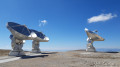
The easiest route to explore the Bure massif in summer, ascending via the ski resort’s chairlifts (open one day a week in July and August only). The plateau offers a lunar landscape with the observatory’s satellite dishes, and in clear weather, the view from the Pic de Bure is extraordinary.
The route is described here starting from La Joue du Loup, but there is a similar route starting from SuperDévoluy. Please note: this route is only accessible during the summer opening period of the ski lifts!
Lachaup – Les Amayères
 12.04 mi
+4,262 ft
-5,033 ft
9h 15
Difficult
Departure from Agnières-en-Dévoluy (Hautes-Alpes)
12.04 mi
+4,262 ft
-5,033 ft
9h 15
Difficult
Departure from Agnières-en-Dévoluy (Hautes-Alpes)
Through the Charnier valley at the foot of the Grand Ferrand, then via Pointe Feuillette, the final stage of this route.
Col des Aiguilles - Return circular via Le Chauvet
 7.94 mi
+2,743 ft
-2,723 ft
6h 00
Difficult
Departure from Agnières-en-Dévoluy (Hautes-Alpes)
7.94 mi
+2,743 ft
-2,723 ft
6h 00
Difficult
Departure from Agnières-en-Dévoluy (Hautes-Alpes)
Most of the route follows theGRP® Tour du Dévoluy trail markedGR®94.
For the return journey, rather than going back the same way, you can vary the route by returning via Small Pass and Le Charvet. This is an off-trail route.
This alternative route must be taken in good visibility and requires the ability to use a map and compass, which is essential for off-trail hiking.
The view from Le Chauvet over Le Dévoluy is magnificent.
From Chaillol 1600 to Chantaussel
 3.05 mi
+121 ft
-1,138 ft
1h 30
Easy
Departure from Saint-Michel-de-Chaillol (Hautes-Alpes)
3.05 mi
+121 ft
-1,138 ft
1h 30
Easy
Departure from Saint-Michel-de-Chaillol (Hautes-Alpes)
A short walk, with very little uphill climb and no difficulty, starting from Chaillol 1600 to the hamlet of Chantaussel (municipality of Saint-Julien-en-Champsaur).
Round-trip walk: you’ll need at least two cars.
Le Lauvet - Lac Labarre
 11.84 mi
+4,869 ft
-3,711 ft
9h 40
Difficult
Departure from Valjouffrey (Isère)
11.84 mi
+4,869 ft
-3,711 ft
9h 40
Difficult
Departure from Valjouffrey (Isère)
From Le Lauvet, descend to La Chapelle-en-Valjouffrey. Then take the Sentier du Facteur trail, cross the Haute Vallée du Béranger nature reserve in Valsenestre, and finish on the GR®54B trail to Lac Labarre.
Up the Gap Canal: from Pont de Frappe to Les Ricous
 6.71 mi
+328 ft
-489 ft
3h 20
Easy
Departure from Chabottes (Hautes-Alpes)
6.71 mi
+328 ft
-489 ft
3h 20
Easy
Departure from Chabottes (Hautes-Alpes)
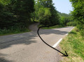
A lovely, idyllic walk with virtually no elevation gain, easy and shaded. Ideal for families. You can walk part of the route and turn back, or tackle it in short sections. Of course, it’s possible to do this walk in the opposite direction.
The canal is always covered, so you can’t see the water.
Please note that between the start and point 2 there is a steep descent through the woods.
Sebeyras Lakes – Les Prés de Lauplat
 7.56 mi
+3,369 ft
-3,970 ft
6h 25
Difficult
Departure from La Chapelle-en-Valgaudemar (Hautes-Alpes)
7.56 mi
+3,369 ft
-3,970 ft
6h 25
Difficult
Departure from La Chapelle-en-Valgaudemar (Hautes-Alpes)
This stage takes you from the Sebeyras Lakes to the Lauplat Meadows via the Col de Pétarel and the Col de la Béranne. The route then descends towards the hamlet of Navette and the Buchardet Waterfall, before a long climb along a more rugged path.
Lakes of Sebeyras - Le Lauvet
 11.28 mi
+5,371 ft
-6,191 ft
9h 50
11.28 mi
+5,371 ft
-6,191 ft
9h 50
 Very difficult
Departure from La Chapelle-en-Valgaudemar (Hautes-Alpes)
Very difficult
Departure from La Chapelle-en-Valgaudemar (Hautes-Alpes)
From the Sebeyras Lakes, the route will first take you to the Col de Pétarel. From there, you will descend towards Saint-Maurice-en-Valgodemar. You will then follow the old transhumance paths to reach the Six Cabanes, then climb the Col de Menoux to Lauvet.
Villar Loubière – Sebeyras Lakes
 5.63 mi
+4,511 ft
-354 ft
6h 30
Difficult
Departure from Villar-Loubière (Hautes-Alpes)
5.63 mi
+4,511 ft
-354 ft
6h 30
Difficult
Departure from Villar-Loubière (Hautes-Alpes)
This first stage takes you along the GRP® Tour du Vieux Chaillol trail, linking Villar-Loubière to the Sebeyras Lakes. The route passes by the Pétarel Lakes, with a gradual climb through the Valgaudémar State Forest.
From Villar-Loubière to La Chapelle-en-Valgaudemar via Lac du Lautier
8.29 mi
+4,780 ft
-4,475 ft
8h 00
Difficult
Departure from Villar-Loubière (Hautes-Alpes)
A beautiful, varied hike with stunning views and a lake perfect for relaxing. A pleasant climb (a little steep at the start and very end), in the shade (early in the morning) for a good half of the route; a fairly long and difficult descent over scree. A full day's hike. Use the shuttle bus or bring two vehicles.