Up the Gap Canal: from Pont de Frappe to Les Ricous

A lovely, idyllic walk with virtually no elevation gain, easy and shaded. Ideal for families. You can walk part of the route and turn back, or tackle it in short sections. Of course, it’s possible to do this walk in the opposite direction.
The canal is always covered, so you can’t see the water.
Please note that between the start and point 2 there is a steep descent through the woods.

Details

36900363
Creation:
Last update:
Last review:
  • Walking
    Activity: Walking
  • ↔
    Distance: 6.71 mi
  • ◔
    Average duration: 3h 20 
  • ▲
    Difficulty: Easy

  • ⚐
    Back to start: No
  • ↗
    Ascent: + 328 ft
  • ↘
    Descent: - 489 ft

  • ▲
    Highest point: 3,973 ft
  • ▼
    Lowest point: 3,753 ft

Photos

Description of the walk

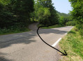
At the Frappe bridge, take the D514 towards Ancelle for 1.5 km. Park on the left, either before or after the path leading down into the forest.

(S) Take the path leading down to the left.

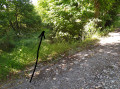
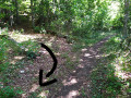
(1) Almost opposite a wooden jump for cyclocross bikes, take an old, poorly maintained track that descends quite steeply to the left and rejoins the Gap Canal.

(2) At the bottom of the descent, you’ll find the canal alongside a dirt track that’s almost passable by vehicles; turn right and continue along this track until you reach a fork (elevation 1169).

(3) Leave this passable dirt track and turn left. A path runs alongside the canal and past an abandoned house: it’s not maintained and leads deep into the forest – adventure seekers will love it! Those who are a bit timid can continue along the dirt track to go past the abandoned house and then turn left. The two paths meet at the D113, at elevation 116.

(4) Cross the D113 (be careful, as cars travel fast on this stretch of road) and continue along the path which runs alongside the canal. Twice, the path takes a slight detour over the watercourse (canal). You’ll emerge onto the Route du Moulin du Serre just below the Centre Médical de la Source.

(5) Cross the road leading there and carry on straight ahead until you reach a crossroad.

(6) Cross the road and carry on straight ahead until you reach the D13.

(7) Here too, cross the road and continue along the path opposite.
After the lovely Gariveau waterfall (caution: falling rocks – do not linger too long), you can reach the Tailla picnic area: a picnic spot with tables, drinking water, a barbecue area, and the Gariveau nearby for a dip. You can reach the D13 via the Tailla car park

(8) To continue the walk, leave the Tailla picnic area on your left and follow the path, which becomes a little more challenging.

(9) At the crossroads of four paths, you can turn left to head down to Pont du Fossé (a village with shops, a pharmacy, restaurants, a bar, an ice-cream parlour, a museum fountain and tourist information at the Maison de la Vallée, sports equipment and a drinking water fountain). Please note that the Chemin des Aymes is very steep!
To continue the walk, carry straight on along this path beside the canal until you reach a stony track at an altitude of 1,171 metres.

(10) Turn left onto this road and walk past a number of houses. When you reach the tarmac road, turn left again and, 500 metres further on, after the bridge over the Drac, you’ll find the Pont des Ricoux car park on your right (E).

Waypoints

  1. S : mi 0 - alt. 3,973 ft - Start
  2. 1 : mi 0.11 - alt. 3,904 ft - Junction, path leading downwards
  3. 2 : mi 0.2 - alt. 3,825 ft - Canal de Gap
  4. 3 : mi 1.17 - alt. 3,825 ft - Turn left - Canal de Gap
  5. 4 : mi 1.43 - alt. 3,822 ft - D113. Possible start or finish point
  6. 5 : mi 2.73 - alt. 3,825 ft - Possible start or finish points
  7. 6 : mi 3.4 - alt. 3,829 ft - Route
  8. 7 : mi 3.64 - alt. 3,822 ft - D13 Possible start or finish point
  9. 8 : mi 4.2 - alt. 3,799 ft - Possible start/finish point: picnic area
  10. 9 : mi 4.46 - alt. 3,829 ft - Pont du Fossé – Possible start/finish point
  11. 10 : mi 6.29 - alt. 3,852 ft - Les Ricous
  12. E : mi 6.71 - alt. 3,829 ft - Pont des Ricoux car park

Notes

Points where you can start or finish a section of this walk:
(S). Parking available along the departmental road. Possible start/finish point
(4) D113. Possible start/finish point
(5) Option to start or finish below the ‘La Source’ medical centre
(7) D13 Option to start/finish
(8) L’aire de la Tailla – Start/finish options
(9) Pont du Fossé – Start/finish point
(E). Pont des Ricous car park – Option to start or finish

Make sure you bring water: apart from the La Tailla rest area, or on the way down to Pont du Fossé, I didn’t see any other sources of drinking water.

Worth a visit

Have a picnic at the Tailla rest area,
Have a bite to eat, a drink or an ice cream at Pont du Fossé

If you enjoyed this walk, you can join it a little before the start, near the hamlet of Manse. Please note that the path is steep, exposed along the aqueduct (with no guardrails) and muddy after rain.

Following the flow of the water, after the aqueduct over the Ancelle torrent, the canal runs underground and re-emerges on the Gap side at the Georges Serres reservoir. The water then continues westwards along another canal: the Drac Canal, which could be the subject of another, much warmer walk (on the sunny side of the slope with little shade).

Reviews and comments

3.9 / 5
Based on 3 reviews

Reliability of the description
4 / 5
Ease of following the route
4.3 / 5
Route interest
3.3 / 5
yvannadine
yvannadine

Overall rating : 4.7 / 5

Date of your route : Jun 09, 2026
Reliability of the description : ★★★★★ Very good
Ease of following the route : ★★★★★ Very good
Route interest : ★★★★☆ Good
Very busy route : Yes

Great hiking routes for all regions.

Machine-translated

BAMX
BAMX

Made 2 years ago

Machine-translated

Nellurt
Nellurt

Overall rating : 4.3 / 5

Date of your route : Jun 29, 2024
Reliability of the description : ★★★★☆ Good
Ease of following the route : ★★★★★ Very good
Route interest : ★★★★☆ Good
Very busy route : No

The Roman road and then the section through the forest, following the canals, are absolutely magnificent. The rest of the route, which is mostly flat, is less interesting.

Machine-translated

CathyF
CathyF

Overall rating : 2.7 / 5

Date of your route : Aug 06, 2023
Reliability of the description : ★★★☆☆ Average
Ease of following the route : ★★★☆☆ Average
Route interest : ★★☆☆☆ Disappointing
Very busy route : No

Starting point no. 1 is pointless; the path is very steep and runs through a forest, which can be dangerous in windy conditions (which was the case). A walk along the ‘invisible’ canal, as it runs underground. A peaceful stroll along the fields – watch out for young children as there are electric fences all along the way!

Machine-translated

Other walks in the area

For more walks, use our search engine .

The GPS track and description are the property of this route's author. Please do not copy them without permission.