Lachaup – La Jarjatte

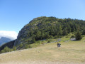
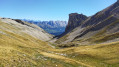
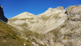
To travel from the Hautes-Alpes to the Drôme, from the Dévoluy to the Vercors via the mountains. A lovely walk through wild and varied countryside. Apart from at the start, the route follows theGR® 93, which presents no problems in terms of signposting or navigation.

This walk is part of a multi-day hike: Cinq jours autour du Dévoluy et du Pic de Bure

Details

n°2766773
Creation:
Last update:
Last review:
  • Walking
    Activity: Walking
  • ↔
    Distance: 8.45 mi
  • ◔
    Average duration: 6h 10 
  • ▲
    Difficulty: Difficult

  • ⚐
    Back to start: No
  • ↗
    Ascent: + 2,657 ft
  • ↘
    Descent: - 3,386 ft

  • ▲
    Highest point: 6,893 ft
  • ▼
    Lowest point: 3,789 ft

Photos

Description of the walk

(S) From the Lachaup lodge, take the yellow-marked path heading north. Stay on this path until you reach the junction withthe GR®93. White/red markings.

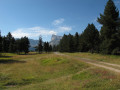
(1) Turn left onto this path through the woods until you reach a wider track. Continue due west, following a few hairpin bends to reach the Cabanes du Chorum Clot.

(2) Stay on theGR®, passing in front of the Chorum sinkhole. rejoin theGR® as it climbs north-west.
After a short descent, you’ll reach the Torrent des Adroits, which is often dry.

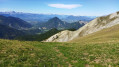
(3) Enter the west-facing Vallon du Charnier and follow its meandering path and successive plateaus to reach the Col du Charnier.

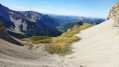
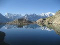
(4) Cross the pass and begin the descent towards Lac du Lauzon. After the lake, keep to the right on the GR®.

(5) Pass the Col des Aurias and reach the Col de la Croix.

(6) Turn left, heading due south, onto the path – this is still theGR®. You’ll rejoin the road at a Y-junction.
Turn right onto it and head towards the houses at La Grange des Forêts.

(7) Stay on this road, which follows theGR®, to reach the hamlet of La Jarjatte and the lodge, today’s stop (S/E).
Waypoints

  1. S : mi 0 - alt. 4,573 ft - Lachaup Lodge - Gîte du Rocher Rond
  2. 1 : mi 0.9 - alt. 4,783 ft - Junction with the GR
  3. 2 : mi 1.81 - alt. 5,636 ft - Shepherd’s hut
  4. 3 : mi 2.74 - alt. 5,794 ft - Torrent des Adroits
  5. 4 : mi 4.03 - alt. 6,893 ft - Col de Charnier
  6. 5 : mi 5.25 - alt. 5,748 ft - Col des Aurias
  7. 6 : mi 6 - alt. 4,902 ft - Col de la Croix
  8. 7 : mi 7.13 - alt. 3,957 ft - Grange des Forêts
  9. E : mi 8.45 - alt. 3,855 ft - La Jarjatte lodge - Gîte le Valgabondage

Notes

Water is available at the start, at the finish, as well as at the water basins near the Cabane du Chourum Clot and at the spring (water intake) at the foot of the Col du Charnier.
There is little shelter; it is advisable to bring rainwear and wear sturdy footwear!

Worth a visit

Lachaup and La Jarjatte are starting points for numerous hiking and skiing routes.
Shops in Lus la Croix Haute.

Always be cautious and plan ahead when you're outdoors. Visorando and the author of this route cannot be held responsible for any accidents occurring on this route.

The GR® and PR® markings are the intellectual property of the Fédération Française de Randonnée Pédestre.

Reviews and comments

5 / 5
Based on 1 review

Reliability of the description
5 / 5
Ease of following the route
5 / 5
Route interest
5 / 5
Nicole Guil
Nicole Guil

Overall rating : 5 / 5

Date of your route : Sep 12, 2022
Reliability of the description : ★★★★★ Very good
Ease of following the route : ★★★★★ Very good
Route interest : ★★★★★ Very good
Very busy route : No

We went on a walk in lovely weather. We walked as far as the Granges des Forêts, where our lodge was located
The scenery is breathtaking throughout the walk.
The descent from the Col du Charnier can be tricky for inexperienced walkers. The view from the Col des Aurias is splendid.

Machine-translated

Other walks in the area

For more walks, use our search engine .

The GPS track and description are the property of this route's author. Please do not copy them without permission.