From Chaillol 1600 to Chantaussel

A short walk, with very little uphill climb and no difficulty, starting from Chaillol 1600 to the hamlet of Chantaussel (municipality of Saint-Julien-en-Champsaur).

Round-trip walk: you’ll need at least two cars.

Details

45563884
Creation:
Last update:
Last review:
  • Walking
    Activity: Walking
  • ↔
    Distance: 3.05 mi
  • ◔
    Average duration: 1h 30 
  • ▲
    Difficulty: Easy

  • ⚐
    Back to start: No
  • ↗
    Ascent: + 121 ft
  • ↘
    Descent: - 1,138 ft

  • ▲
    Highest point: 5,351 ft
  • ▼
    Lowest point: 4,213 ft

Photos

Description of the walk

Start from the car park at the Chaillol 1600 resort.

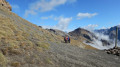
(S) Cross the car park, heading north-west, and exit via a small tarmac path to the left of a ski hire shop. After about 150 m, in a large car park, turn right onto a path that climbs towards a forest track (a ski run in winter). At the next junction, turn left and continue uphill along the track.

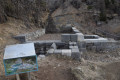
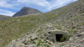
(1) Leave the road and take a path on the left that descends slightly. At the Fork in the road shortly afterwards, turn right onto a path that crosses a torrent. Continue until you reach the Malcros Canal. An information board explains how the canal’s various water distribution basins work.

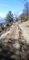
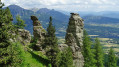
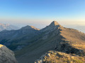
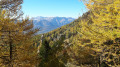
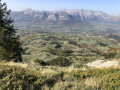
(2) Walk westwards along the balcony-style path, which offers magnificent views of the valley and the surrounding mountains. The path soon passes beneath the Lauzière chairlift line and, further on, crosses a deforested area (a ski run in winter). Further on, the path enters the forest and reaches a crossroads.

(3) Follow the first path on the left downhill, towards Chantaussel. At the next junction, turn left and continue downhill towards Chantaussel.

(4) You’ll come out onto the D543; follow it to the left. Shortly afterwards, as you come out of a left-hand bend, leave the road and take a path that descends to the right (be careful to spot this turn-off). The path descends quite steeply in places and generally heads south. You’ll reach a crossroads very close to a small lake.

(5) Turn right here. At the next junction, turn right again. Pass the hamlet of Les Blancs and carry on straight ahead until you reach the D43 road, near the hamlet of Chantaussel (E).

Waypoints

  1. S : mi 0 - alt. 5,230 ft - Chaillol 1600
  2. 1 : mi 0.31 - alt. 5,351 ft - Start of the trail
  3. 2 : mi 0.51 - alt. 5,266 ft - Malcros Canal
  4. 3 : mi 1.38 - alt. 5,230 ft - Crossroads
  5. 4 : mi 1.77 - alt. 5,016 ft - D543 road
  6. 5 : mi 2.5 - alt. 4,419 ft - Crossroads – Small lake
  7. E : mi 3.05 - alt. 4,213 ft - Chantaussel

Notes

At the start, there is plenty of parking.

At the end of the walk, you can leave a car by the small recycling centre nearby (view this location).

Worth a visit

Interesting remains of the Malcros Canal, whose waters were used to irrigate crops.

Reviews and comments

3.7 / 5
Based on 1 review

Reliability of the description
4 / 5
Ease of following the route
4 / 5
Route interest
3 / 5
BAMX
BAMX

No, actually, it was hot and dry on 6 August. I had already travelled this stretch two years ago, but in the other direction, and it's no better. So we didn't go as far as Chantaussel, but we discovered the hamlet of La Villette and its pretty little painted chapel.

Machine-translated

joel mosbeux
joel mosbeux

Sorry you had difficulties, but I clearly stated in the description that part of the route is quite steep. You probably did the hike after a period of rain. Best regards

Machine-translated

BAMX
BAMX

Overall rating : 3.7 / 5

Date of your route : Aug 06, 2025
Reliability of the description : ★★★★☆ Good
Ease of following the route : ★★★★☆ Good
Route interest : ★★★☆☆ Average
Very busy route : No

The descent to Chantaussel is too difficult and slippery, not to mention dangerous

Machine-translated

Other walks in the area

For more walks, use our search engine .

The GPS track and description are the property of this route's author. Please do not copy them without permission.