Tourneau circular loop

End of June 2025: A few changes!!!
The GR® route between Le Barry and La Bergerie is currently being modified… it’s “more or less” marked out, on the right bank of the (dry) stream, but not signposted.
Before La Bergerie, at the wooden post, where there are no markings, take the small path leading off to the right. It has been cleared, with the low branches cut back, but it is not (yet) signposted. It runs close to the road and goes round La Bergerie and the sheep pens. When you reach the road, another post marks a path that climbs to the left and joins the GR®, below the Col de la Saume.

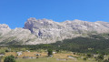
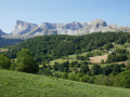
A beautiful pyramid that can be spotted from afar.
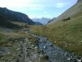
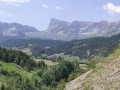
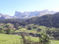
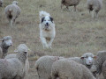
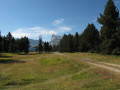
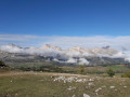
A long walk, without any real difficulty, offering plenty of variety: water, woodland, mountain pastures and herds, a small summit, villages – something to delight everyone. Panoramic views over the Champsaur, the Écrins and, of course, the Dévoluy.

Details

1425873
Creation:
Last update:
Last review:
  • Walking
    Activity: Walking
  • ↔
    Distance: 12.08 mi
  • ◔
    Average duration: 8h 00 
  • ▲
    Difficulty: Difficult

  • ⚐
    Back to start: Yes
  • ↗
    Ascent: + 2,785 ft
  • ↘
    Descent: - 2,802 ft

  • ▲
    Highest point: 6,230 ft
  • ▼
    Lowest point: 3,885 ft

Photos

Description of the walk

Park near the chapel in the village of Le Courtil.

(S/E) Join the D117 road and follow it carefully to the left, heading south-southeast. In Giers, look for the path just below the last house on the left which descends to the left, south-southeast towards the River Souloise.
Cross the river without difficulty. The marked path winds through the woodland alongside the Souloise, heading north, then climbs to join the RD512, which here forms part of the GR® 93 and theGRP®® Tour du Dévoluy.
Follow the red and white markings to the right. You’ll soon reach another junction.

(1) Leave the road and continue left along theGR®® to climb up the Combe de Mayt. At the junction of the paths, keep left on theGR®®93and head for the Pied de Faraut. Walk alongside and up the Rif (dry in summer) parallel to the road. You’ll reach the Y-junction with the D17.

(2) Continue to the left, leaving theGR®® to follow the Rif along its right bank. Cross to the left bank to rejoin the GR®®.

(3) Join the GR®® again and carry on straight ahead, passing the Sources de Pierre Grosse. Continue through the Combe la Saume to emerge at the Col la Saume.

(4) Turn right towards the south, leave theGR®®, and climb up a well-marked track, with markings and cairns, along the ridge. Reach the Tête du Tourneau.

(5) Continue to follow the markings as they descend and join a lovely path leading to the pass’s refuge, the Ancien Refuge Napoléon.

(6) Follow the D17 county road. Before crossing the Torrent de Vallier, join theGR®®93. Take this to the left and reach the Croix de Vallier, then the junction with the D17 which you passed on the way out.

(2) Turn left onto the path running parallel to the road. Join the road a little further on, then leave it again to reach the crossroads in the Truziaud district.

(7) Continue down the slope to the right, passing through the Pré neighbourhood (GR®® 94). Join the road to enter the village of Saint-Étienne-en-Dévoluy. Arrive at the crossroads by the cemetery.

(8) Head left. Pass through Le Fort and Les Étroits to reach the Pont de Giers.

(9) Take the road on the right, pass Giers and the first crossroads, then easily reach the car park at the chapel in the village of Le Courtil (S/E).

Waypoints

  1. S/E : mi 0 - alt. 4,068 ft - Chapelle du Courtil car park
  2. 1 : mi 1.69 - alt. 4,121 ft - GR junction
  3. 2 : mi 3.58 - alt. 4,931 ft - D17 junction – Le Barry
  4. 3 : mi 4.6 - alt. 5,210 ft - GR junction – Bergeries
  5. 4 : mi 5.41 - alt. 5,597 ft - Col la Saume (1704m)
  6. 5 : mi 6.14 - alt. 6,230 ft - Tête du Tourneau
  7. 6 : mi 6.72 - alt. 5,449 ft - Col du Noyer
  8. 7 : mi 9.44 - alt. 4,505 ft - Truziaud
  9. 8 : mi 10.6 - alt. 4,203 ft - Cemetery
  10. 9 : mi 11.41 - alt. 4,003 ft - Giers Bridge - Souloise (rivière)
  11. S/E : mi 12.08 - alt. 4,068 ft - Chapelle du Courtil car park

Notes

Sturdy footwear recommended. Fresh water available from the fountains at Le Courtil, Giers, Truziaud, Le Pré and Saint-Étienne.
Drinks and food available at the Col du Noyer mountain hut (in summer).

Worth a visit

(6) Orientation table at the Col du Noyer (several stages of the Tour de France cycle race have passed through here)
(6) Refuge Napoléon at the Col du Noyer
(Between 8 and 9) Les Étroits via ferrata on the route (Equipment required)
The Napoléon mountain huts.

- “Les Chanterelles” cheese shop at Le Courtil: sheep’s cheese and lamb. (Closed in 2025!)
- “Interstellaire du Dévoluy” brewery at Le Courtil, just to quench your thirst a little...
Via Ferrata at Les Étroits.

Always be cautious and plan ahead when you're outdoors. Visorando and the author of this route cannot be held responsible for any accidents occurring on this route.

The GR® and PR® markings are the intellectual property of the Fédération Française de Randonnée Pédestre.

Reviews and comments

4.8 / 5
Based on 2 reviews

Reliability of the description
4.5 / 5
Ease of following the route
5 / 5
Route interest
5 / 5
Phasme91
Phasme91

Overall rating : 5 / 5

Date of your route : Jul 12, 2022
Reliability of the description : ★★★★★ Very good
Ease of following the route : ★★★★★ Very good
Route interest : ★★★★★ Very good
Very busy route : No

A stunning view of the Tête du Tourneau. We set off from St Etienne and took a shortcut to make the walk a bit shorter, but it was a lovely hike!

Machine-translated

Jonat
Jonat

Overall rating : 4.7 / 5

Date of your route : May 28, 2022
Reliability of the description : ★★★★☆ Good
Ease of following the route : ★★★★★ Very good
Route interest : ★★★★★ Very good
Very busy route : Yes

A superb walk with fantastic views. The start is a bit tricky – there’s no way to cross the stream. The best starting point is further up, by the road bridge, where there’s a large car park at the junction of the D17 and D517. Head to Point One via the road (which isn’t very busy).

Machine-translated

Other walks in the area

For more walks, use our search engine .

The GPS track and description are the property of this route's author. Please do not copy them without permission.