Lachaup – Les Amayères

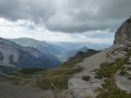
Through the Charnier valley at the foot of the Grand Ferrand, then via Pointe Feuillette, the final stage of this route.

This walk is part of a multi-day hike: Circuit Trièves - Dévoluy

Details

n°98511
Creation:
Last update:
–
Last review:
  • Walking
    Activity: Walking
  • ↔
    Distance: 12.04 mi
  • ◔
    Average duration: 9h 15 
  • ▲
    Difficulty: Difficult

  • ⚐
    Back to start: No
  • ↗
    Ascent: + 4,262 ft
  • ↘
    Descent: - 5,033 ft

  • ▲
    Highest point: 6,890 ft
  • ▼
    Lowest point: 3,629 ft

Photos

Description of the walk

(S) Leave the Rocher Rond lodge and head due north along the forest track to join theGRP® Tour du Dévoluy.

(1) Head due west by turning left at a 90° angle, then head south-west to reach the Cabane du Chourum Clot.

(2) In the heart of the sinkhole, head north-west towards the Torrent des Adroits.

(3) Enter the Vallon de Charnier and walk for some time through this valley to reach the pass of the same name.

(4) Then begin the descent towards Lac du Vallon. Ignore two paths branching off to the left, head slightly uphill and, after a short descent, reach the Col des Aurias.

(5). Continue downhill to the Col de la Croix.

(6) From there, follow theGR®93, marked in red and white, up to the Col de Lachaup and then along the ridge of the Montagne de Paille.

(7) Reach the foot of Pointe Feuillette.

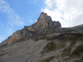
(8) Leave theGR®93, turn left and climb to the summit of Pointe Feuillette.

(9) Begin the south-westerly descent. Enter the forest at a place called Piégros.

(10) Continue the zigzag descent through the Lus-la-Croix-Haute State Forest, ending at the Lauzier chalet.

(11) 300 metres further on, you’ll come to a forest track that fords the stream. Do not take this track, but turn right onto the correct path – signposted ‘Mas Bourget’ – and head for this spot.

(12) Look out over the hamlet, then continue north-west until you reach a road.

(13) Turn right onto it to reach the car park at the bend (E) before Les Amayères.

Waypoints

  1. S : mi 0 - alt. 4,567 ft - Lachaup - Gîte du Rocher Rond
  2. 1 : mi 0.89 - alt. 4,787 ft - GRP Tour du Dévoluy
  3. 2 : mi 1.75 - alt. 5,623 ft - Sinkhole Clot hut
  4. 3 : mi 2.79 - alt. 5,817 ft - Torrent des Adroits
  5. 4 : mi 4.12 - alt. 6,890 ft - Col de Charnier
  6. 5 : mi 5.38 - alt. 5,751 ft - Col des Aurias
  7. 6 : mi 6.13 - alt. 4,902 ft - Col de la Croix
  8. 7 : mi 7.07 - alt. 5,423 ft - Montagne de Paille
  9. 8 : mi 8.05 - alt. 6,089 ft - Junction below Pointe Feuillette. Turn left.
  10. 9 : mi 8.24 - alt. 6,158 ft - Begin the south-westerly descent - Pointe Feuillette (1882m)
  11. 10 : mi 8.79 - alt. 5,128 ft - Piégros
  12. 11 : mi 10.39 - alt. 4,170 ft - Lauzier
  13. 12 : mi 11.48 - alt. 3,701 ft - Mas Bourget
  14. 13 : mi 11.78 - alt. 3,832 ft - Road
  15. E : mi 12.04 - alt. 3,796 ft - Les Amayères

Notes

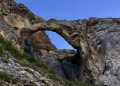
Have a drink from the springs in the Charnier valley.
A pleasant stop at Lac de Lauzon.

Worth a visit

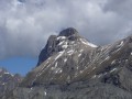
The climb up the Charnier valley offers interesting views of the Grand Ferrand and, above all, the Tête de Vallon Pierra.

Always be cautious and plan ahead when you're outdoors. Visorando and the author of this route cannot be held responsible for any accidents occurring on this route.

The GR® and PR® markings are the intellectual property of the Fédération Française de Randonnée Pédestre.

Reviews and comments

4.5 / 5
Based on 2 reviews

Reliability of the description
4 / 5
Ease of following the route
4.5 / 5
Route interest
5 / 5
ageo
ageo

Overall rating : 4.3 / 5

Date of your route : Aug 17, 2016
Reliability of the description : ★★★★☆ Good
Ease of following the route : ★★★★☆ Good
Route interest : ★★★★★ Very good

Route taken: from Le Grand Villard to La Jarjatte. A lovely walk. The descent from the Col de Charnier can be tricky in wet weather. Descent to La Jarjatte via the Col de la Croix.

Machine-translated

Virginie13
Virginie13

Overall rating : 4.7 / 5

Date of your route : Jun 06, 2015
Reliability of the description : ★★★★☆ Good
Ease of following the route : ★★★★★ Very good
Route interest : ★★★★★ Very good

A slight variation: Lachaup – Lus la Croix Haute. The walk therefore took longer: 10.5 hours.
We lost some time between points 7 and 8, where the markings are very few and far between, or even worn away, making them difficult to spot.

Machine-translated

Other walks in the area

For more walks, use our search engine .

The GPS track and description are the property of this route's author. Please do not copy them without permission.