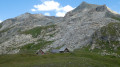
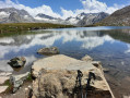
Col du Carro, starting from Lake Serrù

An alpine hike, including a section at the foot of the Carro Glacier, with a possible via ferrata route, up to the border with France.
Please note that this hike is challenging between the points (4) and (6), particularly requiring specialist equipment on the alternative route between (5) and (6); for these sections, it is reserved for experienced hikers accustomed to such challenges.
The section between (S/E) and (4), on the other hand, is very accessible.

Details

n°21289137
Creation:
Last update:
Last review:
  • Walking
    Activity: Walking
  • ↔
    Distance: 6.44 mi
  • ◔
    Duration according to the author: 4 hrs 
  • ▲
    Difficulty: Very difficult

  • ⚐
    Back to start: Yes
  • ↗
    Ascent: + 3,540 ft
  • ↘
    Descent: - 3,550 ft

  • ▲
    Highest point: 10,230 ft
  • ▼
    Lowest point: 7,110 ft

Photos

Description of the walk

Park in the car park at the foot of the Serrù Lake hydroelectric dam.

(S/E) Head towards the small church, then turn right towards the farm building. This section is a bit rough going as you make your way down to the meadow below: weave your way through the undergrowth and then cross the stream. Reach the ruins, walk along the edge of the meadow and cross it on the right-hand side, heading towards the mountain to join the now clearly visible path.

(1) Leave the track on your left and continue uphill, following the red and white markings. You’ll reach a crossroads with a signpost.

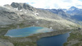
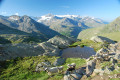
(2) Take the path on the left, following the signs for Lago Rocce – Colle Carro. Continue along several hairpin bends to reach the beautiful Lake Rocce Grandi. You can easily walk around the lake here.

(3) Return to the path and continue the ascent to reach the Col de la Rocca.

(4) Please note that from here onwards the route becomes challenging and is only suitable for experienced walkers.
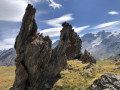
Pass through the narrow passage and turn left. Cross the scree slopes, with cliffs overhanging on the right.
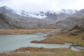
Reach the Glacier del Carro.

(5) Please also take care here: as the route is more complicated because the movement of the glacier is erasing the paths, be very careful of crevasses.
Here, there are two possible routes:
- head up from the foot of the glacier towards the ridge on the other side and climb it,
- head to the base of the glacier at the foot of the rock face, look for the letter ‘A’ painted on the rock to use the steps and pitons of the via ferrata. At the top of the via ferrata, follow the winding ridge to the left along a faintly marked path.
However, this shared section is technical and requires a high level of confidence, as the ground and rock faces are rather unstable.
You will then reach the Col du Carro. Enjoy the panoramic view of Italy and France from here

(6) Retrace your steps along the route you took on the way up to return to the Lac de Serrù car park (S/E).

Waypoints

  1. S/E : mi 0 - alt. 7,362 ft - Serrù Lake car park
  2. 1 : mi 0.37 - alt. 7,156 ft - Start of the trail
  3. 2 : mi 0.57 - alt. 7,467 ft - Signposted junction
  4. 3 : mi 1.23 - alt. 8,002 ft - Lago delle Rocce Grandi
  5. 4 : mi 1.93 - alt. 8,858 ft - Colle della Rocca
  6. 5 : mi 2.77 - alt. 9,475 ft - Start of the Carro Glacier
  7. 6 : mi 3.22 - alt. 10,230 ft - Col du Carro (3149m)
  8. S/E : mi 6.44 - alt. 7,362 ft - Serrù Lake car park

Notes

Watch out for crevasses on the glacier.
Rope, harness and helmet required for the via ferrata section.
The hike took 7 hours there and back.

Worth a visit

(3) A very beautiful lake along the way: Lago delle Rocce Grandi.
Varied scenery, challenging sections.

Reviews and comments

5 / 5
Based on 1 review

Reliability of the description
5 / 5
Ease of following the route
5 / 5
Route interest
5 / 5
Michbo
Michbo

Overall rating : 5 / 5

Date of your route : Jul 30, 2026
Reliability of the description : ★★★★★ Very good
Ease of following the route : ★★★★★ Very good
Route interest : ★★★★★ Very good
Very busy route : Yes

A really lovely hike, very well signposted in red every 2 metres! The cables are easy to spot (a large white square, 50 cm in size, painted at the start). You know you’ve reached the summit because there are cairns (around 1,000). We saw plenty of ibex along the route.

Machine-translated

Other walks in the area

For more walks, use our search engine .

The GPS track and description are the property of this route's author. Please do not copy them without permission.