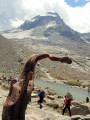
The Col de Leynir

This hike up to the Col de Leynir on the border between Piedmont and the Aosta Valley is a truly beautiful walk. The pass offers a splendid view of Mont Blanc and the summit of the Grand Paradis.

Details

n°1477320
Creation:
Last update:
Last review:
  • Walking
    Activity: Walking
  • ↔
    Distance: 5.85 mi
  • ◔
    Average duration: 4h 25 
  • ▲
    Difficulty: Moderate

  • ⚐
    Back to start: Yes
  • ↗
    Ascent: + 2,024 ft
  • ↘
    Descent: - 1,998 ft

  • ▲
    Highest point: 10,203 ft
  • ▼
    Lowest point: 8,317 ft

Photos

Description of the walk

At Cresole Reale, head towards the Col du Nivolet. At the pass, continue down a short descent to park at the Lac de Nivolet car park.

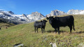
(S/E) Cross the road and take the wide track opposite, which starts next to the Refuge Savoia. After two hairpin bends, you’ll reach the Alpe Riva sheepfold.

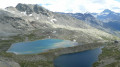
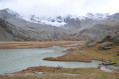
(1) Here, the track becomes a path which crosses the mountain pasture on a very gentle slope. You’ll reach a point above Lac Rosset.

(3) Head north-north-west and continue with the large lake below you. You’ll reach a junction of well-marked paths.

(3) Take the path on the right to look out over and enjoy the Trebecchi Lakes. Continue to the left and begin a steep climb, taking the winding path rather than the straight one up the slope. Go round the ridge, keeping the lakes below in view at all times. You’ll reach another junction of direct and winding paths.

(4) Keep to the right, following the winding path. Complete this ascent to reach a relatively flat path; after this flat section, you’ll come to a tricky area due to the subsidence of the moraine.

(5) Carefully navigate this narrow section and begin a very short descent which ends at a small stream where the path splits into two again.

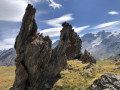
(6) Take the right-hand path, go round the rocky outcrop via a fairly steep climb, and finish with a flatter section to reach the Col de Leynir.

(7) Continue to the right to reach the viewpoint, which offers a remarkable view of the surrounding mountains.

(8) Retrace your steps back to the pass.

(7) Take the direct path on the right, which joins the outward route at the crossroads by the stream.

(6) Continue along the outward route, taking the direct paths rather than the switchbacks, to reach the Lac de Nivolet car park (S/E).
Waypoints

  1. S/E : mi 0 - alt. 8,317 ft - Lac de Nivolet car park
  2. 1 : mi 0.25 - alt. 8,543 ft - Alpe Riva sheepfold
  3. 2 : mi 0.81 - alt. 8,917 ft - Above Lac Rosset
  4. 3 : mi 1.18 - alt. 9,026 ft - Trebecchi Lakes
  5. 4 : mi 1.7 - alt. 9,400 ft - Trail junction with switchbacks
  6. 5 : mi 2.23 - alt. 9,682 ft - Narrow passage
  7. 6 : mi 2.42 - alt. 9,593 ft - Trail junction by the stream
  8. 7 : mi 2.92 - alt. 10,148 ft - Col de Leynir
  9. 8 : mi 3.01 - alt. 10,161 ft - Viewpoint
  10. S/E : mi 5.85 - alt. 8,317 ft - Lac de Nivolet car park

Notes

Water is available at the Alpe Riva fountain.
On the ascent, it is strongly recommended that you take the long route, particularly at (6).

Worth a visit

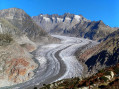
Stunning views of the Grand Paradis, complemented by those of Mont Blanc and the Dent du Géant, which is particularly clearly visible.

Reviews and comments

5 / 5
Based on 1 review

Reliability of the description
5 / 5
Ease of following the route
5 / 5
Route interest
5 / 5
henrigole
henrigole

Overall rating : 5 / 5

Date of your route : Jul 27, 2022
Reliability of the description : ★★★★★ Very good
Ease of following the route : ★★★★★ Very good
Route interest : ★★★★★ Very good
Very busy route : No

A lovely walk with Monte Paradiso as our companion.

Machine-translated

Other walks in the area

For more walks, use our search engine .

The GPS track and description are the property of this route's author. Please do not copy them without permission.