Carro Mountain Hut – L’Écot via Lac du Pys

Unmarked alternative route to descend from the Refuge du Carro via Lac du Pys.

This walk is part of a multi-day hike: Refuge de Carro

Details

1401079
Creation:
Last update:
Last review:
  • Walking
    Activity: Walking
  • ↔
    Distance: 5.85 mi
  • ◔
    Average duration: 3h 10 
  • ▲
    Difficulty: Moderate

  • ⚐
    Back to start: No
  • ↗
    Ascent: + 568 ft
  • ↘
    Descent: - 2,956 ft

  • ▲
    Highest point: 9,075 ft
  • ▼
    Lowest point: 6,637 ft

Photos

Description of the walk

(S) Set off from the refuge via the route you took on the way up.

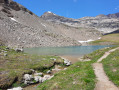
(1) At the fork, stay on the path leading uphill opposite, towards Lac du Pys. Continue uphill, then cross a first valley and the Ruisseau de Plan Sec. Continue along the track to cross a second cirque and the Ruisseau des Vardettes, then descend towards the lake.

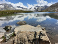
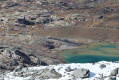
(2) Cross the Ruisseau du Montet, which feeds the waterfall seen the day before, and reach Lac du Pys.

(3) Take a short detour to the right to reach Lac de Pys, then continue along the path which climbs and skirts the Ouille des Reys (3,081 m).

(4) After the bend, you’ll see chalets and ruins below. Continue along the Sentier Balcon to a flat area where you’ll find a sign with contact details for the herd owners in case of any issues with an animal.

(5) At the flat area, turn left onto a path that descends after the first hill towards the chalet and the ruins of Les Reys d’en Bas.

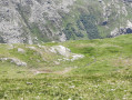
(6) Join the path and turn right to walk past the chalet and back down into the valley to the hamlet of l’Écot.
Please note: the descent is sometimes steep and often muddy. Once at Le Mollard, continue to the left then turn right towards L’Arc, which you cross via the Pont Saint-Clair. Head back to the car park (E).

Waypoints

  1. S : mi 0 - alt. 9,052 ft - Refuge du Carro
  2. 1 : mi 0.56 - alt. 8,848 ft - Junction for Lac du Pys
  3. 2 : mi 2.37 - alt. 8,547 ft - Montet stream
  4. 3 : mi 2.76 - alt. 8,737 ft - Lac du Pys
  5. 4 : mi 3.34 - alt. 8,763 ft - Start of the Balcon Trail
  6. 5 : mi 3.72 - alt. 8,602 ft - Unmarked junction for the return route to L’Écot
  7. 6 : mi 4.17 - alt. 8,199 ft - Les Reys d’en bas
  8. E : mi 5.85 - alt. 6,640 ft - L’Écot, after crossing the - Arc (rivière) - Affluent de l'Isère

Notes

Final descent via a path that is partly unmarked, quite steep and often muddy.

Worth a visit

(S/E) Refuge du Carro, Lac Blanc and Lac Noir.
Craft beer from the Modane Valley and homemade blueberry tart!!

Reviews and comments

4.8 / 5
Based on 2 reviews

Reliability of the description
5 / 5
Ease of following the route
4.5 / 5
Route interest
5 / 5
Astrance69
Astrance69

Overall rating : 4.7 / 5

Date of your route : Jun 20, 2022
Reliability of the description : ★★★★★ Very good
Ease of following the route : ★★★★☆ Good
Route interest : ★★★★★ Very good
Very busy route : No

A lovely balcony path with magnificent views over the valley. Lake PYS is very pretty and easy to reach.
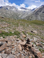
At point 5, the path down to Ecot is on the left, below the balcony path. A cairn is clearly visible from the balcony path, whether you’re coming from the Carro refuge or the Oulietta car park (in which case it’s on the right).
From the balcony path, you can see a second cairn in the distance, marking the route of the descent path.
I didn’t complete the rest of the route; I’ll save that for another time.

Machine-translated

marlene48
marlene48

Overall rating : 5 / 5

Date of your route : Nov 03, 2021
Reliability of the description : ★★★★★ Very good
Ease of following the route : ★★★★★ Very good
Route interest : ★★★★★ Very good
Very busy route : No

Hello
We’d like to spend two weeks in Bonneval-sur-Arc. We’re a couple travelling with our active dog – could you suggest some walks suitable for dogs? Many thanks

Machine-translated

Other walks in the area

For more walks, use our search engine .

The GPS track and description are the property of this route's author. Please do not copy them without permission.