


Refine your search for walks in Col du Blainon
Col du Blainon walks


 GTA, Great Alpine Crossing via the GR®5 and GR®55. From Lake Geneva to Nice.
 Visorando Member
 342.76 mi
 +99,633 ft
 -100,915 ft
 21 days
 Very difficult
 Departure from Saint-Gingolph (Haute-Savoie)
The Grande Traversée des Alpes (GTA) mainly follows the GR®5, with a few possible variations such as the crossing of the Haute Vanoise via the GR®55 and the Via Alpina, which this route takes instead of the GR®5 route via the Col de l’Iseran. It crosses the French Alps from north to south, from Saint-Gingolph to Nice. The guide includes web links to the many accommodation options along the route or nearby: mountain huts, lodges, campsites, cabins and shelters, excluding hotels. Although this guidebook details the GTA as a three-week trek, it can be adapted to suit your own pace, with stages of varying lengths, either completed in one go or in sections over several years. This journey, fuelled by the joy of freedom in unspoilt natural surroundings, will remain a superb and unforgettable experience, offering, moreover, the opportunity to meet many people with whom you can share this same passion for the mountains.
Las Donnas loop starting from Roya
 10.33 mi
+3,333 ft
-3,333 ft
7h 40
 Difficult
Departure from Saint-Étienne-de-Tinée (Alpes-Maritimes)
A short walk in the Tinée, starting from the magnificent hamlet of Roya, combining forest crossings, exposed ridges and breathtaking views. A relatively easy hike, though it will still require a bit of navigation on the climb up to the Col de Chavalet.
From Bousiéyas to Roya
 19.22 mi
+5,515 ft
-6,716 ft
13h 40
Very difficult
Departure from Saint-Dalmas-le-Selvage (Alpes-Maritimes)
This seventeenth stage continues the crossing of the Mercantour massif. From Bousiéyas, the GR®5 climbs gently along the forest track, crosses the Tinée valley and reaches the small lake of Lauzarouotte. The path then crosses the Issias valley and reaches the Col de la Colombière. Winding its way down, it plunges straight into the Vallon de la Combe and, hugging the hillside, reaches the Rochepin chalet before returning to the bottom of the Vallon de la Combe and reaching Saint-Dalmas-le-Selvage. The GR®5 follows the Route d’Anelle, crossing a few torrents before reaching the Col d’Anelle. It descends to Saint-Étienne-de-Tinée, which it passes through, before entering the Tinée Valley. At the hamlet of Drogon, it winds its way up the valley side in a series of hairpin bends to the resort of Auron, then passes through woodland to reach the Col du Blainon before descending the sunny side of the Vallon de la Roya and arriving at the “Ma Vieille École” lodge.
Auron – Longon dairy farm
 16.41 mi
+5,928 ft
-4,970 ft
10 hrs
Very difficult
Departure from Saint-Étienne-de-Tinée (Alpes-Maritimes)
A long but beautiful stage combining the austere landscape of Mont Mounier with the green mountain pastures of Longon.Look up to watch the vultures.A gentle finish at the Vacherie de Longon, surrounded by animals.
Saint-Dalmas-le-Selvage - Roya
13.32 mi
+4,255 ft
-4,203 ft
9h 50
Difficult
Departure from Saint-Dalmas-le-Selvage (Alpes-Maritimes)
Étape de la traversée des Alpes de Saint-Dalmas-le-Selvage jusqu'à Roya. Randonnée offrant un très beau panorama sur la Haute Tinée avec passage de la station de ski d'Auron puis après le Col du Blainon entrée dans le vallon de Roya où le mouton est roi.
Walks near Col du Blainon
From Roya to the Longon Refuge
 12.21 mi
+4,321 ft
-3,081 ft
9h 25
Difficult
Departure from Saint-Étienne-de-Tinée (Alpes-Maritimes)
This eighteenth stage continues the traverse of the Mercantour Massif. From Roya, the GR®5 crosses the Vallon de Roya torrent, follows the Vallon de la Maïris upstream and then the Vallon de Sallevieille, before winding its way up to the Plan des Laces and then the Col de Crousette. From the pass, the path winds its way up the left-hand slope of the Vallon de la Culasse towards the Stèle Vallette, follows the ridge on the Vallon du Démant side, crosses the Baisse du Démant and descends to the Col du Refuge and then to the Col des Moulinés. It drops down to the bottom of the Vallon du Démant, crosses its torrent and, on the slope of the opposite side, meets the Vallon de la Gourgette. Above the hamlet of Vignols, it climbs beneath the ruin-like rocks of Les Chambrettes, where a colony of bearded vultures nests, and passes the small pass of Portes de Longon, then winds its way along a stream to reach the Refuge du Longon or Vacherie de Roure.
Roya - Roure
17.57 mi
+4,469 ft
-5,830 ft
12h 00
Difficult
Departure from Saint-Étienne-de-Tinée (Alpes-Maritimes)
Étape de la traversée des Alpes de Roya jusqu'à Roure. Randonnée allant de la Haute Tinée en passant par le Mercantour où l'on peut apercevoir des vautours. À l'approche du Col de Croussette un univers minéral nous attend puis un plateau quasi désertique pour finir par la douceur des pâturages de Roure.
Saint-Étienne-de-Tinée - Rabuons Refuge
 4.55 mi
+4,951 ft
-423 ft
6h 25
Difficult
Departure from Saint-Étienne-de-Tinée (Alpes-Maritimes)
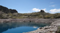
This first stage will take you to the Rabuons mountain hut, on the shores of the largest lake in the Alpes-Maritimes.The landscape is very rocky. You’ll come across plenty of Italians, as just across the border there are several mountain huts offering lovely routes via the nearby Pas de l’Ischiator.
⚠️ Allow around 4 hours for an average hiker in good physical condition to complete this walk.
Saint-Etienne-de-Tinée - Lacs de Vens - Small Pass of Tortisse
 7.52 mi
+5,942 ft
-1,342 ft
7 hrs
Very difficult
Departure from Saint-Étienne-de-Tinée (Alpes-Maritimes)
First stage of a two-day hike in the Haute-Tinée.
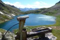
Ascent to the magnificent Lacs de Vens and the small pass of Tortisse via the Claï valley and Lac des Babarottes.
Plenty of marmots and chamois around the Lacs de Vens and below the small pass of Tortisse.
Rabuons Refuge – Vens Refuge
 9.54 mi
+3,383 ft
-3,875 ft
7 hrs
Very difficult
Departure from Saint-Étienne-de-Tinée (Alpes-Maritimes)
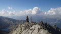
After a night at the Rabuons Mountain Hut, you’ll be ready to climb Mont Ténibre, the main highlight of this second stage. The route is challenging but you’ll be richly rewarded by the panoramic views that await you. To the south, you’ll recognise the Refuge de Rabuons and the lake; to the north and west, there are numerous lakes and the peaks on the border with Italy. After a more leisurely walk along the Chemin de l’Énergie, the scenery will become more pastoral as you approach the Lacs de Vens.
You are now in the Mercantour National Park; there are regulations to be observed, and failure to do so may result in a fine of up to €1,500 – please see the practical information.
Rabuons Mountain Hut – Saint-Étienne de Tinée
4.93 mi
+164 ft
-4,642 ft
2h 25
 Moderate
Departure from Saint-Étienne-de-Tinée (Alpes-Maritimes)
The final day is less demanding than the previous one, consisting entirely of a descent. It’s a chance to walk the ‘Chemin de l’Énergie’ one last time before a long descent to Saint-Étienne-de-Tinée.
Mont Mounier as seen from the Montagne de l’Estrop
 10.63 mi
+2,703 ft
-5,919 ft
7 hrs
Very difficult
Departure from Péone (Alpes-Maritimes)
This hike forms thesecond stage of the ascent of Mont Mounier.
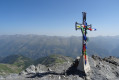
Starting from the Montagne de l’Estrop, you’ll climb to the Col de Crousette for a beautiful view over the valley of the same name and the Haute-Tinée. You’ll then reach the Mont Mounier ridge, which you’ll follow to the summit.
The descent takes you through the hamlet of La Colle before climbing back up towards the Tête de Charnaye, then down again towards the altisurface, and finally the final descent to the Pont d’Aygue Blanche.
From the Aygue Blanche bridge to Montagne de l’Estrop
 3.69 mi
+3,209 ft
-0 ft
4h 30
Difficult
Departure from Péone (Alpes-Maritimes)
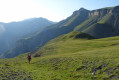
This hike is the first stage of a two-day circular route leading to the ascent of Mont Mounier.
Starting from the Pont d’Aygue Blanche near Péone, you’ll climb gradually towards the small plateau of the Montagne de l’Estrop, where you can camp in sheltered conditions. A stage through deciduous woodland and mountain pastures at the foot of the rocky ridge of the Montagne de l’Alp.
From the Longon Refuge to Saint-Dalmas
 15.05 mi
+3,540 ft
-5,518 ft
10h 00
Difficult
Departure from Alpes-Maritimes
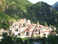
This nineteenth stage continues the long traverse of the Mercantour. From the Refuge de Longon, the path descends the Vallon du Longon diagonally across the slope to the hamlet of Rougios, before following the Fracha forest road and then taking a shortcut to the pretty Provençal village of Roure. Via a stony descent, it cuts across the hairpin bends of the M130 and M30 roads and reaches Saint-Sauveur-sur-Tinée, which it passes through before climbing up to the Chapelle Saint-Roch. Running along the hillside, it crosses the Vallon du Romarinier, passes through the hamlet of Roubinastre, crosses the Ravin de l’Esclosé and arrives at Rimplas. The GR®5 descends gently towards the small pass of Ragias and crosses the Vallon Gros, before climbing back up to the ridge on that side of the slope and then skirting the hamlet of La Bolline. From there, it climbs to the hamlet of La Roche and then ascends the ridge of the Vallon de Bramafam to reach Saint-Dalmas Valdeblore.
Vens Mountain Hut – Saint-Etienne-de-Tinée
 7.56 mi
+1,302 ft
-5,341 ft
4h 35
Difficult
Departure from Saint-Étienne-de-Tinée (Alpes-Maritimes)
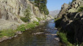
The aim of this third stage is, of course, to return to Saint-Etienne-de-Tinée. You’ll enjoy one last glimpse of the majestic scenery of the Vens Lakes, the Torrent de Vens, the waterfalls and also the Lac des Babarottes, which is a little more secluded. You’ll take the Chemin de l’Energie one last time – a very peaceful route overlooking the valley.