


 Country:

 City:
City:


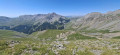
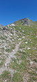
The route starts in the hamlet of Roya, where there are plenty of parking spaces near the church: please note that it can get quite busy in summer. If the car park in the square is full, you can park at the end of the track.
(S/E) Walk up the road, passing behind the lodge. You’ll soon reach marker 139.
(1) Take the path, which crosses the track, to marker 140.
(2) Leave the road and continue along the track until you pass marker 141 and reach the bridge over the Vallon de Roya, which leads into the Mercantour National Park.
(3) You are now entering the Mercantour National Park; please ensure you comply with the park regulations. Further up, you will come to the Ruisseau de Carillas. Cross this small stream; the path is slightly damaged, so take care when crossing.
(4) Continue up the steep climb until you reach marker 148, where there is a footbridge over the Ruisseau du Vallon de Roya.
(5) Turn right to reach the edge of the park. Head north towards the Col de Chavalet. Note: I personally found it very difficult to spot a path and/or the yellow markings here; stay alert, but keep the barns above in sight and you won’t get lost. Use the GPS track here.
(6) Leave the park; the path is still quite difficult to make out, so keep an eye out for the barns.
(7) Here, there’s a yellow marker between the two barns, but the path remains quite inconspicuous. Again, keep an eye on the barns and ruins a little further up to stay on course. Head towards this new ruin.
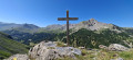
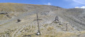
(8) Stay on the path, which is now clearly visible and marked in yellow. Follow it to reach a cross a few bends further on, then a lovely ridge at the next point.
(9) Turn left onto the ridge and follow it to the top, keeping an eye on the yellow markings.
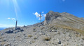
(10) From here, you’ll spot a small hut a little further on amongst the grass, and the Col du Chavalet right at the far end opposite. Carry on and, via a clearly marked path, you’ll emerge at the Col du Chavalet, marked by a sign and marker 149.
(11) Here you have two options:
- take thefirst path on the right and, after a steep climb, you’ll arrive near the top station of the Dôme chairlift,
- take the track to the left; this is the route shown on the map. This option, via a circular loop to the right, allows you to avoid the steep climb and also leads to the foot of the upper station of the Dôme chairlift.
(12) Start the south-easterly descent here by taking the piste, and head towards marker 170.
(13) You’ll pass a storage area for gas cylinders; head down to the left to reach the top station of the Las Donnas cable car, where marker 169 is located.
(14) Take the track on the left, which immediately turns right. Continue the descent to marker 172 at the summit of Le Colombier and the top station of the Blainon chairlift.
(15) Follow the track to reach the Baisse du Colombier very quickly.
(16) Continue along the ridge leading to the Col du Blainon and marker 13a.
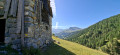
(17) Turn sharply to the right, almost 180°. Head towards the old Saint-Sébastien Chapel.
(18) Walk round the valley to marker 13b.
(19) Keep heading left towards Roya. Shortly afterwards, you’ll come to the hamlet of La Salle, where there’s a small fountain.
(20) Continue down the slope, passing markers 138 and 137. At marker 137, turn left to return to the car park near Roya Church (S/E).
 Visorando Member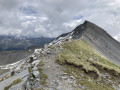

 Moderate
 Very difficult
