


Refine your search for walks in Col d'Artigue Couade (1730m)
Col d'Artigue Couade (1730m) walks


 Col d’Artigue Couade
 Visorando Member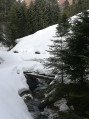
 8.92 mi
 +2,320 ft
 -2,329 ft
 6 hrs
6 hrs
 Difficult
 Departure from Jézeau (Hautes-Pyrénées)
A fairly challenging snowshoe hike in a little-known valley.
This hike is classified as difficult as it takes place off the marked trails. During my hike, there was a lot of snow. Some cars had been buried under a thick layer of snow.
A good sense of direction is absolutely essential. But the scenery is spectacular.
There is no danger whatsoever if you follow this description and this GPS track.
Walks near Col d'Artigue Couade (1730m)
 Fréchet-Aure - Sarrancolin
 3.18 mi
+446 ft
-807 ft
1h 50
3.18 mi
+446 ft
-807 ft
1h 50
 Easy
Departure from Fréchet-Aure (Hautes-Pyrénées)
Easy
Departure from Fréchet-Aure (Hautes-Pyrénées)
Fourth stage of the Ténarèze: this section of the route takes you back to the GR®105 from Fréchet-Aure.
The route continues through Camous, a picturesque village with a rich mining heritage. You will then take a path towards Ilhet, following the old railway line, an industrial relic that adds a touch of nostalgia to the hike.
The walk continues to Sarrancolin, the end point of this stage.
From Ancizan to Fréchet-Aure
 5.60 mi
+984 ft
-1,083 ft
3h 25
5.60 mi
+984 ft
-1,083 ft
3h 25
 Moderate
Departure from Ancizan (Hautes-Pyrénées)
Moderate
Departure from Ancizan (Hautes-Pyrénées)
Third stage of the Ténarèze. From Ancizan, follow the GR® 105 north-east, crossing summer pastures and beech woods with views of the Pic du Midi de Bigorre. After Cadéac, the trail leads to Arreau, the former capital of the Aure Valley. Then take the old railway line (now disused), a flat path lined with ferns, to Fréchet-Aure. This balcony village, listed as one of the "Most Beautiful Villages in France", offers a panorama of the Pyrenees and a preserved pastoral heritage.
From Saint-Lary-Soulan to Ancizan
 5.00 mi
+318 ft
-443 ft
2h 35
Easy
Departure from Saint-Lary-Soulan (Hautes-Pyrénées)
5.00 mi
+318 ft
-443 ft
2h 35
Easy
Departure from Saint-Lary-Soulan (Hautes-Pyrénées)
The second stage of the Ténarèze, at the bottom of the Aure valley, runs alongside the Neste river through fields. In places, the path widens, suggesting the trace of the old drovers' road, particularly near the Nourde footbridge. A peaceful route that passes through several small rural villages set on a plain ideal for resting herds before the climb to the summer pastures.
From Pla d’Adet to the village of Saint-Lary-Soulan
4.46 mi
+62 ft
-2,628 ft
2h 05
Moderate
Departure from Saint-Lary-Soulan (Hautes-Pyrénées)
A family-friendly hike consisting entirely of a descent. It’s (slightly) steep at the start, then you join an old road that used to lead to Les Granges de Lias and beyond. You’ll need to take a cable car or gondola lift up.
Granges d'Astau - Lac du Portillon
6.39 mi
+4,918 ft
-226 ft
7h 15
Difficult
Departure from Oô (Haute-Garonne)
Starting from Les Granges d'Astau, there is a long climb with some steep sections, made more pleasant by the presence of several lakes. Lac d'Oô and its inn, and Lac d'Espingo in its magnificent setting are ideal places to stop for a break. After Lac du Saussat (pronounced Sa-ou-sat), the much smaller Lac de la Coume de l'Abesque marks the start of the steep, winding climb that leads to a plateau dotted with smooth rocks and small lakes, and then to the Jean Arlaud refuge.
Superbagnères – Lac d’Oô – Granges d’Astau
 10.50 mi
+2,723 ft
-4,820 ft
7h 10
Difficult
Departure from Saint-Aventin (Haute-Garonne)
10.50 mi
+2,723 ft
-4,820 ft
7h 10
Difficult
Departure from Saint-Aventin (Haute-Garonne)
Easily accessible without a car, this walk offers views of the surrounding valleys and peaks, as well as the magnificent Lac d’Oô. A perfectly signposted and well-maintained path where it is impossible to get lost. The return journey will be by public transport back to Luchon station.
Campana de Cloutou Mountain Hut – Orédon Mountain Hut
9.03 mi
+3,681 ft
-4,869 ft
7h 20
Difficult
Departure from Bagnères-de-Bigorre (Hautes-Pyrénées)
The final day of the 4-day Tour of the Néouvielle Massif. The longest and most challenging of the four stages, passing by the viewpoint of this multi-day hike: the Pic de Bastan. This peak offers a magnificent view over the entire massif and the surrounding lakes.
Du Refuge du Campana de Cloutou à Artigues par le Lac de Montarrouye
 7.58 mi
+974 ft
-4,275 ft
4h 20
Difficult
Departure from Bagnères-de-Bigorre (Hautes-Pyrénées)
7.58 mi
+974 ft
-4,275 ft
4h 20
Difficult
Departure from Bagnères-de-Bigorre (Hautes-Pyrénées)
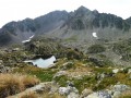
This second stage, after spending the night at the Refuge de Campana de Cloutou, returns to Artigues, off the beaten track, with the discovery of the little-known Montarrouye valley.This day is classified as difficult because you need to know how to find your way.
Lake Espingo - Granges d'Astau
 3.84 mi
+72 ft
-2,746 ft
1h 50
Easy
Departure from Oô (Haute-Garonne)
3.84 mi
+72 ft
-2,746 ft
1h 50
Easy
Departure from Oô (Haute-Garonne)
A gentle descent after the exertions of the previous days. From the Col d’Espingo, the Lac d’Oô below accompanies us for a long while. Once at the stone bridge, don’t hesitate to make a short detour to the Auberge du Lac d’Oô, where you can enjoy the view of the great waterfall, which will help you forget, if only for a moment, the increasingly obvious and cruel shortage of water. The return to Les Granges d’Astau brings this getaway in one of the most beautiful spots in the Luchon area to a pleasant close.
From the village of Artigues to Tournaboup
8.91 mi
+3,907 ft
-3,077 ft
7h 30
Difficult
Departure from Campan (Hautes-Pyrénées)
Third day of a three-day circular route. After a restful night in Artigues, set off having filled your water bottle and packed a packed lunch. To round off this circular route on a high note, take this path between the Col du Tourmalet and the Pic du Midi de Bigorre. A very pleasant walk, with the Pic du Midi towering above you. Return by heading down towards the Tournaboup car park.