Col d’Artigue Couade

A fairly challenging snowshoe hike in a little-known valley.
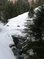
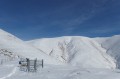
This hike is classified as difficult as it takes place off the marked trails. During my hike, there was a lot of snow. Some cars had been buried under a thick layer of snow.
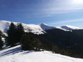
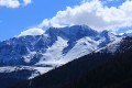
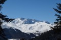
A good sense of direction is absolutely essential. But the scenery is spectacular.
There is no danger whatsoever if you follow this description and this GPS track.

Details

475049
Creation:
Last update:
Last review:
  • Snowshoeing
    Activity: Snowshoeing
  • ↔
    Distance: 8.92 mi
  • ◔
    Duration according to the author: 6 hrs 
  • ▲
    Difficulty: Difficult

  • ⚐
    Back to start: Yes
  • ↗
    Ascent: + 2,320 ft
  • ↘
    Descent: - 2,329 ft

  • ▲
    Highest point: 5,653 ft
  • ▼
    Lowest point: 3,356 ft

Photos

Description of the walk

Please note: when there is heavy snow, the trail barriers, footbridges and bridges are barely visible. You must therefore follow the GPS route closely. Snow bridges should be avoided.

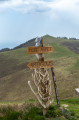
(S/E) Set off from a small car park on the D19 (1,030 m) just before Ardengost. Head towards the junction on the right and follow the track just above the road. Go through a barrier and leave the track that climbs steeply to the right. Follow the main track, keeping to the left bank of the Ruisseau d’Ardengost. Ignore the adjacent tracks on either side of this path, which climbs gently following the slope of the stream. You will reach a fork (1,150 m).

(1) Turn right, south-west, and climb up a wide track to the next junction (1,250 m).

(2) Turn sharply left, heading due east, and follow a wide track uphill for approximately 800m.

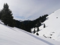
(3) At the fork (1,335 m), turn sharply right, south-west, climbing up a narrower track. Continue climbing in the same direction, leaving the tracks and paths on either side. The climb is steep for 1 km. You’ll reach a crossroads (elevation 1,448) on a mountain pasture where the view is exceptional.

(4) Turn left, heading due east, following the edge of the forest on your left. Simply follow the firing positions located at the edge of the forest. The route is almost entirely flat, running above the Chemin de la Serre. You’ll reach Plan Des Pins (1,480m).

(5) At the crossroads, carry on straight ahead, heading due east. At the edge of the forest, the path climbs steeply, following a wooded ridge. You’ll reach Cap du Cros (altitude 1,646 m). Please note: the path now turns south-east, climbing slightly, and reaches another fork (altitude 1,653 m).

(6) Turn right, heading due south. Head towards the open summer pasture area. Pass at an altitude of 1,658m. Now keep parallel to the Chemin de la Serre, on your left. Pass beneath Cap d’Artigue Couade (1,731m), on your right. You’ll reach the Col d’Artigue Couade (1,710m).
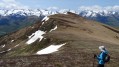
A well-deserved break is worth considering in this open and magnificent spot.

(7) Turn left, north-east, descending only slightly towards the Chemin de la Serre. Head right, north-east, along this small track which descends gently, entering the forest. Exit the forest. Cross the valley floor, heading due north. Marker posts and boundary stones indicate the direction to follow. You’ll need to climb a few metres. You’ll reach the top of a wide, open area. To the north-west, you’ll see the Cabanes de Jézeau (in very good condition but closed).
You can reach them by following the Chemin de la Serre, which leads to the huts.

(8) Alternatively, turn left (1,700 m) and descend into the valley, heading due south. Watch out for the stream and snow bridges. Pass the point at an altitude of 1,586 m. Stay in the open area and you’ll reach a large crossroads with numerous paths and tracks (1,471 m).

(9) Continue south-west for 100m, then veer to the right and follow the Ruisseau d’Ardengost, making a very wide right-hand bend (north-north-west). A track on the left bank of the stream also allows you to descend. Ignore the adjacent paths and tracks. Continue downwards, maintaining the same direction. Pass the altitudes of 1,411m and 1,372m. Continue following the main course of the stream, once again ignoring the adjacent paths and tracks.

(10) Pass the point with an altitude of 1270m. Continue along the track, which begins a wide left-hand bend and now heads west, alongside the Ruisseau d’Ardengost.

(1) Go straight on to descend via the same route as on the way up. When you reach the end of the track, go through the gate and return to the cars (S/E).

Waypoints

  1. S/E : mi 0 - alt. 3,366 ft - Parking along the D19
  2. 1 : mi 0.97 - alt. 3,776 ft - Junction (1,150 m) – turn right
  3. 2 : mi 1.75 - alt. 4,124 ft - Crossroads (1,250 m) – turn left
  4. 3 : mi 2.19 - alt. 4,360 ft - Junction (1,335 m) – turn right
  5. 4 : mi 2.72 - alt. 4,738 ft - Crossroads (altitude 1,448 m) – turn left
  6. 5 : mi 3.15 - alt. 4,833 ft - Crossroads – straight ahead
  7. 6 : mi 3.86 - alt. 5,377 ft - Junction (altitude 1,653 m) – turn right
  8. 7 : mi 4.79 - alt. 5,620 ft - Col d'Artigue Couade (1730m)
  9. 8 : mi 5.75 - alt. 5,600 ft - Head off to the left
  10. 9 : mi 6.41 - alt. 4,928 ft - Grand Carrefour
  11. 10 : mi 7.4 - alt. 4,150 ft - Altitude: 1,270 mètres
  12. S/E : mi 8.92 - alt. 3,356 ft - Parking along the D19

Notes

Access: From Lannemezan, head towards Saint-Lary-Soulan via the Aure Valley (D929).
At the entrance to Arreau, turn immediately left onto the bridge (698m) crossing the Neste d’Aure.
Follow the signposts for Ardengost. Please note that the road (D19) is narrow and winding.
Before a sharp left-hand bend, about 1.5 km from the village, park in a fairly large space on the right-hand side of the road. The start of the walk is 20 metres further on.

This walk is often unmarked and requires a basic sense of direction.
Please note that the huts along the route are closed. There are no water sources in winter.

A day’s snowshoeing in the mountains requires specialised equipment. You will therefore need, at the very least, a hot drink, gloves, a hat, poles, snowshoes, sunglasses, warm clothing, a map, route description and GPS track.

Being able to read a map at a scale of 1:50,000 or 1:25,000 is very useful in such areas.

Worth a visit

Reviews and comments

4.7 / 5
Based on 2 reviews

Reliability of the description
5 / 5
Ease of following the route
5 / 5
Route interest
4 / 5
raylann
raylann

Overall rating : 4.3 / 5

Date of your route : Nov 30, 2023
Reliability of the description : ★★★★★ Very good
Ease of following the route : ★★★★★ Very good
Route interest : ★★★☆☆ Average
Very busy route : No

Much of this route is in a restricted area 😕 and is of only moderate interest
However, from Ardenghost there’s a lovely ride to the Col des Sonères, offering superb views.
But be warned: there are few parking options, and in summer it’s likely to be tight.

Machine-translated

Marc 31200
Marc 31200

Overall rating : 5 / 5

Date of your route : Feb 07, 2022
Reliability of the description : ★★★★★ Very good
Ease of following the route : ★★★★★ Very good
Route interest : ★★★★★ Very good
Very busy route : No

Hello,
I did this in early February 2022; I didn’t come across anyone, and there were no tracks on the descent!

Some lovely views once you’ve left the forest track
The GPX track from the website was spot on
Plenty of snow, which suits me down to the ground for the descent without skis or snowshoes.

I’d recommend it

Machine-translated

rambau
rambau

Not done yet

Machine-translated

labuscasse
labuscasse

Thank you for your reply.
I deliberately tried to be provocative in order to get a response.
I actually don’t understand how the app works.
I’ve subscribed to the IGN maps;
I’ve cached the map.
I open the app and disconnect from the internet.
I can’t access the maps – the app asks me to connect to the internet.
Can you help me understand?
Thank you

Machine-translated

labuscasse
labuscasse
• Edited:

Problem with loss of network coverage along half the route

Machine-translated

Charlatan
Charlatan

Not done

Machine-translated

Other walks in the area

For more walks, use our search engine .

The GPS track and description are the property of this route's author. Please do not copy them without permission.