


 Country:

 City:
City:


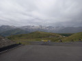
Arrive at Luchon station, then take the cable car to Superbagnères.
(S) Follow the small road, turning right as you exit the cable car, until you pass through the middle of a large car park, then turn left onto the road. Continue to a small car park with information boards. Leave the road by turning right.
(1) Then, head straight left onto a slightly gravelly path: this is the GR®10, marked with red and white signs, which you should follow throughout the hike. Then follow the ridge (which remains very wide).
(2) The junction with the GR®10 path isn’t immediately obvious: look for it before a small, isolated building further along the path. Leave this path and turn left onto a narrower dirt track that descends down the mountainside.
(3) After a gentle descent and having crossed the Ruisseau de Betet, turn right whilst continuing to follow the signposted path: this is the first steep climb with hairpin bends, so do take care.
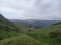
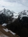
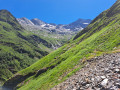
(4) First pass (stunning views of the surrounding peaks and valleys): several paths cross here. Follow the GR®10 path carefully and turn left after passing the pass. A short but fairly steep descent down the mountainside before climbing again.
(5) Second pass, smaller and intermediate in height. This is followed by another descent before a short but steep climb with hairpin bends, which requires a degree of caution.
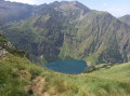
(6) Third and final pass: the Hourquette des Hounts Secs (magnificent view of Lake Ôo below). Be careful to take the path that descends; there is another path which you must not take, marked by a red and white cross (wrong direction). You’ll reach a very well-signposted junction after a steep descent.
(7) Turn right, towards Les Granges d’Astau. If you wish, you can head to the Refuge d’Espingo, a quarter of an hour from the junction by turning left. The descent continues, and is much rockier than before.
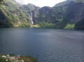
(8) The shore of Lac d’Oô.
(9) Carry on straight ahead after passing Lac d’Ôo, leaving the bridge on your left. Signs once again indicate the direction to follow (Les Granges d’Astau). A short climb leads into the forest.
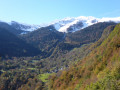
(10) A slight clearing in the forest offers a view over the valley, particularly of Les Granges d’Astau. A long, fairly repetitive descent along winding paths through the forest before reaching your destination (E).
You can take a Lipy shuttle bus back to Luchon station.

 Visorando Member
 Easy
Easy  Association / Club / Walk leader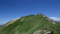
 Moderate
 Very difficult
