Country:

 City:
City:


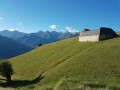
The route starts from Pla d’Adet or La Cabane (the chalet village) or anywhere between these two points. The ascent is by cable car or gondola lift.
(S) Walk down the road to the bottom of the chalet village of La Cabane.
(1) Head down along the path. Follow the GPX track as there are few landmarks. There are several paths you can take. Avoid heading too far to the right to steer clear of steep slopes.
(2) Continue to the right along the wide track heading due east. Aim for Les Granges de Lias.
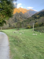
(3) An old road leads down to the village of Vignec in the valley. There is a path running alongside it which shortens the route by avoiding the hairpin bends on the road.
(4) You can make a return trip to the Pont de Bayul (where there’s nothing to see!).
(4) Continue along the old road to the village of Vignec, near the Church of Saint-Jacques de Vignec and the D223.
(5) Turn right onto this road to reach Saint-Lary-Soulan.
(6) The Vignec–Saint-Lary–1700 cable car station is on the right; take this to reach Pla d’Adet, then follow the D123 to the right as far as the car park (S). Alternatively, cross the bridge over the Neste. Turn right, passing close to the thermal baths. Cross the D19 and turn right (shops). Join the D19 and follow it to the left as far as the Pic Lumière cable car station (E), which takes you to Pla d’Adet, then continue to the right along the small road to the car park (S).
 Visorando Member
 Easy
Easy 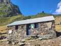
 Very difficult