From the village of Artigues to Tournaboup

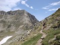
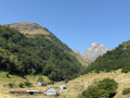
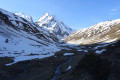
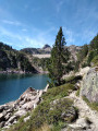
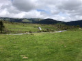
Third day of a three-day circular route. After a restful night in Artigues, set off having filled your water bottle and packed a packed lunch. To round off this circular route on a high note, take this path between the Col du Tourmalet and the Pic du Midi de Bigorre. A very pleasant walk, with the Pic du Midi towering above you. Return by heading down towards the Tournaboup car park.

This walk is part of a multi-day hike: Three days in the Néouvielle Nature Reserve

Details

101680121
Creation:
Last update:
Last review:
  • Walking
    Activity: Walking
  • ↔
    Distance: 8.91 mi
  • ◔
    Average duration: 7h 30 
  • ▲
    Difficulty: Difficult

  • ⚐
    Back to start: No
  • ↗
    Ascent: + 3,907 ft
  • ↘
    Descent: - 3,077 ft

  • ▲
    Highest point: 7,812 ft
  • ▼
    Lowest point: 3,937 ft

Description of the walk

(S) From D’Artigues, rejoin the GR®10 Accès, turning right towards the west.

(1) Cross the D918 road heading up towards the Tourmalet, then follow the GR® route to the right just before the bridge over the Adour d’Arizes. Head towards the Pic du Midi de Bigorre.

(2) Cross the Pont des Vaquès over the Adour d’Arizes, then continue to the right along the GR®10 Accès towards the Pic du Midi de Bigorre as far as the Col de Sencours (site of the very first observatory before the one at the summit of the Pic du Midi de Bigorre was built).

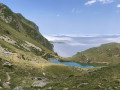
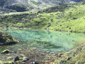
(3) Cross this pass, then head down to the left, passing above Lac d’Oncet on a wide path. Up there, take full advantage of the exceptional 360° view, then head down, skirting around Lac d’Oncet and following the old Route du Pic du Midi. Leave this road to the right and head down following the GR®10 Accès. You’ll come to a fork in the path and a cross-country track.

(4) Turn left, then, about 200 m further on, continue straight ahead on the GR®10 Accès. Do not take the path that branches off to the left. Descend to the Tournaboup car park (E).

Waypoints

  1. S : mi 0 - alt. 3,937 ft - Municipal campsite
  2. 1 : mi 0.5 - alt. 4,229 ft - Crossing the Route du Tourmalet - Adour du Tourmalet ou Adour de Gripp (ruisseau)
  3. 2 : mi 1.49 - alt. 5,089 ft - Pont des Vaquès
  4. 3 : mi 4.47 - alt. 7,812 ft - Viewpoint - Col de Sencours (2379 m)
  5. 4 : mi 6.1 - alt. 6,558 ft - Junction on the left
  6. E : mi 8.91 - alt. 4,767 ft - Car park - Tournaboup

Always be cautious and plan ahead when you're outdoors. Visorando and the author of this route cannot be held responsible for any accidents occurring on this route.

The GR® and PR® markings are the intellectual property of the Fédération Française de Randonnée Pédestre.

Other walks in the area

For more walks, use our search engine .

The GPS track and description are the property of this route's author. Please do not copy them without permission.