


Refine your search for walks in Coglès
Coglès walks


 La Potelais through the Tronçon valley
 Visorando Member
 3.31 mi
 +66 ft
 -69 ft
 1h 35
1h 35
 Easy
Easy
 Departure from Coglès (Ille-et-Vilaine)
The first little gem on this route is the Chapelle de la Potelais, tucked away in the heart of the countryside. Immediately afterwards, and for almost two kilometres, you are invited to follow the meandering course of the Tronçon through woods and fields.
At the edge of the Gâtines, starting from La-Selle-en-Coglès
12.75 mi
+282 ft
-289 ft
6h 05
 Moderate
Departure from La Selle-en-Coglès (Ille-et-Vilaine)
Moderate
Departure from La Selle-en-Coglès (Ille-et-Vilaine)
This circuit symbolically unites two regions by linking the Moulin de Champ Pinel (Brittany) to the Moulin de Roche Garé (Normandy), as this is where the Tronçon river marks the departmental and therefore regional boundary. You will pass through a variety of landscapes as you walk along a beautiful section of the Bois de Gâtines forest and alongside the Château du Rocher Portail, not forgetting to take the opportunity to discover the village of La-Selle-en-Coglès (the monastery of the North).
The descent from Mont Noël along the Ruisseau des Échelles
6.07 mi
+171 ft
-200 ft
2h 55
Easy
Departure from Montours (Ille-et-Vilaine)
On the edge of the Coglais, a charming route combining a walk along a stream with paths through green hills and sunken lanes.
The crosses and wayside shrines of Montours
5.42 mi
+131 ft
-135 ft
2h 35
Easy
Departure from Montours (Ille-et-Vilaine)
A Breton speciality: this route is dotted with several wayside crucifixes and granite crosses. It also offers magnificent views of the Coglais region, but above all, on a clear day, provides an exceptional vantage point looking north as far as the Bay of Mont-Saint-Michel and west over the hills of the Fougères hinterland.
The castles of Coglais
 6.18 mi
+171 ft
-184 ft
3h 00
Moderate
Departure from Saint-Brice-en-Coglès (Ille-et-Vilaine)
6.18 mi
+171 ft
-184 ft
3h 00
Moderate
Departure from Saint-Brice-en-Coglès (Ille-et-Vilaine)
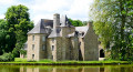
This circuit allows you to discover the architectural side of the Coglais region. It offers breathtaking views of the manor houses and châteaux and their estates. It should be remembered that in the Middle Ages, the Seigneury of Saint-Brice was of exceptional importance in the barony of Fougères. Later, in 1794, it was here that the first Chouannerie began, as did the second in 1815.
Les rabines de Courtine
8.74 mi
+213 ft
-203 ft
4h 10
Moderate
Departure from Saint-Étienne-en-Coglès (Ille-et-Vilaine)
Une rabine désignait autrefois un chemin large et bordé d'arbres. Le circuit en emprunte à plusieurs reprises. Il suit également un petit ruisseau et permet d'apercevoir plusieurs châteaux car il emprunte des sentiers communs à une autre randonnée décrite sur le site au départ de Saint-Brice-en-Coglès.
From the Anaïs to the Loisance
7.37 mi
+233 ft
-246 ft
3h 35
Moderate
Departure from Tremblay (Ille-et-Vilaine)
The Greenway, the stream flowing from the Pré des Douétaux, the Loisance, the Douétel and, finally, an old railway station situated near a disused sawmill – this walk will allow walkers to appreciate the beauty of the Gallo countryside.
Between Loysance and Coquillonnais
5.61 mi
+187 ft
-213 ft
2h 45
Moderate
Departure from Tremblay (Ille-et-Vilaine)
As we follow the banks of the Loysance, we enjoy the tranquillity of the Voie Verte, punctuated by a few inclines that allow us to explore the surrounding countryside, having previously walked through the Tremblay countryside along shaded paths.
The Minette Valley as seen from Saint-Étienne-en-Coglès
9.75 mi
+167 ft
-167 ft
4h 40
Moderate
Departure from Saint-Étienne-en-Coglès (Ille-et-Vilaine)
You have now arrived in one of the most beautiful settings in the Coglais district: first of all, you’ll discover the Ruisseau de la Piquellerais, then the Ruisseau du Vocadieu, as you cross the magnificent Minette Valley. This small river, 25 km long, is a tributary of the Couesnon, fed by a multitude of streams: the Piquellerais and the Vocadieu, but also the Frénouse, the Aunay, the Couard, and so on.
Along the Beuvron in Saint-James
 3.73 mi
+302 ft
-331 ft
2h 00
Easy
Departure from Saint-James (Manche)
3.73 mi
+302 ft
-331 ft
2h 00
Easy
Departure from Saint-James (Manche)
This easy and very pleasant route along the banks of the Beuvron was suggested by the Saint-James Children's Municipal Council.
It also passes close to the American military cemetery, allowing for a short extension to the walk.
The Devil has taken up residence at Le Châtellier.
 6.59 mi
+440 ft
-446 ft
3h 25
Moderate
Departure from Saint-Germain-en-Coglès (Ille-et-Vilaine)
6.59 mi
+440 ft
-446 ft
3h 25
Moderate
Departure from Saint-Germain-en-Coglès (Ille-et-Vilaine)
The legend of the Smoking Stone, also known as the Devil's Rock, says that when the Devil is hungry, he makes the stone smoke by baking his cake between the enormous blocks of rock that form a cave. This circular loop will take you from legendary places to sacred sites. It would be the devil's work if you didn't reach the gates of the Domaine de la Foltière, the kingdom of flowers in the Parc Floral de Haute-Bretagne.
Legends of the Coglais region
 6.95 mi
+358 ft
-344 ft
3h 30
Moderate
Departure from Saint-Germain-en-Coglès (Ille-et-Vilaine)
6.95 mi
+358 ft
-344 ft
3h 30
Moderate
Departure from Saint-Germain-en-Coglès (Ille-et-Vilaine)
Saint-Germain-en-Coglès, God and Satan regularly meet here as soon as granite appears in a field or water gushes from the stone.
With Le Châtellier hidden behind the woods, the commune of Saint-Germain offers some of the most beautiful stories in the region, which this walk allows you to hear as you wander along the paths.
But beware, these legends are drawn as much from local imagination as from historical truths.
Passing by Saint-Germain-en-Coglès station
7.30 mi
+259 ft
-282 ft
3h 35
Moderate
Departure from Saint-Germain-en-Coglès (Ille-et-Vilaine)
The Rocher Jacquot dolmen and the magnificent view from the Saint-Jacques Chapel near the Marigny reservoir: two sites that walkers will discover during this easy walk.
The Writers’ Circular in Saint-Germain-en-Coglès
 6.93 mi
+436 ft
-463 ft
3h 35
Moderate
Departure from Saint-Germain-en-Coglès (Ille-et-Vilaine)
6.93 mi
+436 ft
-463 ft
3h 35
Moderate
Departure from Saint-Germain-en-Coglès (Ille-et-Vilaine)
Whilst Balzac perfectly described Les Couardes, one of the gems of this circular ‘Writers’ Loop’, the route will also take you on a journey to discover Chateaubriand and the early life of Jean Guéhenno.
The Chemin des Bogues around Saint-Marc-le-Blanc
8.11 mi
+118 ft
-108 ft
3h 50
Moderate
Departure from Saint-Marc-le-Blanc (Ille-et-Vilaine)
The Chemin des Bogues winds through a landscape where working with granite has become second nature and part of the local culture. Granite has left an indelible mark on the landscape. Houses and manor houses dating from the 16th and 17th centuries are a common sight in a region where the rock even features in the names of villages: Rocher-Guy, Rocher Gerré, Rocher Renard, Rochedien, … You may even come across rock carvings on the sides of certain quarries, former haunts of the Picaous (granite workers).
The Saint-Crespin Circuit
5.85 mi
+131 ft
-131 ft
2h 50
Easy
Departure from Saint-Marc-le-Blanc (Ille-et-Vilaine)
A picturesque walk in the Coglais region, presenting no difficulty.
Peace and tranquillity are its main attractions.
The route from Saint-Georges to Chauvigné
 5.27 mi
+131 ft
-148 ft
2h 30
Easy
Departure from Chauvigné (Ille-et-Vilaine)
5.27 mi
+131 ft
-148 ft
2h 30
Easy
Departure from Chauvigné (Ille-et-Vilaine)
Lulled by the calm waters of the Ritort and the Moulinet, Chauvigné invites you to discover its hidden treasures and offers you a glimpse into its history.
The Route des Rochers in Chauvigné
7.46 mi
+102 ft
-98 ft
3h 30
Moderate
Departure from Chauvigné (Ille-et-Vilaine)
In the 1920s, Chauvigné had granite quarries next to the village of Le Fretay on the "Rochers des Renaisières" site.
The quarrying operation, which remained small-scale, focused mainly on the creation of funerary monuments.
Walkers will enjoy a stroll right in the heart of granite country: amongst meadows where the rock outcrops and traditional buildings.