Country:
 City:


Park in the car park near the town hall in Saint-Germain-en-Coglès.
(S/E) Leave the car park heading towards the roundabout and turn left onto Rue de la Gare.
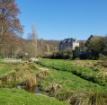
Walk past the town hall and turn right into the “Jardin des Eaux”. Walk westwards through the garden until you reach a road.
(1) Turn left, crossing a stream, and join the footpath on the left. Follow this to the wash house on your right. Take the hairpin bend to the left onto the path running alongside the road.
Cross the D105 and continue eastwards along Rue des Marronniers. A path on the right allows you to walk alongside it behind the detached houses. Then continue to the right towards La Nouriais.
(2) In the hamlet, after a bend to the left, take the path on the right, running north-south. Follow it round several bends to reach the houses at Rocher Jacquot.
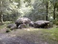
(3) The dolmen with the covered passageway at Rocher Jacquot is 200 metres to the left (follow the signs). Then retrace your steps.
(3) At the bend, turn left and continue to the road. Turn right onto it, then, very soon after a telegraph pole, turn left onto the Voie Verte.
Follow it north-west. After several hundred metres, Saint-Germain-en-Coglès station, a remnant of the old railway line, will be on your left.
Carry on along the Voie Verte, crossing a road.
(4) Carry on along the Voie Verte to the bridge over the Route de la Croix Triquet. Follow this road northwards for 150 metres and turn right.
(5) Carry on to the left. Before the bend leading to Maison Neuve, take the path on the left, heading due north. Follow it until you reach the D19 county road.
(6) Please take care: this section of the road requires great caution as vehicles travel at high speed and, due to the bends, visibility is poor.
Follow the D19 to the right until you reach the first road on the left. Turn left twice towards La Gapaillère.
(7) Turn right towards La Gapaillère and pass through the hamlet. Continue until you reach the stream.
(8) Before the trees, go down the embankment to the left and follow the stream. This will take you straight to the Chapelle Saint-Jacques. Carry on to the right.
(9) At the crossroads, take the left-hand path, heading north. After 250m, ignore the path on the left and carry on for 200m.
(10) Follow the path to the right – which does not appear on the IGN map – and walk past the farm buildings at L’Épinay. Continue along the road; pass through the houses at La Saudrais, then those at Loisance, and you will reach the D12 county road.
(11) Cross the road and turn right onto the old road leading to the cemetery. When you reach the cemetery, cross the D17 at the pedestrian crossing and enter Saint-Germain-en-Coglès.
(12) Take a sharp right-hand hairpin bend (almost 180°) into Rue de la Bazillais. Before No. 21, take the path on the left which runs alongside the river and ends at Rue de Saint-Étienne. Turn left onto this street and cross the road.
(1) Enter the Jardin des Eaux and return via the same route you took on the way there to the car park at the start (S/E).

 Visorando Member

 Easy