Country:
 City:
City:


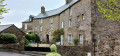
Park in the hamlet of La Beucherais.
(S/E) Leave the hamlet via the old road heading west.
At the end of the road, follow the path to the left. Very soon, it rises above the road and turns right.
Leave the path by turning left to walk down the road to the crossroads.
Cross with care and continue along the path opposite to reach La Doubaie.
(1) Take a short detour to join the path opposite, heading south. Cross the Voie Verte and then the river.
Follow the road for 100 metres to the right until you reach the Gué crossroads.
(2) Turn left, then, after 50m, take the path on the right (not shown on IGN maps).
When the path ends at a field, turn right, then, after 10 metres, turn right again (wooden sign pointing towards La Tremblaie).
Follow this path. Cross the D113 county road and continue straight ahead. When you reach a gravel road, turn right. You will see the tower of the Château de la Coquillonnais opposite.
(3) At the crossroads, turn left to walk alongside a lake on your right.
Carry on northwards until you reach the D97. Take this to the left to pass under the D155 viaduct.
(4) After the house on the right – the former railway station – take the Voie Verte on the left. You’ll reach the junction with theGR®34. (see note in practical information)
Red and white markings forthe GR® 34
(5) Follow the Voie Verte as it curves widely to the left until you reach a small road.
(6) Follow this road to the right. Cross the bridge over the Douétel and continue along this road.
At the T-junction, turn left and then follow the path to the left. Pass over the Voie Verte, from where you can see the tunnel you will go through a little further on.
Ignore a path on the left and follow the path as it takes a sharp bend to the right. As you head downhill, rejoin the Voie Verte.
(7) Follow it to the right. Go through the tunnel and rejoin the junction you passed on the way out.
(6) Carry straight on through the junction and reach the junction on the wide circular loop.
(5) Take the path on the left (it’s a steep climb but not for long). After 10 metres, turn left onto the road towards La Châtière, then take the path on the right.
Follow it to where it ends on the Route de la Beucherais.
No further signposting
(9) Turn right, then, after 200 metres, turn right again to return to the starting point (S/E).

 Visorando Member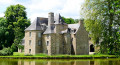

 Easy
Easy  Association / Club / Walk leader