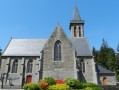
The crosses and wayside shrines of Montours

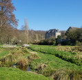
A Breton speciality: this route is dotted with several wayside crucifixes and granite crosses. It also offers magnificent views of the Coglais region, but above all, on a clear day, provides an exceptional vantage point looking north as far as the Bay of Mont-Saint-Michel and west over the hills of the Fougères hinterland.

Details

984789
Creation:
Last update:
Last review:
  • Walking
    Activity: Walking
  • ↔
    Distance: 5.42 mi
  • ◔
    Average duration: 2h 35 
  • ▲
    Difficulty: Easy

  • ⚐
    Back to start: Yes
  • ↗
    Ascent: + 131 ft
  • ↘
    Descent: - 135 ft

  • ▲
    Highest point: 558 ft
  • ▼
    Lowest point: 430 ft
  • ⚐ Country: France
  • ⚐ City: Montours (35460)
  • ⚑
    Start/End: N 48.443284° / W 1.306713°
  • ❏
    IGN map(s): Ref. 1316O
  • Hour-by-hour weather

Description of the walk

To return to the starting point in Montours, coming from Saint-Germain-en-Coglès, after a right-hand bend, turn right into Rue du Sacré-Cœur, just before the church. Pass the street leading past the cemetery on your right and take the first street on the left. The Clos Breton car park lies between the school and the community hall.

Yellow markings forthe PR® “Route de Terre Rouge”

(S/E) Leave the car park via the road that goes uphill and turn left to walk alongside the school playground.
Carry on to the right and go down the natural steps. Continue northwards along this path.
The path leads onto the Route du Haut Chemin. Follow it to the left.

(1) Carry on straight ahead to the crossroads, with a wayside cross on your left. Take the road on the right and join the D103. Follow it to the left for sixty metres and turn right towards Clos Janvier.

(2) At the right-hand bend, carry straight on along the path and follow it until you reach a road.
Turn right and carry on straight ahead, crossing the Rousserie Davy.

(3) When the road takes a wide bend to the left, turn onto a track on the right. Carry on along this track as it bends sharply to the left. Cross a road and continue straight ahead.

(4) Before you reach the first houses in La Boulaie, turn right and head for the D15.
This isa dangerous crossing as vehicles travel at high speed – this is the slip road to the A84 motorway.
Carry on straight ahead northwards to Monpson.

(5) Take the tarmac track on the right and continue eastwards. Pass Le Grand Clos on your left and reach La Valnais. At the end of the road, turn left.

(6) Turn right onto the footpath and follow it first to the Petit Valnel, then on to the Pendant.

(7) Follow the road to the right, crossing the Grand Valnel. Cross the D15 again, taking great care, and continue straight ahead. The path leads to the junction marking the end of the circular route.

(1) Turn left and, 100 metres further on, take the path on the right to rejoin the car park via the path you took on the way out (S/E).

Waypoints

  1. S/E : mi 0 - alt. 505 ft - Car park at the Salle du Clos Breton
  2. 1 : mi 0.82 - alt. 531 ft - On the way there = straight on – On the way back = turn left
  3. 2 : mi 1.23 - alt. 476 ft - At the right-hand bend – go straight on
  4. 3 : mi 1.77 - alt. 433 ft - At a wide bend to the left, take the path on the right
  5. 4 : mi 2.38 - alt. 446 ft - Path on the right
  6. 5 : mi 2.78 - alt. 443 ft - Monpson
  7. 6 : mi 3.5 - alt. 459 ft - Path on the right
  8. 7 : mi 4.03 - alt. 463 ft - The Pendant
  9. S/E : mi 5.42 - alt. 505 ft - Car park at the Salle du Clos Breton

Notes

(6) Off the route: continue for 200 metres along the road to reach the little chapel of Valaine.

Worth a visit

Whilst it is true that, being situated on granitic soil highly conducive to legends, these ‘croix bouëssées’ have lost their boxwood enclosures, the crosses placed at crossroads are said to have a pagan origin: as a night-time gathering place for the ‘dansous’ or revenants, they would stop late-night passers-by for a frenzied dance that would exhaust them, allowing them to regain their strength only at daybreak.

Always be cautious and plan ahead when you're outdoors. Visorando and the author of this route cannot be held responsible for any accidents occurring on this route.

The GR® and PR® markings are the intellectual property of the Fédération Française de Randonnée Pédestre.

Reviews and comments

4.1 / 5
Based on 3 reviews

Reliability of the description
4.3 / 5
Ease of following the route
4.7 / 5
Route interest
3.3 / 5
Laurent50240
Laurent50240
• Edited:

Overall rating : 3.7 / 5

Date of your route : Jan 19, 2021
Reliability of the description : ★★★★☆ Good
Ease of following the route : ★★★★★ Very good
Route interest : ★★☆☆☆ Disappointing
Very busy route : Yes

This walk is easy, although there are a few muddy sections, which is to be expected at this time of year. It’s fine for a stroll but not particularly interesting. The route is signposted.

Machine-translated

manik
manik

Overall rating : 4 / 5

Date of your route : Feb 25, 2019
Reliability of the description : ★★★★☆ Good
Ease of following the route : ★★★★☆ Good
Route interest : ★★★★☆ Good

We got off to a difficult start because there are two schools (or rather, three classrooms) in the village of Montours, and this had us going round in circles for a quarter of an hour: we couldn’t make sense of the initial instructions, which mentioned going down some natural steps, when all we could see was a way to go up them! Luckily, a lovely lady from the village gave us some guidance; it’s also a shame that there isn’t a map of the route at the start of the walk; in fact, you have to go past the multi-sports ground, or up the steps next to the hall – the start of the route is behind it – and then you finally come across those natural steps (we only realised all this on the way back!)
Otherwise, it’s a pleasant route along lovely paths, with very little road; it’s interesting, and on a beautiful sunny day in February 2019, it’s a great way to enjoy the surrounding countryside;

Machine-translated

LOUÂPRE Louis
LOUÂPRE Louis

Overall rating : 4.7 / 5

Date of your route : Mar 26, 2018
Reliability of the description : ★★★★★ Very good
Ease of following the route : ★★★★★ Very good
Route interest : ★★★★☆ Good

Very popular!

Machine-translated

Other walks in the area

For more walks, use our search engine .

The GPS track and description are the property of this route's author. Please do not copy them without permission.