


Refine your search for walks in Grand canal d'Alsace
Grand canal d'Alsace walks


 Along the former bed of the Rhine: from the drawbridge to the Ecluse
 Visorando Member
 4.18 mi
 +36 ft
 -36 ft
 1h 55
1h 55
 Easy
Easy
 Departure from Kembs (Haut-Rhin)
Before the construction of the Canal of Alsace (1928), the Rhine extended its arms east of the Huningue Canal (1806) over a wide area of 1km to 2km. From the Rhone Canal on the North Rhine to the Barre d'Istein on the Old Rhine, along paths and trails often in the protected areas of the "Little Alsatian Camargue.", you'll discover numerous natural and industrial sites related to the history of the Rhine.
Begin with a stroll between the drawbridge of Kembs (1831) and l'Ecluse Le Corbusier (1961).
Walk along the old bed of the Rhine: from the Huningue Canal to the Old Rhine
 6.31 mi
+253 ft
-256 ft
3h 05
Easy
Departure from Kembs (Haut-Rhin)
6.31 mi
+253 ft
-256 ft
3h 05
Easy
Departure from Kembs (Haut-Rhin)
Two centuries ago, the Rhine flowed in a network of meandering channels. From 1842, with the construction of dykes by Tulla, and then around 1930 with the construction of the Grand Canal, the river was channelled into a single course and the Rhine’s ecosystem was profoundly altered.Today, there is a stark contrast between nature, which is becoming overgrown again as it adapts to the drying conditions with diverse and unique flora and fauna, and the intense industrial activity centred on shipping and hydroelectric power.
Walk along the old bed of the Rhine: from Pont-levis to Ferme du Moulin
 2.77 mi
+16 ft
-16 ft
1h 15
Easy
Departure from Kembs (Haut-Rhin)
2.77 mi
+16 ft
-16 ft
1h 15
Easy
Departure from Kembs (Haut-Rhin)
Between the marina and the Ferme du Moulin, this unpretentious little walk allows you to enjoy the tranquillity of the banks of the Canal de Huningue, the Grand Canal d'Alsace and the Augraben, which still feature a few oxbow lakes and ponds, natural remnants of the old bed of the Rhine.
Walk in the old bed of the Rhine: around the Petit Rhin
 6.80 mi
+157 ft
-154 ft
3h 15
Easy
Departure from Weil am Rhein (Regierungsbezirk Freiburg)
6.80 mi
+157 ft
-154 ft
3h 15
Easy
Departure from Weil am Rhein (Regierungsbezirk Freiburg)
The extensive renaturation project on the Île du Rhin, which began in 2013, is drawing to a close. A new river, the Petit Rhin, has emerged between the Grand Canal and the Vieux Rhin. The surrounding land and aquatic environment has been completely transformed and will enable the return or continued presence of numerous plant and animal species.This walk therefore takes place against the backdrop of a natural environment undergoing profound change, where everything is set to change for the great benefit of biodiversity.
Route de la Réserve Naturelle Nationale du Taubergiessen
 9.95 mi
+39 ft
-39 ft
4h 35
9.95 mi
+39 ft
-39 ft
4h 35
 Moderate
Departure from Rheinau/Rhinau (Regierungsbezirk Freiburg)
Moderate
Departure from Rheinau/Rhinau (Regierungsbezirk Freiburg)
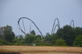
A route through the Taubergiessen National Nature Reserve, in the German part of Rhinau, along the Old Rhine with views of Rhinau Island and a short detour to Europa-Park (Rust).
This is a thousand-hectare nature reserve owned by the French commune of Rhinau on German territory (650 ha of forest and 350 ha of meadows or fields).
I was lucky enough to spot roe deer, swans and herons.
Between Niffer and Petit Landau, towards the Grand Canal d’Alsace
 6.50 mi
+33 ft
-33 ft
3h 00
Easy
Departure from Niffer (Haut-Rhin)
6.50 mi
+33 ft
-33 ft
3h 00
Easy
Departure from Niffer (Haut-Rhin)
A walk in the Haut-Rhin starting from Niffer and its lock. Along the Rhône-Rhine Canal, then across the plain facing the Black Forest, and back via the Grand Canal d’Alsace (the canalised Rhine).
Route franco-allemande: Neuenburg-am-Rhein via la Rhine Island de Chalampé
 5.01 mi
+131 ft
-131 ft
2h 25
Easy
Departure from Chalampé (Haut-Rhin)
5.01 mi
+131 ft
-131 ft
2h 25
Easy
Departure from Chalampé (Haut-Rhin)
The Rhine takes centre stage! On this walk, explore the Rhine Island via the short Pic Vert trail and the village of Neuenburg-am-Rhein with its lovely central square featuring ice cream parlours.
 The Rhine and its locks
 21.08 mi
+52 ft
-52 ft
2 hrs
Easy
Departure from Huningue (Haut-Rhin)
21.08 mi
+52 ft
-52 ft
2 hrs
Easy
Departure from Huningue (Haut-Rhin)
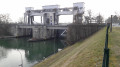
A short cycle ride along both banks of the Rhine, exploring hydroelectric and river engineering structures.
An easy cycle ride on a virtually flat route.
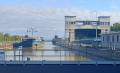
Kembs lock between the Grand Canal d'Alsace and the Old Rhine
 3.26 mi
+52 ft
-52 ft
1h 35
Easy
Departure from Haut-Rhin
3.26 mi
+52 ft
-52 ft
1h 35
Easy
Departure from Haut-Rhin
A short walk between the wild Old Rhine and the tamed canal, with its array of industrial installations: the locks, the German motorway which you cannot see but can hear, the high-voltage power lines you pass under at the start of the route, as well as its natural beauty: the winding, sand-filled Rhine, exposed at the Barre d’Istein. To make the most of the views of the Rhine, the route is best enjoyed in winter when the trees are still bare.
One river and three canals from Huningue
 10.20 mi
+36 ft
-36 ft
4h 45
Moderate
Departure from Huningue (Haut-Rhin)
10.20 mi
+36 ft
-36 ft
4h 45
Moderate
Departure from Huningue (Haut-Rhin)
A lovely walk along the Rhine and the Grand Canal d’Alsace, the drainage canal and the Huningue Canal (the decommissioned Rhône–Rhine Canal). Very gentle in terms of elevation, but a bit long in distance (due to having to go round the port area, which is off-limits to the public).
It offers the chance to discover the beauty and rich river heritage of the Three Borders region.
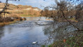
The Île du Rhin to the north of the Kembs bottleneck
 9.10 mi
+66 ft
-69 ft
4h 15
Moderate
Departure from Kembs (Haut-Rhin)
9.10 mi
+66 ft
-69 ft
4h 15
Moderate
Departure from Kembs (Haut-Rhin)
The Île du Rhin is a narrow strip of land stretching over 50 km between the Grand Canal d’Alsace and the Vieux Rhin, shared by the neighbouring municipalities.Less well-known and less frequented than its southern neighbour – which has been renaturalised, is fed by the Petit Rhin and has been developed for walking and birdwatching – the northern section within the municipality of Kembs is nevertheless well worth a visit for walkers, especially when the vegetation is not too dense, allowing visitors to observe the birds of the wetlands near the Old Rhine.
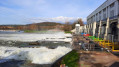
In the heart of the Au plain, Rosenau, daughter of the Rhine
 8.42 mi
+98 ft
-98 ft
3h 55
Moderate
Departure from Kembs (Haut-Rhin)
8.42 mi
+98 ft
-98 ft
3h 55
Moderate
Departure from Kembs (Haut-Rhin)
The Plaine de l’Au is this wetland region on the Rhine’s floodplain in the Land of the Three Borders, where the river, before its course was straightened by dykes (19th century) and then channelled (early 20th century), spread out into multiple branches.Between the Kembs hydroelectric power station to the north and the Grand Marais trail to the south, water accompanies us throughout this route, where biodiversity and human activities strive to coexist harmoniously.The time given does not include stops at the five observation points and other points of interest along the route.
Circular cycling loop around Neuf-Brisach
29.78 mi
+26 ft
-26 ft
3h 16
Easy
Departure from Vogelgrun (Haut-Rhin)
This route follows cycle paths, tracks and trails, alternating between sections through woodland, along rivers and canals, and through countryside. Several places to stop and have a picnic along the route.
Along the canals south of Kembs
 5.48 mi
+13 ft
-13 ft
2h 30
Easy
Departure from Kembs (Haut-Rhin)
5.48 mi
+13 ft
-13 ft
2h 30
Easy
Departure from Kembs (Haut-Rhin)
Walk from the car park near the turbine roundabout in Kembs, towards Rosenau Sud along the Rosenau Stream, through Rosenau to the Huningue Canal, then back to the starting point along the towpath.
La Petite Camargue by Rosenau
 3.98 mi
+13 ft
-13 ft
1h 50
Easy
Departure from Haut-Rhin
3.98 mi
+13 ft
-13 ft
1h 50
Easy
Departure from Haut-Rhin
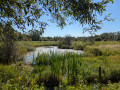
Do you live in the urban area of the three borders and want to get away from it all without travelling dozens of kilometres? Come and discover the Petite Camargue to get some fresh air and observe many species of birds and plants in a well-preserved area. Leaving from the pretty village of Rosenau, you'll find it hard to believe that you're only 4 kilometres away from the airport as the crow flies.