


Refine your search for walks in Chilhac
Chilhac walks


 Lavoûte-Chilhac from Chilhac
 Visorando Member
 8.03 mi
 +1,194 ft
 -1,168 ft
 4h 45
4h 45
 Moderate
 Departure from Chilhac (Haute-Loire)
This circular loop connects two beautiful villages via theGR®®470and small roads (see § Practical information). Added to this loop are a visit to Chilhac, a visit to the Sainte-Croix Priory, and a short loop on the heights of Lavoûte-Chilhac offering beautiful views.
Medieval Chilhac
7.08 mi
+866 ft
-886 ft
4h 00
Moderate
Departure from Saint-Cirgues (Haute-Loire)
An easy hike with beautiful views, starting from the pretty village of Lavoûte, which will take you to the small village of Chilhac, equally beautiful with its narrow streets, museum and black lava rock formations that store heat and allow Mediterranean plants, rare in Auvergne, to grow.
Circular around Cerzat and Pié du Roi
4.37 mi
+341 ft
-341 ft
2h 20
 Easy
Departure from Cerzat (Haute-Loire)
Easy
Departure from Cerzat (Haute-Loire)
Set off to explore the pretty little village of Cerzat, with its oven, church and wash house. Along the way, you'll enjoy beautiful views of Margeride and the plateau. The highlight of the walk is entering the Pié du Roi volcano and discovering the small lake that occupies what remains of the crater. You'll love this walk through the nature of the Hautes-Pyrénées.
Pruneyrolles circular starting from Blassac
 6.92 mi
+1,345 ft
-1,322 ft
4h 20
Moderate
Departure from Blassac (Haute-Loire)
6.92 mi
+1,345 ft
-1,322 ft
4h 20
Moderate
Departure from Blassac (Haute-Loire)
A moderately difficult walk suitable for families, taking you through woods, hills and forests of beech, oak and fir trees.
From Reilhac to Guérin via Langeac
 9.52 mi
+1,752 ft
-1,765 ft
5h 55
Moderate
Departure from Mazeyrat-d'Allier (Haute-Loire)
9.52 mi
+1,752 ft
-1,765 ft
5h 55
Moderate
Departure from Mazeyrat-d'Allier (Haute-Loire)
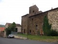
A walk along the Ramade Valley. Starting from Reilhac, passing through Langec and Volmadet, then descending through the villages of Guérin and Francon, before returning via Peyrusse and Le Chambon.
Circular route around the hill overlooking Saint-Ilpize and the Allier via Chazieux
3.80 mi
+643 ft
-640 ft
2h 20
Easy
Departure from Saint-Ilpize (Haute-Loire)
This circular path offers a continuous and exceptional panorama of the Allier valley. The path is made up of rounded stones, where you can sometimes see the tracks of the iron wheels of carts. Although today the landscape is a heath where bushes, broom and prickly pears grow, before the phylloxera attack it was an important vineyard. As you pass through the village of Chazieux and the old town of Saint-Ilpize, you will notice numerous wine cellars. Today, the vineyard is being revived. Vines are planted in the village of Auzat on the left bank and the old grape varieties are preserved in the vine conservatory located before the village of Chazieux.
Villages and banks of the Allier in Langeac
5.77 mi
+249 ft
-279 ft
2h 50
Easy
Departure from Mazeyrat-d'Allier (Haute-Loire)
A pleasant circular loop on the west bank of the Allier. From the Costet bridge north of Langeac to the viewpoint on the Biot cliff, with a detour through the charming villages of Truchon and Cerzat. Stops at beautiful stretches of river where you may see fly fishers. Return to the car park along the river.
Panoramic view of Chaliergues (Paulhaguet basin)
4.57 mi
+269 ft
-272 ft
2h 20
Easy
Departure from Salzuit (Haute-Loire)
This route passes through the villages on the eastern side of the Paulhaguet basin called Le Chaliergue. It corresponds to the lower volcanic plateau of Paulhaguet, at around 600 m, drained by the Senouire. The name was once written Callianicum and refers to stones, a stony area; it is also known as the Paulhaguet plateau. The panorama opens up from Jaroussier and Scombalou.
The Langeadois Mines
 6.55 mi
+407 ft
-397 ft
3h 20
Easy
Departure from Langeac (Haute-Loire)
6.55 mi
+407 ft
-397 ft
3h 20
Easy
Departure from Langeac (Haute-Loire)
A former mining area, with a few remains but above all a long, flat path that used to be a railway line.
From Chassagnes to Les Sauces via La Brousse
5.26 mi
+715 ft
-715 ft
3h 00
Easy
Departure from Chassagnes (Haute-Loire)
You will discover two landscapes. The walk starts in Chassagnes, crosses part of Chaliergues (the Paulhaguet basin), an area dedicated to agriculture, then climbs gradually through the woods, passing through hamlets that are mostly restored and inhabited.
Circular Étang de Lavaux in Saint-Préjet-Armandon
5.18 mi
+614 ft
-607 ft
2h 55
Easy
Departure from Domeyrat (Haute-Loire)
Starting from the Lavaux Pond (the pond is a former clay quarry), the route crosses pastures and fields and then reaches the woods on the heights of Saint-Préjet-Armandon.This route passes through villages with houses built from basalt stones from a distant volcanic period. Take the time to wander through the villages and notice the old workshops of blacksmiths and carpenters, and the communal ovens. Listen carefully and you may hear the sound of a hammer on an anvil or a carpenter's saw... These villages, once bustling with activity, are now quiet.
La Bretogne - Barlet - Marsanges circular
 6.63 mi
+1,093 ft
-1,093 ft
4h 00
Moderate
Departure from Langeac (Haute-Loire)
6.63 mi
+1,093 ft
-1,093 ft
4h 00
Moderate
Departure from Langeac (Haute-Loire)
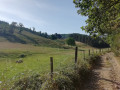
Circular with the highest point halfway along the route, offering superb views of Langeac surrounded by mountains.
Senouire Valley from Domeyrat
4.15 mi
+177 ft
-177 ft
2h 05
Easy
Departure from Domeyrat (Haute-Loire)
This route allows you to discover the Senouire valley between Domeyrat and Esbelin, a small "limagne" (flat area) framed by wooded slopes. The Senouire accompanies you with its murmurs all along the route, where you can sometimes hear it without seeing it. The majestic 12th-century feudal castle with its imposing ruins dominating the village is sure to impress, and the old Romanesque bridge completes the medieval feel of the village.
Chanteuges, Bourleyre and Tavernat
 Association / Club / Walk leader4.57 mi
+568 ft
-541 ft
2h 35
Easy
Departure from Chanteuges (Haute-Loire)
Association / Club / Walk leader4.57 mi
+568 ft
-541 ft
2h 35
Easy
Departure from Chanteuges (Haute-Loire)
This walk, through woods and alongside the river, follows mainly wide paths. In particular, it follows old routes used before the construction of the current roads inthe 19th century. It links four villages and hamlets in the commune of Chanteuges.
Circular loop between Chanteuges and La Cambuse
2.18 mi
+141 ft
-138 ft
1h 05
Easy
Departure from Chanteuges (Haute-Loire)
A short walk around Chanteuges, combining the cool banks of the Desges with a section of the old road from Brioude to Saugues (until 1825), offering lovely views of the Desges and Allier valleys.
Between Chanteuges and Pébrac
9.67 mi
+1,572 ft
-1,555 ft
5h 50
Moderate
Departure from Chanteuges (Haute-Loire)
After a climb offering a beautiful view of the Chanteuges Abbey site, the route winds through the woods to Pébrac. It then follows paths overlooking the Desges Valley as far as Chanteuges.
Between Chanteuges and La Bretagnolle
5.27 mi
+1,020 ft
-1,027 ft
3h 20
Moderate
Departure from Chanteuges (Haute-Loire)
After a climb offering a fine view of the Chanteuges Abbey site, the route winds through meadows and woods, linking three of the hamlets in the commune of Chanteuges: Féry, Fromenty and La Bretagnolle.
Between Chanteuges and Saint-Julien-des-Chazes
8.85 mi
+1,070 ft
-1,070 ft
5h 00
Moderate
Departure from Chanteuges (Haute-Loire)
The route follows part of the old track from Langeac to Saugues (before the current road was built around 1825), then the old track from Chanteuges to Prades. It is a particularly beautiful walk above Saint-Julien-des-Chazes and around Le Chausse.
Short circular loop from Chanteuges to the Allier
2.12 mi
+269 ft
-256 ft
1h 15
Easy
Departure from Chanteuges (Haute-Loire)
A short walk around Chanteuges to the banks of the Allier. It first crosses the village’s paved slanting streets beneath the old abbey, then passes through La Vialle – which was undoubtedly the village’s original settlement – before reaching the banks of the Allier and then a section of the old road from Saugues to Brioude (in use until 1825).
Sapinières de l'Armandon, miellerie de Grattepaille et villages isolés
 6.01 mi
+1,122 ft
-1,132 ft
3h 45
Moderate
Departure from Saint-Préjet-Armandon (Haute-Loire)
6.01 mi
+1,122 ft
-1,132 ft
3h 45
Moderate
Departure from Saint-Préjet-Armandon (Haute-Loire)
This route passes through fir forests and a few pastures, reminders of a bygone era of pastoral farming.The Grattepaille honey farm is breathing new life into this beautiful region.
 Difficult