Country:

 City:
City:


The route starts at the bridge over the Desges in the centre of the village of Chanteuges.
(S/E) From the bridge over the Desges, take Rue des Moulins for 15 metres, then the St-Marcellin paved slanting street which climbs to the left. This was the old road from Langeac to Saugues until around 1825. Follow this paved slanting street straight on (it changes name) until you reach a small, level road where the GR® 470 is signposted (red and white markings).
(1) Take this road on the right for 200 metres and pass through the hamlet of Le Péroux.
(2) On leaving Le Péroux, follow the level path straight on (tarmac for about a hundred metres), the Chemin Grand. After passing a villa, carry on straight ahead, ignoring the track branching off to the right, and continue until you reach a road.
(3)Turn right onto this road, then at the Stop sign 50 metresfurther on, turn left.120 metres further on, turnright onto the Route dePébrac and pass under the railway line.
(4) Leave the road 50 m before the bridge over the River Desges, turning left onto a dirt track suitable for vehicles, the Chemin de la Prade, which follows the right bank of the river.
(5) About forty metres past the mill buildings on the other side of the river, at the junction, leave the GR® and take a track on the left which first runs alongside a sewage treatment plant and then climbs up to the village of Bourleyre.
(6) At the end of this wide track, turn left onto a dirt track suitable for vehicles and , after 15 metres, take the track leading uphill to the right which joins the village. Go round the communal bakery on the left.Take Rue du Fouganier on the left until you reach the D585 countyroad . Turn right onto it and follow it for about sixty metres.
(7) Cross it and turn left onto a track, the GR®470, heading north-east.The GR® passes a first track on its right.
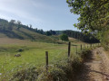
(8) Continue straight ahead along the very beautiful old path from Chanteuges to Prades, passing a second path on the right, then a third.
(9) It is possible to continue along the GR® as far asSaint-Julien-des-Chazes, 900 m away in 15 minutes, and then return to the gate via the same path.
At the 650-metre mark, leave the GR®470. Take the path on the right, heading south, which passes through a wooden gate 10 m further on and leads to the hamlet of Le Monteil. Ignore the path branching off to the right and continue straight on towards the hamlet. 100 m from the hamlet, ignore the path branching off to the right and turn left towards the hamlet.
(10) You’ll come to a crossroads with a drinking fountain opposite. Take the road on the right, heading north. Ignore the first path on the right 200 m from the fountain, and 30 m further on , take a sloping dirt track on the right, which joins the GR® 470.
(8) Take the GR® to the left, in the opposite direction to the outward journey , until you reach the D585 county road in the village of Bourleyre.
(7)Cross the departmentalroad carefully and follow the road uphill to the left for about a hundredmetres , passing the fountain.
(11) Take the tarmac path known as the ‘Chemin de la Riade’ on the right, between the bus shelter and a former hotel, still following the GR®. Follow this path; 100 metres past the departmental road, pass a street on the left, then a track suitable for vehicles on the right. Cross the woodland, and as you reach the edge of the woodland, pass a path on the left and continue for a further 80 metres.
(12) You’ll come to a tarmac track; follow it to the right. Walk past the two housesat Moulin Bleu near the River Desges, then follow theriver’s right bank. Join the track you took on the way there.
(5)Carry on straight ahead in the opposite direction to the outward journey and reach the junction with the road.
(4) Then leave the GR® andtake the D30 road on the left to cross the bridge overthe Desges.
(13) Just after this bridge, take a track on the right – part of the GRP® Robe de Bure and Cotte de Maille (marked in yellow and red) – and go under the railwaybridge . Follow this track to the left (theChemin de la Pelle), which runs alongside the Desges and the railway lineuntil you reach Rue de la Gare near a level crossing.
(14) Turn right and walk down this street to the D585 to reach the bridge over the Desges, the starting point (S/E).
 Association / Club / Walk leader
 Easy
Easy  Visorando Member
 Difficult