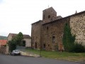
Pruneyrolles circular starting from Blassac

A moderately difficult walk suitable for families, taking you through woods, hills and forests of beech, oak and fir trees.

Details

31805714
Creation:
Last update:
Last review:
  • Walking
    Activity: Walking
  • ↔
    Distance: 6.92 mi
  • ◔
    Average duration: 4h 20 
  • ▲
    Difficulty: Moderate

  • ⚐
    Back to start: Yes
  • ↗
    Ascent: + 1,345 ft
  • ↘
    Descent: - 1,322 ft

  • ▲
    Highest point: 2,785 ft
  • ▼
    Lowest point: 1,650 ft

Photos

Description of the walk

Access is via the D585 road. At a place called Labout, turn left onto the D144 and park in the car park at Blassac Town Hall.

(S/E) Walk past the church and continue straight on to the cemetery.

(1) Continue due north, skirting the local green waste disposal site. You’ll come to a Y-junction further down. Take care here: take the gently sloping path straight ahead on the left and enter the woods. You’ll then reach a small earthen platform a few metres from the D585. Keep parallel to this road.

(2) Turn left at the Fork in the road just before the Ravin d’Espagney. Here, begin a climb through the woods to reach the junction with theGR®470.

(3) Turn right onto the GR®470, then further on cross the Ruisseau de Riou Marquis and walk until you reach the vicinity of the hamlet of Pruneyrolles.

(4) Leave theGR® and turn left onto the path for a long climb through the woods. Cross the Ruisseau de Riou Marquis again. The climb ends here and you’ll soon reach the junction with the road leading to the hamlet of Le Feuil.

(6) Leave this road on your right and continue left along the road. You’ll soon come to a path junction. Turn sharply left, skirt a field and head down into the forest along a narrow, stony path, damaged by motorised vehicles and eroded by heavy rain. At the bottom of the descent, you’ll come to a forest track.

(7) Turn right onto it and carry on until you reach the Rocher du Cheyla.

(8) Carry on and you’ll very soon come to a junction of paths. Take care at this junction; head left, taking thefirst steep forest track to go downhill. You’ll reach another junction.

(9) Turn right to climb up the mule track and you will then reach a ridge.

(10) Turn right and climb up a sloping path; a few hundred metres further on, you’ll reach a pasture and an electric fence.

(11) Turn left onto the Chemin du Facteur. Head down to reach theGR® junction at Blassac. Turn right here to return to the town hall car park (S/E).

Waypoints

  1. S/E : mi 0 - alt. 1,795 ft - Blassac Town Hall car park
  2. 1 : mi 0.14 - alt. 1,824 ft - Cemetery
  3. 2 : mi 0.99 - alt. 1,690 ft - Fork in the road. Near - Allier (rivière)
  4. 3 : mi 1.38 - alt. 2,014 ft - GR470
  5. 4 : mi 2.73 - alt. 1,932 ft - Pruneyrolles crossroads
  6. 5 : mi 3.35 - alt. 2,379 ft - Riou Marquis stream
  7. 6 : mi 4.2 - alt. 2,785 ft - Le Feuil crossroads
  8. 7 : mi 4.62 - alt. 2,621 ft - Cheyla forest track
  9. 8 : mi 4.95 - alt. 2,605 ft - Cheyla Rock
  10. 9 : mi 5.52 - alt. 2,323 ft - Mule Track
  11. 10 : mi 5.75 - alt. 2,388 ft - Pasture and electric fence
  12. 11 : mi 6.08 - alt. 2,395 ft - Chemin du Facteur
  13. S/E : mi 6.92 - alt. 1,795 ft - Blassac Town Hall car park

Worth a visit

Between (1) and (3), admire the villages of Le Chambon de Blassac opposite, and a little higher up, Chanat.
(8) Rocher du Cheyla: enjoy a magnificent panoramic view of the Allier valley from here, featuring:
- the hamlet of Mondésir directly opposite,
- below inthe foreground, the village of Pruneyrolles; further away, the village of Auzat, the market town of Villeneuve d’Allier and the Château de Saint-Ilpize.

Always be cautious and plan ahead when you're outdoors. Visorando and the author of this route cannot be held responsible for any accidents occurring on this route.

The GR® and PR® markings are the intellectual property of the Fédération Française de Randonnée Pédestre.

Reviews and comments

4.7 / 5
Based on 2 reviews

Reliability of the description
5 / 5
Ease of following the route
4.5 / 5
Route interest
4.5 / 5
Bruno Campens
Bruno Campens

Overall rating : 4.3 / 5

Date of your route : May 27, 2024
Reliability of the description : ★★★★★ Very good
Ease of following the route : ★★★★☆ Good
Route interest : ★★★★☆ Good
Very busy route : No

A lovely walk, mostly through the forest, with a few lovely views.

Machine-translated

Nadine et Etienne Renard

Overall rating : 5 / 5

Date of your route : Aug 07, 2023
Reliability of the description : ★★★★★ Very good
Ease of following the route : ★★★★★ Very good
Route interest : ★★★★★ Very good
Very busy route : No

This was our first experience with Visorando, and we were thoroughly satisfied. We completed the route on a gloomy day in August. Part of the route took us through woods with a wide variety of vegetation. There were a few lovely views of the Cantal massif and the Allier Gorges.

Machine-translated

Other walks in the area

For more walks, use our search engine .

The GPS track and description are the property of this route's author. Please do not copy them without permission.