Refine your search for walks in Châteauneuf-Val-de-Bargis
Châteauneuf-Val-de-Bargis walks


 In the distant forest of Châteauneuf-Val-de-Bargis
 Tourist office
 8.57 mi
 +623 ft
 -633 ft
 4h 30
4h 30
 Moderate
 Departure from Châteauneuf-Val-de-Bargis (Nièvre)
This walk takes you deep into the Bellary State Forest.
Towards the bats of Cessy
 4.23 mi
+1,165 ft
-1,145 ft
3h 00
Moderate
Departure from Cessy-les-Bois (Nièvre)
4.23 mi
+1,165 ft
-1,145 ft
3h 00
Moderate
Departure from Cessy-les-Bois (Nièvre)
Nestled at the bottom of the Talvanne valley, Cessy-les-Bois is classified as a Natura 2000 site due to the presence of two large bat colonies on its territory: the Greater Horseshoe Bat and the Geoffroy's Bat.
Along the first two kilometres of the hike, you will find information panels explaining this local feature. In addition, a booklet is available for purchase at the Cosne-Cours-sur-Loire reception point of the Bourgogne Cœur de Loire Tourist Office.
Route of the Chapel of La Tête Ronde
 Visorando Member
 6.72 mi
+538 ft
-522 ft
3h 35
6.72 mi
+538 ft
-522 ft
3h 35
 Easy
Departure from Menou (Nièvre)
Easy
Departure from Menou (Nièvre)
Discover Menou and its Chapelle de la Tête Ronde chapel, overlooking the village.
 Route des Forges
 14.03 mi
+509 ft
-502 ft
2 hrs
Easy
Departure from Donzy (Nièvre)
14.03 mi
+509 ft
-502 ft
2 hrs
Easy
Departure from Donzy (Nièvre)
This route takes you back to the days when the iron and steel industry was flourishing in the Donziais region. Champdoux, a hamlet in the commune of Sainte-Colombe-des-Bois, was then a major centre of the Nièvre iron and steel industry. It was home to one of the department’s largest factories.
La grande escapade de Donzy
6.72 mi
+174 ft
-157 ft
3h 15
Moderate
Departure from Donzy (Nièvre)
From a village dotted along the River Nohain, to the boardwalk through the wetland, a stroll along a shaded fitness trail, the chance to admire the magnificent tympanum of Donzy-le-Pré Priory, the breathtaking view of the Bois de l’Éminence and a well-deserved break at the Cabets water point. The Donzy Grand Tour has everything to charm you!
On the hills above Donziais
 23.52 mi
+1,178 ft
-1,165 ft
4 hrs
Moderate
Departure from Donzy (Nièvre)
23.52 mi
+1,178 ft
-1,165 ft
4 hrs
Moderate
Departure from Donzy (Nièvre)
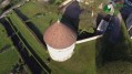
This route allows you to explore the villages of southern Donziais. You’ll follow the Talvanne valley towards the hills of Colméry, which boasts the highest point in the Donziais region. Take a moment at Mont Grès, the highest point (357 m), which offers a magnificent panorama from which to admire the superb scenery and enjoy the tranquillity of the surroundings. Head towards Saint-Malo-en-Donziois before reaching Cessy-les-Bois, nestled at the bottom of the Talvanne Valley.
Walk in Donzy
4.06 mi
+36 ft
-43 ft
1h 55
Easy
Departure from Donzy (Nièvre)
A leisurely walk to discover this pretty village in the Nièvre region, crossed by the River Nohain, which preserves traces of its history, in particular the ruins ofthe Church of Notre-Dame du Pré, as well as old mills, half-timbered houses and wash houses.
Near the fortified castle of La Motte Josserand
 7.52 mi
+272 ft
-259 ft
3h 40
Moderate
Departure from Perroy (Nièvre)
7.52 mi
+272 ft
-259 ft
3h 40
Moderate
Departure from Perroy (Nièvre)
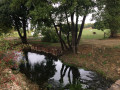
This route takes you back to the time of fortified castles and knights. Built on the marshy lands of Perroy, the Château de la Motte Josserand is one of the most beautiful military constructions of the Middle Ages in the Nièvre region, with its famous adventurer Perrinet Gressard who acquired the seigneury in the 15th century.
Promenade du Val in La Charité-sur-Loire
 4.84 mi
+43 ft
-43 ft
2h 15
Easy
Departure from La Charité-sur-Loire (Nièvre)
4.84 mi
+43 ft
-43 ft
2h 15
Easy
Departure from La Charité-sur-Loire (Nièvre)
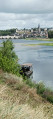
A short route through the Loire Valley, offering stunning views of La Charité-sur-Loire and its Benedictine abbey, the “eldest daughter of Cluny”.
Entrains - Ouanne via the Roman road
15.69 mi
+1,234 ft
-1,033 ft
2 hrs
Moderate
Departure from Entrains-sur-Nohain (Nièvre)
Route along part of the Roman road linking Bourges to Auxerre, starting from Entrains-sur-Nohain (formerly Intaranum in Gallo-Roman times) in the Nièvre department to Ouanne (Odoana) in the Yonne department.From the vast expanses of woods and forests and the large plains of cultivated land, passing through two of the highest points in this region (367m and 368m), discover new spaces, views, fauna and flora on these limestone plateaus and hills.
Source de l’Oisy, near Fondelin
7.02 mi
+433 ft
-453 ft
3h 35
Easy
Departure from Billy-sur-Oisy (Nièvre)
A lovely, relaxing walk along pleasant paths. Along the route, you’ll find a pretty well-and-washhouse and the La Motte washhouse, fed by the River Oisy. A shaded stretch through part of the Trucy Forest.
Let's go for a walk in the woods
 4.97 mi
+285 ft
-272 ft
2h 30
Easy
Departure from Saint-Loup (Nièvre) (Nièvre)
4.97 mi
+285 ft
-272 ft
2h 30
Easy
Departure from Saint-Loup (Nièvre) (Nièvre)
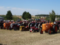
Discover the village of Saint-Loup-des-Bois, its inhabitants, the Saints-Lupéens, and the forests that surround it. You will pass by the Museum of Agricultural Machinery and Rural Life, which traces the history of agricultural machinery. In addition to these major collections in Europe, there is an astonishing and impressive collection of irons and a collection dedicated to woodworking trades (clog makers, coopers, wheelwrights, etc.).
Medieval Walk in Saint-Vérain
 0.67 mi
+75 ft
-75 ft
0h 25
Easy
Departure from Saint-Vérain (Nièvre)
0.67 mi
+75 ft
-75 ft
0h 25
Easy
Departure from Saint-Vérain (Nièvre)
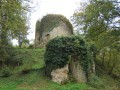
Follow the castle path to discover the keep and the remains of the13th-century feudal town.
The Vérinoise Circular
 2.99 mi
+213 ft
-184 ft
1h 35
Easy
Departure from Saint-Vérain (Nièvre)
2.99 mi
+213 ft
-184 ft
1h 35
Easy
Departure from Saint-Vérain (Nièvre)
Marked route No. 34.
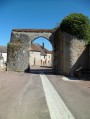
The village of Saint-Vérain, built on a hillside, was surrounded by fortified walls in the Middle Ages, making it one of the most powerful feudal cities in the region. Numerous remains bear witness to the city's importance, including ramparts, towers, gates, wells, a keep, etc.