Route des Forges

This route takes you back to the days when the iron and steel industry was flourishing in the Donziais region. Champdoux, a hamlet in the commune of Sainte-Colombe-des-Bois, was then a major centre of the Nièvre iron and steel industry. It was home to one of the department’s largest factories.

Details

309279
Creation:
Last update:
Last review:
  • Mountain biking
    Activity: Mountain biking
  • ↔
    Distance: 14.03 mi
  • ◔
    Duration according to the author: 2 hrs 
  • ▲
    Difficulty: Easy

  • ⚐
    Back to start: Yes
  • ↗
    Ascent: + 509 ft
  • ↘
    Descent: - 502 ft

  • ▲
    Highest point: 892 ft
  • ▼
    Lowest point: 564 ft
  • ⚐ Country: France
  • ⚐ City: Donzy (58220)
  • ⚑
    Start/End: N 47.371537° / E 3.12825°
  • ❏
    IGN map(s): Ref. 2522SB, 2523SB

  • ◶
    Type of surface:
  •  
     100% Path
  • ⇧
    Bike carrying: Not specified
  • ▲
    Difficulty: Not specified
  • Hour-by-hour weather

Photos

Description of the route

Starting point: Place Gambetta, in Donzy.

(S/E) Head south towards Cessy-les-Bois.

(1) Take the path opposite, at the junction of Rue de la Chaumette and Rue des Remparts.

(2) At the D2, turn left then right onto the first path (PR®). Join and cross the D1, then continue for a few metres.

(3) Turn left towards the Saint-Jean wash house. At the entrance to the hamlet, turn right and cross two bridges. Follow the Talvanne, ignoring the paths branching off to the right.

(4) At the road, turn left, cross two bridges, pass through the hamlet of Les Cabets and reach the D1.

(5) Cross the D1 and follow the path opposite.

(6) At the T-junction (elevation 194), turn left and continue to the road.

(7) Turn left (D178) towards Champdoux. Pass through Ferrières and continue to the next junction.

(8) Turn right, head towards the hamlet of Les Geais and turn left there.

(9) At the bottom of the track, by the ford, take the track that turns left.

(10) At the D178, turn right towards the village of Sainte-Colombe-des-Bois, pass through the village and continue eastwards, staying on the D178.

(11) After Villarnault, take the path on the left towards the Fauverney Forest and leave the D178. Continue for approximately 2.1 km.

(12) At the junction, turn left towards Le Petit Rond.

(13) At Le Petit Rond, turn left and follow the lane.

(14) At Le Grand Rond, turn right at the fourth junction (narrow track) and rejoin the road.

(15) When you reach the road, turn left towards Donzy.

(1) Head to Place Gambetta (S/E).

Waypoints

  1. S/E : mi 0 - alt. 597 ft - Place Gambetta
  2. 1 : mi 0.16 - alt. 627 ft - Path
  3. 2 : mi 0.58 - alt. 689 ft - Junction with the D2
  4. 3 : mi 1.81 - alt. 604 ft - Turn left towards Saint-Jean
  5. 4 : mi 3.09 - alt. 577 ft - Towards the bridges - Nohain (rivière)
  6. 5 : mi 3.8 - alt. 610 ft - Crossing the D1
  7. 6 : mi 4.63 - alt. 636 ft - Turn left
  8. 7 : mi 5.42 - alt. 666 ft - Ferrieres
  9. 8 : mi 5.98 - alt. 696 ft - Towards Les Geais
  10. 9 : mi 6.75 - alt. 643 ft - Ford
  11. 10 : mi 7.57 - alt. 699 ft - Towards Sainte-Colombe-des-Bois
  12. 11 : mi 9.18 - alt. 741 ft - Turn left after Villarnault
  13. 12 : mi 10.51 - alt. 853 ft - Towards Le Petit Rond
  14. 13 : mi 11.47 - alt. 843 ft - Petit Rond
  15. 14 : mi 12.01 - alt. 837 ft - Grand Rond
  16. 15 : mi 12.65 - alt. 810 ft - Turn left onto the road
  17. S/E : mi 14.03 - alt. 597 ft - Place Gambetta

Notes

Blue Trail No. 4.
The route is closed during the hunting season from 15 September to 28 February.

Worth a visit

__
- Built and historical heritage__

The hamlet of Champdoux: a centre of the Nièvre steel industry.
Steel production in the Nièvre has existed since Gallo-Roman times.
Champdoux, a hamlet belonging to the commune of Sainte-Colombe-des-Bois, had been a major centre of the Nièvre iron and steel industry since the 16th century.
This blast furnace belonged to the Duchy of Nevers and produced a significant quantity of pig iron and iron ingots. The ores yielded 30 per cent pig iron at the time; the output was used at the forges in Bailly, L’Éminence (Donzy) and Chailloy (Suilly-la-Tour). The production cycle at that time lasted 10 months a year and consumed 16,000 quintals of charcoal, equivalent to the carbonisation of 20,000 stères; The situation in the Nièvre in 1827 was as follows: there were 200 mine owners, 23 blast furnaces out of 500 in France, 20 large forges and 100 small forges.
The Champdoux blast furnace ceased operations in 1873, and in the Nièvre region in 1890, forges began to move closer to coal mining sites.

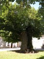
The village of Sainte-Colombe-des-Bois, with its church square and its 400-year-old lime tree, is the only listed site in the Donziais region, recognised amongst monuments and natural sites of artistic, historical, scientific, legendary or picturesque significance. In this square stands the Sully lime tree, planted in 1590 next to the church, which is listed in the inventory of sites, notably for its Roman-Byzantine architecture (13th century). An inscription carved into a wall connecting the church, dating from 1591, reads ‘ICY CE DONE LE GRIS’. Its meaning remains unexplained to this day.

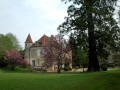
Challoy Manor: the ancestral home of the family of Théodore de Bèze, the great French Protestant theologian. In the 18th century, the Lespinasse family – powerful local dignitaries and master ironmongers – developed the estate’s ironworks. The site, which is rich in history and in very good condition, retains much of the same appearance it must have had in the 18th century. The manor house is in the Renaissance style. (Visits to the ironworks and the grounds by appointment; contact: 03 86 26 36 22)

- Crafts:
Villarnault pottery: stoneware and porcelain, everyday ceramics.

Always be cautious and plan ahead when you're outdoors. Visorando and the author of this route cannot be held responsible for any accidents occurring on this route.

The GR® and PR® markings are the intellectual property of the Fédération Française de Randonnée Pédestre.

Reviews and comments

4.7 / 5
Based on 2 reviews

Reliability of the description
4.5 / 5
Ease of following the route
5 / 5
Route interest
4.5 / 5
benoit58
benoit58

Overall rating : 4.3 / 5

Date of your route : Jun 11, 2018
Reliability of the description : ★★★★☆ Good
Ease of following the route : ★★★★★ Very good
Route interest : ★★★★☆ Good

Beautiful views. Take a short detour to see the Moulin de la Montagne aux Alouettes: 47.525834, 3.302652. The villages of Vellery and Chauminet are of little interest apart from the old oak tree in Vellery (approx. 400 years old): 47.523607, 3.332397.

A wide, grass-free path; shorts are fine during tick season...

Machine-translated

Thesupermat
Thesupermat
• Edited:

Overall rating : 5 / 5

Date of your route : Apr 01, 2018
Reliability of the description : ★★★★★ Very good
Ease of following the route : ★★★★★ Very good
Route interest : ★★★★★ Very good

Hello,

A pleasant ride despite the rain over the previous few days. The ground was muddy in places, but nothing insurmountable. We had to carry our bikes over a couple of fallen trees. A fairly straightforward and easy ride, which I did with my wife, who cycles with a club. We completed the route in 1 hour 45 minutes without pushing ourselves too hard. Strava shows an elevation gain of 259m https://www.strava.com/activities/148399...

Machine-translated

For more walks, use our search engine .

The GPS track and description are the property of this route's author. Please do not copy them without permission.