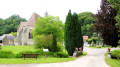
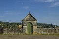
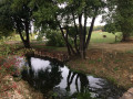
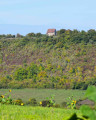
In the distant forest of Châteauneuf-Val-de-Bargis

This walk takes you deep into the Bellary State Forest.

Details

3488760
Creation:
Last update:
Last review:
  • Walking
    Activity: Walking
  • ↔
    Distance: 8.57 mi
  • ◔
    Average duration: 4h 30 
  • ▲
    Difficulty: Moderate

  • ⚐
    Back to start: Yes
  • ↗
    Ascent: + 623 ft
  • ↘
    Descent: - 633 ft

  • ▲
    Highest point: 1,089 ft
  • ▼
    Lowest point: 801 ft

Description of the walk

Start from the car park at the Place de la Mairie.

Blue signposts

(S/E) Turn left and cross the N151 with care, heading towards Nannay/La Charité-sur-Loire, then follow the A-road.

(1) Turn right and head towards Château de la Tour (C6). At the hamlet, turn left and head towards the château.

(2) At the junction, turn right towards the hamlet of Le Pressour and follow the Route des Petites Vallées. Pass through the hamlet of Le Pressour

(3) At the edge of the hamlet, at the crossroads, keep left and continue straight on along the track to the Grand Rond crossroads, following the Ligne de Châteauneuf.

(4) Then take thefourth path on the right, towards Le Petit Rond, following the Route de Bellary.

(5) At the Petit Rond crossroads, take thesecond road on the right, following the Ligne du Châtelet.

(6) At the 244 mark, at the end of the straight track, turn right, then left at the first junction. At the next junction, turn right and carry on straight ahead until the second junction.

(7) Turn left and, at the end of the track, turn right and pass through the hamlet of Le Mont.

(8) Take the path on the right at the bend and head for the hamlet of Champboyard.

(9) Continue eastwards along the track until you reach the hamlet of Les Taules.

(10) In the hamlet, turn right towards the hamlet of Le Pressour and rejoin the route you have already taken.

(3) Continue left along the path in the opposite direction until you reach the Town Hall Square (S/E).

Waypoints

  1. S/E : mi 0 - alt. 909 ft - Town hall car park
  2. 1 : mi 0.18 - alt. 912 ft - Crossroads, turn right – C6
  3. 2 : mi 0.6 - alt. 853 ft - Turn right at the fork
  4. 3 : mi 1.02 - alt. 840 ft - Crossroads of the circular loop. Le Pressour
  5. 4 : mi 3.06 - alt. 958 ft - Le Grand Rond, Route de Bellary
  6. 5 : mi 3.73 - alt. 810 ft - Le Petit Rond, Ligne du Châtelet
  7. 6 : mi 4.51 - alt. 843 ft - Marker 244, on the right
  8. 7 : mi 5.03 - alt. 928 ft - Turn left at the fork
  9. 8 : mi 5.74 - alt. 889 ft - Le Mont
  10. 9 : mi 6.1 - alt. 886 ft - Champboyard, due east
  11. 10 : mi 7.02 - alt. 938 ft - Les Taules
  12. S/E : mi 8.57 - alt. 909 ft - Town hall car park

Notes

Follow the blue markings.

Worth a visit

The Bellary Forest.
The Way of St James.
The Chartreuse de Bellary (not open to visitors): a former abbey founded in 1209. It is one of three abbeys founded by Hervé IV, Baron of Donzy, and Mahaut de Courtenay, daughter of the Count of Nevers. The other two are the Abbey of L’Epeau in the commune of Donzy and the Abbey of Coche in the commune of Vielmanay (the latter has completely disappeared). The only remaining vestige is the gateway dating from 1788.
The feudal motte at Château de la Tour.
The mill valley pond: it offers a few hectares of fishing and shaded areas.

Reviews and comments

4.3 / 5
Based on 3 reviews

Reliability of the description
4 / 5
Ease of following the route
4.3 / 5
Route interest
4.7 / 5
coeurdeloire
coeurdeloire

Thank you for your feedback on this circular walk through the heart of Bellary Forest

Machine-translated

jean jacques verdier

A lovely circular loop
Part of a Tour of the Donziais via the hills (of the Nivernais)

Machine-translated

jbp58
jbp58

Overall rating : 5 / 5

Date of your route : May 16, 2021
Reliability of the description : ★★★★★ Very good
Ease of following the route : ★★★★★ Very good
Route interest : ★★★★★ Very good
Very busy route : No

A lovely route, perfectly signposted

Machine-translated

bcr
bcr

Overall rating : 4 / 5

Date of your route : Sep 10, 2020
Reliability of the description : ★★★★☆ Good
Ease of following the route : ★★★★☆ Good
Route interest : ★★★★☆ Good
Very busy route : No

Beautiful scenery, but much of it is forest, which is a bit monotonous

Machine-translated

Sylale
Sylale

Overall rating : 4 / 5

Date of your route : Aug 27, 2020
Reliability of the description : ★★★☆☆ Average
Ease of following the route : ★★★★☆ Good
Route interest : ★★★★★ Very good
Very busy route : No

Point 1: continue on to the next hamlet
Point 3: after the wash house (well worth a look) at the wayside shrine, head straight on towards the woods (no signposting for the Châteauneuf route)
Point 4: Before this, cross a tarmac road at km 4.71
Point 5: no signposting for the Ligne; add ‘cross a tarmac road’

Practical information: in the hamlet of Les Taules, the blue signposting does not correspond to that on the GPS

Machine-translated

Other walks in the area

For more walks, use our search engine .

The GPS track and description are the property of this route's author. Please do not copy them without permission.