On the hills above Donziais

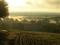
This route allows you to explore the villages of southern Donziais. You’ll follow the Talvanne valley towards the hills of Colméry, which boasts the highest point in the Donziais region. Take a moment at Mont Grès, the highest point (357 m), which offers a magnificent panorama from which to admire the superb scenery and enjoy the tranquillity of the surroundings. Head towards Saint-Malo-en-Donziois before reaching Cessy-les-Bois, nestled at the bottom of the Talvanne Valley.

Details

n°309282
Creation:
Last update:
Last review:
  • Mountain biking
    Activity: Mountain biking
  • ↔
    Distance: 23.52 mi
  • ◔
    Duration according to the author: 4 hrs 
  • ▲
    Difficulty: Moderate

  • ⚐
    Back to start: Yes
  • ↗
    Ascent: + 1,178 ft
  • ↘
    Descent: - 1,165 ft

  • ▲
    Highest point: 1,138 ft
  • ▼
    Lowest point: 597 ft
  • ⚐ Country: France
  • ⚐ City: Donzy (58220)
  • ⚑
    Start/End: N 47.371606° / E 3.128258°
  • ❏
    IGN map(s): Ref. 2522SB, 2523SB, 2622SB, 2623SB

  • ◶
    Type of surface:
  •  
     
     
    ■ 33% Road ■ 34% Byway ■ 33% Path
  • ⇧
    Bike carrying: Not specified
  • ▲
    Difficulty: Not specified
  • Hour-by-hour weather

Photos

Description of the route

(S/E) Start at Place Gambetta in Donzy. Follow the road up towards Cessy-les-Bois.

(1) After Le Courtil au Loup, take the forest track on the right as far as the large roundabout, then turn left towards the small roundabout. Turn right and follow the path. At the next junction, turn left and follow the path towards the Croix Pèlerin roundabout.

(2) At the junction with the Route de Cessy, turn right and follow the road, then take the path on the left which leads down into the village centre of Cessy-les-Bois.

(3) In the village centre, head towards Colméry, then turn right onto Rue du Montignon and head towards La Redouterie. Walk through the Bois de la Redouterie.

(4) At the junction with the road, carry on straight ahead, then turn left and right towards Les Métairies. Cross the D154 towards the village centre of St Malo en Donziois.

(5) Take the road on the right after the church towards Les Pontots and the N151. At the junction, take the road on the left, then take the path on the right to enter the woods; follow the signposts to the hamlet of Les Potiers.

(6) Pass Les Potiers, then turn right towards Les Gardes and follow the road.

(7) At the hamlet of Le Beauchot, cross the D154 and take the road opposite towards Colméry. At the junction with the D127, take the path on the right to go behind the hamlet of Les Moutots.

(8) Pass in front of the Moutots washhouse, then turn left towards the village of Colméry.

(9) At the roundabout, take the road leading down towards Les Lacs. Pass through the hamlet, then turn left. Follow the signposts through Colméry’s communal forest. At the junction with the road, turn left towards Les Godards du Bas.

(10) At Les Godards du Bas, turn right and follow the D127, then turn right towards Les Pénitiaux and follow the path on the left. Continue along the path that runs alongside the Talvanne to Donzy – Place Gambetta (S/E)

Waypoints

  1. S/E : mi 0 - alt. 597 ft - Place Gambetta
  2. 1 : mi 1.36 - alt. 810 ft - Fauvernay Forest
  3. 2 : mi 3.94 - alt. 879 ft - Rond de la Crois Pèlerin
  4. 3 : mi 5.34 - alt. 768 ft - Cessy-les-Bois
  5. 4 : mi 7.75 - alt. 1,135 ft - Le Verger des Dairy Farms
  6. 5 : mi 9.41 - alt. 902 ft - St-Malo-en-Donziois
  7. 6 : mi 12.03 - alt. 902 ft - The Potters
  8. 7 : mi 13.89 - alt. 984 ft - Le Beauchot
  9. 8 : mi 15.12 - alt. 896 ft - The wash house
  10. 9 : mi 15.74 - alt. 850 ft - Colméry Church
  11. 10 : mi 19.13 - alt. 728 ft - Les Godards
  12. S/E : mi 23.52 - alt. 597 ft - Place Gambetta

Notes

You can shorten the route by going via Colméry through the hamlets of La Cour and Paray to reach Cessy-les-Bois.
Blue Route No. 5.
The route is closed during the hunting season from 15 September to 28 February.

Worth a visit

Built and historical heritage

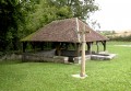
(8)The Moutôts washhouse and its cross: dating from the 19th century. Its rectangular basin is surrounded by stone coping.

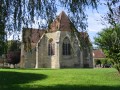
(9)The 16th-century church at Colméry: listed as a Historic Monument, it features stained-glass windows restored using the original stained-glass from the Basilica of Notre-Dame in Maastricht.
The Beauchot and Carrés washhouses

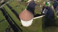
(3)The monks’ dovecote from the days of the former monastery; the church at Cessy-les-Bois: paved with fragments of tombstones and engraved with inscriptions, an architectural gem of the 16th century.

Natural heritage

(6)The hamlet of Les Potiers: the forest conceals numerous man-made quarries, once used for collecting clay. These pits offer an ideal playground for mountain bike cross enthusiasts.

(3) Cessy-les-Bois: A Natura 2000-designated area, it is home to two significant bat colonies: the notched-eared bat and the greater horseshoe bat.

Crafts
(4)Le Verger des Métairies: artisanal production of apple juice

Reviews and comments

3.8 / 5
Based on 2 reviews

Reliability of the description
3.5 / 5
Ease of following the route
4 / 5
Route interest
4 / 5
Dumoulin529
Dumoulin529

Overall rating : 4 / 5

Date of your route : Sep 22, 2025
Reliability of the description : ★★★★☆ Good
Ease of following the route : ★★★★☆ Good
Route interest : ★★★★☆ Good
Very busy route : No

I liked this route because it takes you through places I wouldn't have seen otherwise. Even though I made a few changes, the suggested route is interesting.

Machine-translated

jean jacques verdier

Overall rating : 3.7 / 5

Date of your route : Jan 20, 2025
Reliability of the description : ★★★☆☆ Average
Ease of following the route : ★★★★☆ Good
Route interest : ★★★★☆ Good
Very busy route : No

A beautiful route that is typical of the Côtes du Nivernais, which would benefit from more detailed descriptions of the landscape and heritage.
And will mountain bikers enjoy the road sections in St Malo en Donziois?
There’s an option to take a shorter alternative route along footpaths from the viewpoint to stay on the ridge.

Machine-translated

Other walks in the area

For more walks, use our search engine .

The GPS track and description are the property of this route's author. Please do not copy them without permission.