


Refine your search for walks in Caudiès-de-Conflent
Caudiès-de-Conflent walks


 Pic de la Socarrada and Caudiès-de-Conflent Lake
 Visorando Member
 5.10 mi
 +1,421 ft
 -1,421 ft
 3h 35
3h 35
 Moderate
 Departure from Caudiès-de-Conflent (Pyrénées-Orientales)
A beautiful, wild route in the Garrotxes valley, starting from Caudiès-de-Conflent. The hike climbs up to the splendid panorama of Pic de la Soccarada. Once back in Caudiès-de-Conflent, I recommend continuing on to the lake, a peaceful spot for a picnic.
In the heart of Les Garrotxes
 6.48 mi
+1,591 ft
-1,585 ft
4h 20
Moderate
Departure from Ayguatébia-Talau (Pyrénées-Orientales)
6.48 mi
+1,591 ft
-1,585 ft
4h 20
Moderate
Departure from Ayguatébia-Talau (Pyrénées-Orientales)
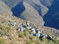
A beautiful excursion in the heart of Les Garrotxes (a wild and little-known region of the Eastern Pyrenees) to discover two of its villages, Ayguatébia-Talau and Caudiès-de-Conflent.
Ayguatébia-Talau and the Vallée du Feu
4.38 mi
+1,214 ft
-1,224 ft
3h 05
Moderate
Departure from Ayguatébia-Talau (Pyrénées-Orientales)
A beautiful, unspoilt hike through the Garrotxes Valley, starting from Ayguatébia.
Circular route around Railleu
 6.87 mi
+1,775 ft
-1,749 ft
4h 40
Moderate
Departure from Railleu (Pyrénées-Orientales)
6.87 mi
+1,775 ft
-1,749 ft
4h 40
Moderate
Departure from Railleu (Pyrénées-Orientales)
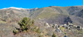
A lovely getaway to a remote and little-known corner of the Catalan Pyrenees Regional Nature Park, namely the Garrotxes and, more specifically, the village of Railleu. You can also explore the neighbouring village of Sansa on this route.
From Railleu to Sansa
3.51 mi
+945 ft
-942 ft
2h 25
 Easy
Departure from Railleu (Pyrénées-Orientales)
Easy
Departure from Railleu (Pyrénées-Orientales)
A short, accessible hike connecting two of the five villages located in the wild and little-known Garrotxes valley. Several old mills with information panels can be found along the route.
Around Sansa
 9.11 mi
+1,644 ft
-1,644 ft
5h 35
Moderate
Departure from Sansa (Pyrénées-Orientales)
9.11 mi
+1,644 ft
-1,644 ft
5h 35
Moderate
Departure from Sansa (Pyrénées-Orientales)
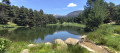
This route, starting from Sansa, will take you on a tour of the surroundings of the northernmost village in the Garrotxes. A fairly long and challenging hike.
The Refuge des Estagnols from Sansa
 7.06 mi
+1,532 ft
-1,549 ft
4h 35
Moderate
Departure from Sansa (Pyrénées-Orientales)
7.06 mi
+1,532 ft
-1,549 ft
4h 35
Moderate
Departure from Sansa (Pyrénées-Orientales)
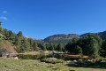
A lovely walk taking in some of the Catalan heritage sites of the Garrotxes.Route marked in yellow, with directional and information signs that are either recent or in very good condition.No signposting between (7) and (9), but it is impossible to go wrong. The yellow markings indicated, and present in November 2022, are not guaranteed to remain in place over time (disappearance, destruction).Paths are in perfect condition. This walk can be shortened as desired.The most challenging part is returning to Sansa via the small D4/D4e road: allow half an hour’s drive from Olette.
From Sansa to the Estanyols Lakes
5.54 mi
+1,562 ft
-1,552 ft
3h 55
Moderate
Departure from Sansa (Pyrénées-Orientales)
A family hike accessible to all in the wild Garrotxes valley. From the village of Sansa, on a forest trail on the way there, the route leads to the Estagnols Lakes, where there is also a refuge.
The Coll del Torn refuge
 7.90 mi
+1,358 ft
-1,365 ft
4h 50
Moderate
Departure from Matemale (Pyrénées-Orientales)
7.90 mi
+1,358 ft
-1,365 ft
4h 50
Moderate
Departure from Matemale (Pyrénées-Orientales)
This route will take you to the Coll del Torn refuge, where you can enjoy a beautiful view of the Capcin peaks and some of the Ariège peaks.
From Coll de Creu to Caudiès-de-Conflent (circular)
 12.12 mi
+2,300 ft
-2,300 ft
7h 35
Moderate
Departure from Matemale (Pyrénées-Orientales)
12.12 mi
+2,300 ft
-2,300 ft
7h 35
Moderate
Departure from Matemale (Pyrénées-Orientales)
This long circular hike takes you via Coll del Torn and Caudiès-de-Conflent. The mix of open and wooded sections offers a hike rich in varied landscapes and atmospheres.
 Loop from the Col de Creu to the Estagnols refuge
 6.50 mi
+1,020 ft
-1,020 ft
5 hrs
Moderate
Departure from Matemale (Pyrénées-Orientales)
6.50 mi
+1,020 ft
-1,020 ft
5 hrs
Moderate
Departure from Matemale (Pyrénées-Orientales)
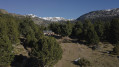
A lovely circular route to do on snowshoes (or on foot in summer) starting from Matemale.The return via the other track requires a certain level of fitness if there are no tracks in the snow. From the Col de La Sansa, follow the yellow-red markings.You must also follow the route description carefully; otherwise, you’ll have to return to the bottom of the road and walk back up to the pass to retrieve your cars.
Circular forest loop between the Col de Quillane and La Llagonne
10.18 mi
+886 ft
-886 ft
5h 25
Moderate
Departure from La Llagonne (Pyrénées-Orientales)
This hike, mostly through forest, will introduce you to a wild, mountainous landscape. You will enjoy this shaded hike in summer and winter on snowshoes, following part of the Voie Blanche (groomed and free).
The elevation gain is low and the trails are wide enough to enjoy the scenery in complete tranquillity.
You can take shortcuts to give your legs a rest at point (3) or point (10).
Circular walk from Lake Matemale
6.00 mi
+427 ft
-397 ft
3h 10
Easy
Departure from Matemale (Pyrénées-Orientales)
Discover a pleasant walk suitable for all, combining the mysteries of the Forêt de la Matte with the historic charm of the Tour de Creu, for a chance to immerse yourself in the heart of nature and local heritage.
The Mackintosh Trail from La Llagonne to Fetges
6.05 mi
+863 ft
-863 ft
3h 30
Moderate
Departure from La Llagonne (Pyrénées-Orientales)
Accessible to all, this trail offers the chance to discover several murals installed along the way, inspired by the landscapes that Charles Rennie Mackintosh immortalised during his time in the Pyrénées-Orientales. The route crosses the Mont-Louis area and offers a walk combining nature, art and heritage.
La Llagonne – Lac d’en Calvet – Pla de Barrès – Mont-Louis
10.22 mi
+778 ft
-787 ft
5h 25
Moderate
Departure from La Llagonne (Pyrénées-Orientales)
This pleasant walk through woodland, along the banks of the River Têt and through the fortifications is a synthesis of the walks in the Catalan Pyrenees that follow thePR®®10,PR®®19andPR®®20routes. This route starts from the village of La Llagonne but could just as easily begin at the Citadel of Mont-Louis or Lac d’en Calvet.
La Llagonne State Forest
5.68 mi
+561 ft
-535 ft
3h 05
Easy
Departure from La Llagonne (Pyrénées-Orientales)
A beautiful, bucolic walk in the Haut Conflent region of the Pyrénées Orientales that will delight young and old alike.
The Carança Gorges in two days
18.92 mi
+5,935 ft
-5,906 ft
2 days
 Difficult
Departure from Canaveilles (Pyrénées-Orientales)
Difficult
Departure from Canaveilles (Pyrénées-Orientales)
Nestled in the heart of the Eastern Pyrenees, the Carançà Gorges offer an unforgettable adventure for hiking enthusiasts. This two-day route will take you through spectacular landscapes, suspended footbridges over the rushing torrent, vertiginous cornices and dense forests. On the first day, you will climb up the gorge to the Ras de la Carança refuge, before continuing on to the Estany de Carançà for a high-altitude bivouac. The next day, you will descend via a loop route through the heights, offering breathtaking views of the valley. A total immersion in unspoilt wilderness awaits you.
The Carança Gorges loop
 3.22 mi
+2,031 ft
-2,028 ft
3h 15
Moderate
Departure from Canaveilles (Pyrénées-Orientales)
3.22 mi
+2,031 ft
-2,028 ft
3h 15
Moderate
Departure from Canaveilles (Pyrénées-Orientales)
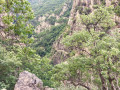
A lovely, short and very scenic route through the Carança Gorges. This walk offers multiple options up to the suspension footbridge, meaning you can do a circular route (and return to the starting point or switch to the other bank) at several points.Moderator’s note: some people have got lost on this hike; see reviews
Carança Gorges
 11.45 mi
+5,282 ft
-5,282 ft
9h 50
Difficult
Departure from Canaveilles (Pyrénées-Orientales)
11.45 mi
+5,282 ft
-5,282 ft
9h 50
Difficult
Departure from Canaveilles (Pyrénées-Orientales)
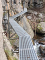
A magnificent hike between gorges and mountains. Aerial passages, footbridges and rope bridges are guaranteed on this route. Do not attempt this route in rainy or snowy weather.
Please note: the elevation gain is overestimated by the software. The total elevation gain is 1,100 metres.
Carançà Gorges - Abri de la Balmère AR (return via the upstream ledge)
 7.14 mi
+3,363 ft
-3,363 ft
6h 15
Difficult
Departure from Thuès-Entre-Valls (Pyrénées-Orientales)
7.14 mi
+3,363 ft
-3,363 ft
6h 15
Difficult
Departure from Thuès-Entre-Valls (Pyrénées-Orientales)
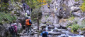
In summer, you will be looking for coolness and a few thrills: for you, there is a stream, gorges, undergrowth and a few fun passages on footbridges and monkey bridges (return trip). You can then return via a narrow ledge, which is not recommended for young children, people with poor footwear or those prone to vertigo.
(There is an alternative route via the downstream ledge, which is the most vertiginous).