Ayguatébia-Talau and the Vallée du Feu

A beautiful, unspoilt hike through the Garrotxes Valley, starting from Ayguatébia.

Details

24435579
Creation:
Last update:
Last review:
  • Walking
    Activity: Walking
  • ↔
    Distance: 4.38 mi
  • ◔
    Average duration: 3h 05 
  • ▲
    Difficulty: Moderate

  • ⚐
    Back to start: Yes
  • ↗
    Ascent: + 1,214 ft
  • ↘
    Descent: - 1,224 ft

  • ▲
    Highest point: 4,400 ft
  • ▼
    Lowest point: 3,369 ft

Description of the walk

Park in the Ayguatébia car park (5–6 spaces) on the main square on the road to Olette.

(S/E) From the car park, head east along Carrer de las Voltas (there’s a sign to help you).
About ten metres further on, the tarmac turns into a footpath; take this, heading down to the right.
Walk along the balcony path for just over a kilometre before reaching a series of hairpin bends.

(1) Descend via several hairpin bends of varying lengths before joining the D4c road.

(2) Take the road on the right. Cross the River Pujalts and stay on the road for just over 500 metres before leaving it at a junction.

(3) Take the path up to the right towards Talau. About a hundred metres further on, cross the track and head straight ahead to continue climbing.
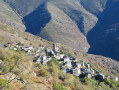
Further on, the gradient levels out and you finally reach Talau (a hamlet that has been part of Ayguatébia since 1983).

(4) Take in the superb panoramic view before taking the road to the right (there’s a lodge here with a refreshment bar if you fancy a short break).
Walk past the Romanesque Church of Saint-Étienne and stay on the road until you reach a junction indicating that you should leave the D4d.

(5) Take the path leading uphill to the left. After this slope, the path winds through the woodland for about 1 km (shaded section) before rejoining the road.

(6) Cross the road to take the signposted path leading off to the left. Cross the River Pujalts, then head back up to Ayguatébia via Rue du Lavoir and the Moulin Del Xic (recently renovated). This will be the final climb before reaching the Ayguatébia car park (S/E).


Waypoints

  1. S/E : mi 0 - alt. 4,337 ft - Ayguatébia car park
  2. 1 : mi 0.86 - alt. 3,868 ft - Start of the hairpin bends
  3. 2 : mi 1.38 - alt. 3,389 ft - D4c road - Rivière de Cabrils
  4. 3 : mi 1.83 - alt. 3,547 ft - End point: D4c road
  5. 4 : mi 2.69 - alt. 4,344 ft - Talau
  6. 5 : mi 3.3 - alt. 4,301 ft - End point: D4d road
  7. 6 : mi 3.94 - alt. 4,147 ft - D4c road
  8. S/E : mi 4.38 - alt. 4,327 ft - Ayguatébia car park

Notes

A video of the walk can be viewed via the following link: https://www.youtube.com/watch?v=Cm1IwOri...

Please note that this walk certainly lives up to its name; a hat or cap is strongly recommended, despite a few shaded sections.

In the hamlet of Talau, there is a lodge with a refreshment bar (open from April to October).

Worth a visit

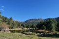
Near Ayguatébia is Lake Caudiès, which has picnic tables.

Another walk to try in Ayguatébia starts near the church.

Reviews and comments

4.4 / 5
Based on 3 reviews

Reliability of the description
4.7 / 5
Ease of following the route
4.3 / 5
Route interest
4.3 / 5
Vejapi
Vejapi

Overall rating : 4 / 5

Date of your route : Sep 29, 2025
Reliability of the description : ★★★★☆ Good
Ease of following the route : ★★★★☆ Good
Route interest : ★★★★☆ Good
Very busy route : No

A somewhat monotonous hike with a long rocky descent, the very pretty village of Ayguatébia with its wash houses and mill, and a visit to the Romanesque church of Saint-Etienne in Talau.

Machine-translated

Mangione Patrice
Mangione Patrice

Overall rating : 4.7 / 5

Date of your route : Aug 21, 2023
Reliability of the description : ★★★★★ Very good
Ease of following the route : ★★★★☆ Good
Route interest : ★★★★★ Very good
Very busy route : No

A descent where you need to watch your step and stay focused. A challenging climb with magnificent views. It takes 3 hours to complete the route. Very enjoyable

Machine-translated

Nico de Lyon
Nico de Lyon

Overall rating : 4.7 / 5

Date of your route : Jul 05, 2023
Reliability of the description : ★★★★★ Very good
Ease of following the route : ★★★★★ Very good
Route interest : ★★★★☆ Good
Very busy route : No

A lovely route that takes you on a tour of the charming village of Ayguatébia, which certainly lives up to its name (water from springs, rivers, streams and wetlands flows in abundance here).

Machine-translated

Other walks in the area

For more walks, use our search engine .

The GPS track and description are the property of this route's author. Please do not copy them without permission.