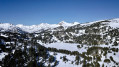
Circular walk from Lake Matemale

Discover a pleasant walk suitable for all, combining the mysteries of the Forêt de la Matte with the historic charm of the Tour de Creu, for a chance to immerse yourself in the heart of nature and local heritage.

Details

68217914
Creation:
Last update:
Last review:
  • Walking
    Activity: Walking
  • ↔
    Distance: 6.00 mi
  • ◔
    Average duration: 3h 10 
  • ▲
    Difficulty: Easy

  • ⚐
    Back to start: Yes
  • ↗
    Ascent: + 427 ft
  • ↘
    Descent: - 397 ft

  • ▲
    Highest point: 5,089 ft
  • ▼
    Lowest point: 4,767 ft

Description of the walk

Park in the Lake Matemale car park, situated just past the dam.

(S/E) From the car park, follow theGRP® du Capcir Nord/Est towards Matemale. Walk past the dam and, at the junction, take the path on the left running parallel to the road. Stroll through the forest before reaching a road.

(1) Cross carefully and continue straight ahead before taking the path on the right. Further on, pass under the road bridge (view of Matemale) and join a road. Follow it to the left and you’ll reach the village entrance sign.

(2) Head downhill to the left (still on theGRP®) then climb back up to the junction at the corner of the church. Turn right into a sloping lane that runs alongside the church and, at the next junction (by a restaurant), take theGRP® to the left, Rue de la Mouline, and carry on straight ahead along the road. Leave the village and head towards the junction at the Pont de la Molina.

(3) Leave the road and turn right, crossing the bridge over the River Aude, then follow the forest track (still on theGRP®). You’ll come to a junction (signposted ‘Chemin Vauban’).

(4) Leave theGRP® and continue left towards the Tour de Creu until you reach it.

(5) Before continuing, take a moment to enjoy the view and note the restoration work that now allows visitors to climb to the top of the tower. Continue downhill to the left along a track and follow it all the way to a four-way junction where you’ll find the “Camps Grans” sign.

(6) Turn left towards “Planal de Dalt”. Ignore any side tracks on this stretch and join a road (D118).

(7) Cross it carefully and continue straight ahead on the “Voie Royale”. Quickly ignore this track as it branches off to the right and carry on straight ahead until you reach a multi-way junction marked “Domaine de la forêt de la Matte”.

(8) Turn left towards Lac de Matemale and stay on the track on the right until you reach a road (D52).

(9) Cross it carefully and continue straight ahead on the route (marked in yellow) until you reach a three-way junction. Turn left and return to the car park (S/E).

Waypoints

  1. S/E : mi 0 - alt. 5,059 ft - Car park - Lac de Matemale
  2. 1 : mi 0.62 - alt. 5,059 ft - D52 road
  3. 2 : mi 1.24 - alt. 4,928 ft - Entrance to the village of Matemale
  4. 3 : mi 1.8 - alt. 4,833 ft - End of route - Aude (fleuve)
  5. 4 : mi 2.71 - alt. 4,885 ft - Junction
  6. 5 : mi 2.88 - alt. 4,823 ft - Tour de Creu (Torre de Creu)
  7. 6 : mi 3.63 - alt. 4,918 ft - Sign for Camps Grans
  8. 7 : mi 4.54 - alt. 5,026 ft - D118 road
  9. 8 : mi 5.19 - alt. 5,089 ft - Junction
  10. 9 : mi 5.48 - alt. 5,082 ft - D52 road
  11. S/E : mi 6 - alt. 5,059 ft - Lac de Matemale car park

Notes

Worth a visit

Explore Lake Matemale andits various activities, particularly in summer.

The village of Les Angles is a one-hour walk away along theGRP® Tour du Capcir trail.

Reviews and comments

4.8 / 5
Based on 3 reviews

Reliability of the description
5 / 5
Ease of following the route
4.7 / 5
Route interest
4.7 / 5
Celineetfrederic
Celineetfrederic

Overall rating : 5 / 5

Date of your route : Jul 15, 2026
Reliability of the description : Not used / Not applicable
Ease of following the route : ★★★★★ Very good
Route interest : ★★★★★ Very good
Very busy route : No

We use the GPS track and IGN maps, rather than the route description.
We really enjoyed this walk. It’s best to set off in the morning (there’s no shade on the first section) and carry on to the beach to have a nap in the pine forest and go for a swim in the afternoon.
The car park is pay-and-display, but there’s another one – free of charge – to the left of the road at the start of the path, before you head towards the lake.

Machine-translated

zephir2
zephir2

I will test this route when I go to Matemale in September.
I mainly use Visorando for the GPX routes (road cycling and hiking) that I already have.
I'm not interested in IGN maps.
I much prefer the free maps.

Machine-translated

Vejapi
Vejapi

Overall rating : 4.7 / 5

Date of your route : Aug 25, 2025
Reliability of the description : ★★★★★ Very good
Ease of following the route : ★★★★★ Very good
Route interest : ★★★★☆ Good
Very busy route : Yes

A lovely walk along the River Aude, through pastures and forests, the Creu tower offers an unobstructed view of the surrounding area.

Machine-translated

randolionel
randolionel
• Edited:

Overall rating : 4.7 / 5

Date of your route : Feb 24, 2025
Reliability of the description : ★★★★★ Very good
Ease of following the route : ★★★★☆ Good
Route interest : ★★★★★ Very good
Very busy route : No

Thank you once again
I’m organising two hiking trips with and for my friends
I’m using your routes to get information (profile, difficulty, timings, alternative routes, etc.)
and I use them as a reference and sometimes even as the basis for my own routes.
I’m a loyal user of your website
Yours sincerely
L LOISTRON
P.S. This is a general reply regarding the various routes, and I hope to explore them in the spring

Machine-translated

Other walks in the area

For more walks, use our search engine .

The GPS track and description are the property of this route's author. Please do not copy them without permission.