Circular route around Railleu

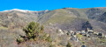
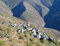
A lovely getaway to a remote and little-known corner of the Catalan Pyrenees Regional Nature Park, namely the Garrotxes and, more specifically, the village of Railleu. You can also explore the neighbouring village of Sansa on this route.

Details

6202966
Creation:
Last update:
Last review:
  • Walking
    Activity: Walking
  • ↔
    Distance: 6.87 mi
  • ◔
    Average duration: 4h 40 
  • ▲
    Difficulty: Moderate

  • ⚐
    Back to start: Yes
  • ↗
    Ascent: + 1,775 ft
  • ↘
    Descent: - 1,749 ft

  • ▲
    Highest point: 5,377 ft
  • ▼
    Lowest point: 4,334 ft

Photos

Description of the walk

From Olette, head up the D4 towards Sansa. At around 1,275 m, turn left at the Pont de Railleu, staying on the D4 and leaving the road to Sansa behind. Park in the car park near Railleu church.

(DA) From the car park, head north and turn left towards the town hall. Cross the D4 and continue straight ahead. A few metres further on, turn right, heading due north, onto the signposted path: Sansa 2.5 km. After a short climb, you’ll reach the signpost for Avellanosa

(1) Head north-west towards Sansa. Cross the Ribera de Cabrils and join the D4e road.

(2) Follow it to the left for a few hundred metres. Pass the old Blazi flour mill (with information boards) and, at the bend to the right, leave the road to take the path climbing to the left. This is a fairly challenging climb up to the junction (elevation 1442).

(3) Take the track to the left (Sansa is on the right). Cross the Ribera de Cabrils once more and follow the ridge path to the Col du Dragon (Coll del Dragó), which offers a beautiful panorama from Canigó to Pic Redoun.

(4) Carry on straight ahead and, a few metres further on, take care as the path is no longer clearly marked. We recommend keeping a close eye out for the yellow-marked posts. Continue due west to the D4 (elevation 1538).

(5) Cross this road and take the path leading off to the left, heading due south, at the signpost. Further on, cross the Rec de Fontanal Gros via a footbridge and join a track a few hundred metres further on.

(6) Follow the track to the left for about 600 metres.

(7) Leave the track and take the path that climbs to the right. Be prepared, as the climb is quite steep up to the Collada.

(8) Head straight ahead and take care on this section, where the yellow markings are very patchy, particularly as they are not present in both directions.
We recommend looking back from time to time to make sure the markings are still there
Furthermore, do not rely on the IGN map, as the route shown is not at all the same as the actual terrain.
You’ll reach a vast flat area; continue south-east to rejoin a track and the ubiquitous yellow markings, which will lead you onto the D4f road.

(9) Take the road on the left for about 300 metres.

(10) Leave the road to take the path that descends to the right, runs alongside the River Caudiès and brings you back onto the road.

(11) Head straight on to reach the Railleu car park via the Moulin del Bac, bringing this very pleasant outing to an end (S/E).

Waypoints

  1. S/E : mi 0 - alt. 4,373 ft - Railleu car park
  2. 1 : mi 0.37 - alt. 4,606 ft - L’Avellanosa
  3. 2 : mi 1.16 - alt. 4,364 ft - Take the D4e road, then cross the bridge over the - Rivière de Cabrils
  4. 3 : mi 1.61 - alt. 4,738 ft - Track
  5. 4 : mi 2.96 - alt. 5,187 ft - Coll del Dragó
  6. 5 : mi 3.27 - alt. 5,049 ft - Road: D4
  7. 6 : mi 4 - alt. 5,154 ft - Track – Clot d’Avall
  8. 7 : mi 4.38 - alt. 4,908 ft - Trail ends
  9. 8 : mi 5.01 - alt. 5,308 ft - La Collada
  10. 9 : mi 5.52 - alt. 5,233 ft - D4f road
  11. 10 : mi 5.67 - alt. 5,187 ft - Abort the route
  12. 11 : mi 5.95 - alt. 4,882 ft - Route
  13. S/E : mi 6.87 - alt. 4,373 ft - Railleu car park

Notes

You can watch a video of this walk via the following link: https://www.youtube.com/watch?v=Z9XCb0l4...

Please note that the signposting is very inconsistent between (5) and between (8) and (9)

There is a picnic table between (2) and (3).

This walk is not recommended in very hot weather.

Worth a visit

The old Blazi flour mill between (2) and (3).
Visit the village of Sansa by turning right at point (3).
You can reach the village of Caudiès-de-Conflent and its lake by turning right at point (9).
You can reach the village of Ayguatébia by turning right at point (11).

Reviews and comments

4.4 / 5
Based on 3 reviews

Reliability of the description
4.7 / 5
Ease of following the route
4 / 5
Route interest
4.7 / 5
PAT le lion
PAT le lion

Overall rating : 4.7 / 5

Date of your route : Nov 03, 2025
Reliability of the description : ★★★★★ Very good
Ease of following the route : ★★★★★ Very good
Route interest : ★★★★☆ Good
Very busy route : Yes

Beautiful scenery, easy, through forests and fields, a lovely walk overall.

Machine-translated

TRILLAS
TRILLAS

Overall rating : 4.7 / 5

Date of your route : Nov 13, 2023
Reliability of the description : ★★★★★ Very good
Ease of following the route : ★★★★☆ Good
Route interest : ★★★★★ Very good
Very busy route : No

Thank you, VISORANDO – on two or three occasions, we went the wrong way because there were no signposts, and the app got us back on the right track.
A lovely walk along a pleasant path, made even more enjoyable by the autumn colours.

Machine-translated

lolo36
lolo36

Overall rating : 4 / 5

Date of your route : Aug 06, 2021
Reliability of the description : ★★★★☆ Good
Ease of following the route : ★★★☆☆ Average
Route interest : ★★★★★ Very good
Very busy route : No

Thank you for this lovely walk in a region untouched by mass tourism!
Lovely paths and stunning views!
Railleu and Sansa are very picturesque villages.
A few comments, however, regarding the route: unless my GPS is out of order, there are a few sections that don’t match up with the actual terrain.

  • Between (1) and (2), the path I recorded is lower down and doesn’t follow the route shown on the IGN map;
  • I’ve also noticed a discrepancy just before (4);
  • between (8) and (9), my route is more winding at the start. Once you reach the flat section, the marked path on the ground first goes round it to the west, then follows the contour line to the south-west before descending gently straight down to point (10). You simply need to cross the road to take the path towards Railleu (which isn’t exactly the route shown on the IGN map either, and doesn’t run alongside the river but is higher up!).

The rest of the route is very reliable.

Machine-translated

Other walks in the area

For more walks, use our search engine .

The GPS track and description are the property of this route's author. Please do not copy them without permission.