


Refine your search for walks in Cap Corse
Cap Corse walks


 Seneca’s Tower and the menhirs of Pinzu a Vergine
 Visorando Member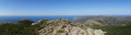
 5.86 mi
 +1,759 ft
 -1,755 ft
 4h 15
4h 15
 Difficult
 Departure from Luri (Haute-Corse)
A walk in the heights of Cap Corse. Views of the sea, the cape, the Corsican mountains and Italy in the distance. Corsica seen from above.
Customs officers' path starting from the port of Macinaggio
 6.93 mi
+738 ft
-728 ft
3h 50
6.93 mi
+738 ft
-728 ft
3h 50
 Moderate
Departure from Haute-Corse
Moderate
Departure from Haute-Corse
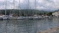
The trail starts at the northern end of the long beach of Macinaggio, covered with a thick layer of Posidonia leaves. The route, marked in yellow, follows the rugged coastline and is punctuated by two Genoese towers. Superb views of the neighbouring islands of Capraia and Elba. Some Corsican specialities, the Filles du Cap on the beach (see photos). Caution! This is an extremely fragile area with a wealth of flora and fauna.
Centuri - Sentier des Douaniers
 8.88 mi
+2,031 ft
-2,021 ft
5h 50
Moderate
Departure from Centuri (Haute-Corse)
8.88 mi
+2,031 ft
-2,021 ft
5h 50
Moderate
Departure from Centuri (Haute-Corse)
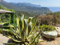
This loop starts in Centuri and follows the Sentier des Douaniers to Cap Grosso (semaphore) on the way out and returns via the ridges, passing by the Moulin Mattéï.
Seneca Tower from Luri
 8.10 mi
+2,375 ft
-2,375 ft
5h 50
Moderate
Departure from Luri (Haute-Corse)
8.10 mi
+2,375 ft
-2,375 ft
5h 50
Moderate
Departure from Luri (Haute-Corse)
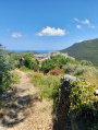
Perched at an altitude of over 500 metres, the Tower of Seneca overlooks the Col de Santa Lucia. It protected both the Pinu coastline and the coastline bordering the Luri valley on the other side of Cap Corse. To reach it, the route suggests approaching it via the ridges overlooking it to the north and returning via the village of Luri.
Monte Stello
 9.16 mi
+3,553 ft
-3,566 ft
7h 20
Difficult
Departure from Brando (Haute-Corse)
9.16 mi
+3,553 ft
-3,566 ft
7h 20
Difficult
Departure from Brando (Haute-Corse)
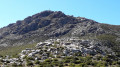
At an altitude of 1,307 metres, Monte Stello is the second highest peak in Cap Corse. This viewpoint on the central ridge of Cap Corse offers a magnificent panorama of the east and west coasts.
Round trip on the customs officers' path from Macinaggio to Barcaggio
 15.46 mi
+1,762 ft
-1,745 ft
8h 40
Difficult
Departure from Haute-Corse
15.46 mi
+1,762 ft
-1,745 ft
8h 40
Difficult
Departure from Haute-Corse
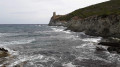
A superb coastal route where the path alternates between beaches and small climbs to Capandola Bay. The terrain changes completely as you now have to climb 130 metres to reach a small pass, with an exceptional view of the Finocchiarola Islands on one side and Barcaggio Bay on the other.
The path runs along the cliffs, descends to the Agnello Tower and then levels out to Barcaggio.
The only difficulty lies in the length of the route.
Monte Stellu via Olmeta di Capicorsu
 9.22 mi
+3,379 ft
-3,360 ft
7h 10
Difficult
Departure from Olmeta-di-Capocorso (Haute-Corse)
9.22 mi
+3,379 ft
-3,360 ft
7h 10
Difficult
Departure from Olmeta-di-Capocorso (Haute-Corse)
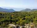
A hike in a magnificent corner of Cap Corse. Very beautiful view on both sides at the summit. From the village to the summit, a true corner of Corsica. Pure. Authentic.
Route from the Genoese Bridge to Erbalunga
2.34 mi
+607 ft
-607 ft
1h 35
 Easy
Departure from Brando (Haute-Corse)
Easy
Departure from Brando (Haute-Corse)
Climb up to see the Genoese Bridge and enjoy a view overlooking Erbalunga.
The old magnetite mine at A Ferrera
1.98 mi
+538 ft
-538 ft
1h 25
Easy
Departure from Farinole (Haute-Corse)
Climb from the village of Farinole to the old magnetite mine. Panoramic view of the Gulf of Saint-Florent and the Agriates desert.
From Tamarone to the Tour d'Agnelo
8.16 mi
+1,237 ft
-1,243 ft
4h 50
Moderate
Departure from Haute-Corse
Like a pointing finger, Cap Corse seems to point in the direction of Genoa, which was for a long time the dominant power in Corsica. The Republic left behind a series of stone towers that were intended to provide initial coastal defence.
Between Macinaghju and the island of Giraglia, four of them still stand guard. The proposed route connects them.
The Annunziata to Conchigliu trail
1.16 mi
+344 ft
-315 ft
0h 50
Easy
Departure from Barrettali (Haute-Corse)
A walk suitable for everyone, offering the chance to discover part of the heritage of the village of Barrettali.
Punta di a Filetta Suprana from the Col de Santa Lucia
2.40 mi
+722 ft
-722 ft
1h 45
Easy
Departure from Pino (Haute-Corse)
This short walk is an alternative to the ascent to the Tower of Seneca. It allows you to set off directly from the Col de Santa Lucia along a track (not a road) that is relatively easier: no scree and few exposed rocks. The path is very well maintained; it follows the ridge along the watershed, offering breathtaking views over the Luri valley with the Island of Elba in the background and, at times, even Italy. On the final stretch, you can also enjoy the view to the west and of Seneca’s Tower on the other side of the pass. As this is a round trip, the duration can easily be adjusted to suit your preferences. Much of the route is shaded by the maquis.
Mausoleo and Silgaggia as seen from Erbalunga
3.92 mi
+997 ft
-991 ft
2h 40
Moderate
Departure from Brando (Haute-Corse)
With its crumbling Genoese tower, picturesque narrow streets, vaulted passageways and fishing harbour, the village of Erbalunga is a renowned holiday destination, brimming with charm and poetry. Situated on the east coast of Cap Corse, this picturesque listed site has inspired many local painters who have come to capture its spirit on canvas. Brando’s marina welcomes you to a setting suspended in time. From the village of Erbalunga, you’ll head inland from the coast into the Corsican mountains towards Silgaggia, then Castello and finally Mausoleo, before returning to Erbalunga.
From Tamarone Beach to the Santa Maria Tower
 2.47 mi
+180 ft
-151 ft
1h 15
Easy
Departure from Haute-Corse
2.47 mi
+180 ft
-151 ft
1h 15
Easy
Departure from Haute-Corse
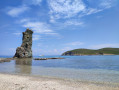
This route allows you to easily walk there and back between the Tamarone Beach car park and the Santa Maria Tower. This walk is suitable for families. There are no difficult sections along the route.
From Barcaggio to the Cap Corse signal box
 6.94 mi
+1,266 ft
-1,247 ft
4h 05
Moderate
Departure from Ersa (Haute-Corse)
6.94 mi
+1,266 ft
-1,247 ft
4h 05
Moderate
Departure from Ersa (Haute-Corse)
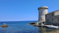
You’ll be walking along the coastal path between Barcaggio and the Cap Corse signal station, passing via Monte Riuzzulu. The path is well-marked and signposted; the main challenge is the climb after Tollare, though it’s not particularly steep and there’s no rock climbing involved.
From Barcaggio to the Santa Maria Tower
 8.71 mi
+1,017 ft
-984 ft
4h 25
Moderate
Departure from Ersa (Haute-Corse)
8.71 mi
+1,017 ft
-984 ft
4h 25
Moderate
Departure from Ersa (Haute-Corse)
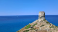
You’ll hike towards Cap Corse and the Genoese tower of Santa Maria, setting off from the small village of Barcaggio and passing by the Genoese tower of Agnelo, with breathtaking views of the gulf and Giraglia Island. A few hundred metres past the Santa Maria Tower, you’ll see the chapel of the same name.