From Tamarone Beach to the Santa Maria Tower

This route allows you to easily walk there and back between the Tamarone Beach car park and the Santa Maria Tower. This walk is suitable for families. There are no difficult sections along the route.

Details

100152608
Creation:
Last update:
Last review:
  • Walking
    Activity: Walking
  • ↔
    Distance: 2.47 mi
  • ◔
    Average duration: 1h 15 
  • ▲
    Difficulty: Easy

  • ⚐
    Back to start: Yes
  • ↗
    Ascent: + 180 ft
  • ↘
    Descent: - 151 ft

  • ▲
    Highest point: 289 ft
  • ▼
    Lowest point: 164 ft

Photos

Description of the walk

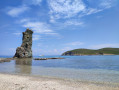
The track leading to the Tamarone Beach car park is quite long, with a mix of rocks, potholes and dirt, so take your time to avoid damaging your vehicle. Once parked, you can enjoy the magnificent Tamarone Beach.

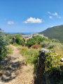
(S/E) Take the Sentier des Douaniers. The path is well-marked. There’s little elevation gain, but the ground is quite hard and sometimes rocky.

(1) You’ll pass through a wooden gate – please make sure you close it properly.

(2) You then walk past the chapel.

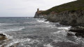
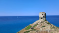
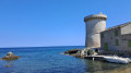
(3) Finally, you’ll reach the Santa Maria Tower (largely in ruins), which is magnificent. Here, you can once again enjoy a beautiful beach. To return to the car park, follow the path in the opposite direction (S/E).

Waypoints

  1. S/E : mi 0 - alt. 174 ft - Car park
  2. 1 : mi 0.24 - alt. 180 ft - Gate
  3. 2 : mi 0.91 - alt. 184 ft - Chapel
  4. 3 : mi 1.23 - alt. 187 ft - Santa Maria Tower
  5. S/E : mi 2.47 - alt. 174 ft - Car park

Notes

Make sure you bring sturdy shoes, your swimwear, something to drink and sun protection (there’s hardly any shade).

Worth a visit

The chapel, the beaches.

Other walks in the area

For more walks, use our search engine .

The GPS track and description are the property of this route's author. Please do not copy them without permission.