


Refine your search for walks in Brignogan-Plage
Brignogan-Plage walks


 Autour de Plounéour-Trez
 Visorando Member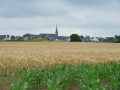
 5.25 mi
 +52 ft
 -52 ft
 2h 25
2h 25
 Easy
Easy
 Departure from Plounéour-Trez (Finistère)
From the village of Plounéour-Trez, take theGR®®34 trail, first following the Goulven beach, which changes with the tides, then opening onto the open sea with a view of Île de Batz on the horizon to the north-east.The return journey winds its way through the fields. Beautiful dolmen to discover.
Around Brignogan
 Association / Club / Walk leader
 4.19 mi
+69 ft
-66 ft
2h 00
Easy
Departure from Brignogan-Plage (Finistère)
4.19 mi
+69 ft
-66 ft
2h 00
Easy
Departure from Brignogan-Plage (Finistère)
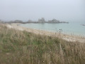
Hike along the coast on theGR®34and inland to see the megaliths.
Between Ménéham and Pointe de Pontusval
 4.98 mi
+56 ft
-56 ft
2h 20
Easy
Departure from Kerlouan (Finistère)
4.98 mi
+56 ft
-56 ft
2h 20
Easy
Departure from Kerlouan (Finistère)
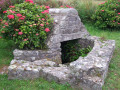
Between sea and land, this route follows theGR®34to the Pontusval Lighthouse at the tip of Brignognan, where you will also find the Chapelle Sain-Pol chapel and an old customs guardhouse perched atop a large granite boulder. The return journey takes you along paths and small country roads, passing by the Chapelle Saint-Guénal chapel.
Ménéham
 2.66 mi
+23 ft
-23 ft
1h 15
Easy
Departure from Kerlouan (Finistère)
2.66 mi
+23 ft
-23 ft
1h 15
Easy
Departure from Kerlouan (Finistère)
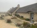
A short walk combining the seaside with its large rocks and a stretch of countryside also dotted with large granite boulders here and there. The walk ends in the village of Ménéham, which has been restored to its former state and offers the chance to visit a few craft workshops.
Between land and sea in Kerlouan
 6.97 mi
+69 ft
-69 ft
3h 15
6.97 mi
+69 ft
-69 ft
3h 15
 Moderate
Departure from Kerlouan (Finistère)
Moderate
Departure from Kerlouan (Finistère)
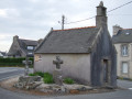
This walk showcases various aspects of the commune of Kerlouan: its countryside with its many hamlets and its rocky coastline.
Along the route, you’ll notice the many stone crosses dotted across the countryside, as well as the enormous granite boulders characteristic of this region.
The route passes near the site of Ménéhan, a former village of farmers, sailors and seaweed gatherers, and the Croazou Chapel, where numerous stone crosses of various styles have been gathered together.
Countryside and sea to the west of Kerlouan
 5.43 mi
+59 ft
-59 ft
2h 35
Easy
Departure from Kerlouan (Finistère)
5.43 mi
+59 ft
-59 ft
2h 35
Easy
Departure from Kerlouan (Finistère)
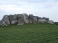
The route follows the coast and through the countryside in the western part of Kerlouan.
Along the route, the Ménéham site, the Saint-Égarec Chapel and its underground fountain, as well as the Kervizouarn fountain.
Another aspect of this landscape, dotted with impressive large granite boulders.
In the footsteps of Saint-Goulven
 2.03 mi
+112 ft
-112 ft
1h 00
Easy
Departure from Goulven (Finistère)
2.03 mi
+112 ft
-112 ft
1h 00
Easy
Departure from Goulven (Finistère)
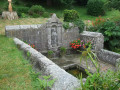
This small coastal village, nestled at the far end of the bay, is linked to the life of Saint Goulven. The central stained-glass window in the parish church depicts various episodes from his life. In addition to the church, there are two other sites associated with him: the Pénity Chapel, where he is said to have retired to escape the crowds, and its miraculous fountain.
The Eastern Abers: from Guissény to Portsall
 56.52 mi
+1,516 ft
-1,562 ft
4 days
56.52 mi
+1,516 ft
-1,562 ft
4 days
 Difficult
Departure from Guissény (Finistère)
Difficult
Departure from Guissény (Finistère)
A coastal walk following the GR®34 for the most part. The paths are well maintained and the signposting is adequate. The route offers beautiful views of the sea, the islands and the rocks, which vary with the tide but are always a pleasure to behold.
Guissény - LiLia
15.02 mi
+226 ft
-266 ft
7h 05
Difficult
Departure from Guissény (Finistère)
Hike along the GR®34, on a coastal path between Guisseny and Plouguerneau Lilia. A feast for the eyes; you’ll never tire of the ever-changing landscapes shaped by the tides. Magnificent white sandy beaches that invite you to sunbathe. The rocks, sculpted by the elements, evoke a surrealist bestiary.
Circular between Guissény and Beg ar Skeiz
 6.78 mi
+46 ft
-46 ft
3h 10
Easy
Departure from Guissény (Finistère)
6.78 mi
+46 ft
-46 ft
3h 10
Easy
Departure from Guissény (Finistère)
A circular without difficulty (but take care along the roads), offering views of Anse de Tresseny and Pointe de Beg ar Skeiz, as well as a few other points of interest. Don't miss the parish enclosure.
Around the Curnic Pond in Guissény
 3.97 mi
+20 ft
-20 ft
1h 50
Easy
Departure from Guissény (Finistère)
3.97 mi
+20 ft
-20 ft
1h 50
Easy
Departure from Guissény (Finistère)
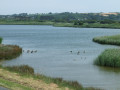
This route combines a walk along the seafront at Vougot Beach with a crossing of the marshy area of the Curnic Pond.
The return journey is along the dyke between the lake and the sea.
Kerema Dunes from Paluden Hir
 11.92 mi
+23 ft
-23 ft
5h 30
Moderate
Departure from Plouescat (Finistère)
11.92 mi
+23 ft
-23 ft
5h 30
Moderate
Departure from Plouescat (Finistère)
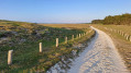
This is a longer walk than route no. 10, “Les Chardons bleus”, in the guidebook “Le Pays du Léon à pied” published by the FFRP. The route passes along the famousGR®34. The Ker Emma dune area is magnificent.
Apart from the length, there are no difficulties; the sand on the path is compacted, with a few exceptions.
The Korrigans Trail in Plouescat
 4.06 mi
+98 ft
-108 ft
1h 55
Easy
Departure from Plouescat (Finistère)
4.06 mi
+98 ft
-108 ft
1h 55
Easy
Departure from Plouescat (Finistère)
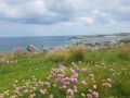
This walk, which I could have called "Between Land and Sea on the Plouescat Coast", will allow you to discover the countryside bordering the sea on one side and the coastal path, part of theGR®34, which runs along the sea on the other.
Depending on the season, you will have the opportunity to discover the artichoke and onion fields of the legendary coast. Enjoy the pleasant fragrance of the flower-filled fields and the ocean stirred by the wind from the sea.
A journey through the Aber Wrac’h valley from Lanarvily
3.47 mi
+302 ft
-331 ft
1h 50
Easy
Departure from Lanarvily (Finistère)
This pleasant circular route starting from Lanarvily offers a refreshing and verdant immersion in the heart of the inland landscapes of Léon, following the upper reaches of the Aber Wrac’h. At this point near Lanarvily, the Aber Wrac’h is unquestionably a river (or a ‘rivière’ in everyday language), and not a ria. The watercourse flows through a steep-sided valley in a strictly fluvial bed (the water here is exclusively fresh, with no tidal range or estuarine influence). The maritime influence only begins to make itself felt much further downstream. This route therefore invites you to discover an authentic riverine and woodland landscape!
Walk through the village of Ploudaniel
 1.52 mi
+23 ft
-23 ft
0h 45
Easy
Departure from Ploudaniel (Finistère)
1.52 mi
+23 ft
-23 ft
0h 45
Easy
Departure from Ploudaniel (Finistère)
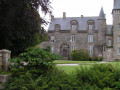
The village of Ploudaniel, a rural commune in northern Finistère, can be spotted from afar by its slender bell tower with three galleries. This short route takes you around the village, highlighting its heritage and green surroundings.
The Devil's Bridge over the Aber Wrac'h
 3.64 mi
+207 ft
-190 ft
1h 50
Moderate
Departure from Plouguerneau (Finistère)
3.64 mi
+207 ft
-190 ft
1h 50
Moderate
Departure from Plouguerneau (Finistère)
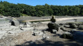
A truly exceptional route along the banks of the Aber Wrac'h, surrounded by herons and egrets. Granite boulders rise out of the ground and oak trees cling to the small cliffs of brownish-yellow silt. Be careful, this scenery has to be earned as the bank is very muddy and slippery. Be sure to wear waterproof shoes or boots and bring walking sticks to avoid slipping. Check the tide times carefully and plan to set off two hours before high tide. As a guide, it took us 1 hour and 15 minutes to reach the Devil's Bridge.
Autour de l'Aber Benoît depuis Plouvien
 10.33 mi
+381 ft
-351 ft
5h 05
Moderate
Departure from Plouvien (Finistère)
10.33 mi
+381 ft
-351 ft
5h 05
Moderate
Departure from Plouvien (Finistère)
Ce parcours suit en partie celui du Rand'abers 11 en sens inverse. Il vous fera découvrir de beaux paysages de campagne et vous emmènera le long de l'Aber Benoît et ses nombreux moulins à eau.