Between land and sea in Kerlouan

This walk showcases various aspects of the commune of Kerlouan: its countryside with its many hamlets and its rocky coastline.
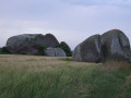
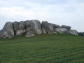
Along the route, you’ll notice the many stone crosses dotted across the countryside, as well as the enormous granite boulders characteristic of this region.
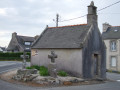
The route passes near the site of Ménéhan, a former village of farmers, sailors and seaweed gatherers, and the Croazou Chapel, where numerous stone crosses of various styles have been gathered together.

Details

23333148
Creation:
Last update:
Last review:
  • Walking
    Activity: Walking
  • ↔
    Distance: 6.97 mi
  • ◔
    Average duration: 3h 15 
  • ▲
    Difficulty: Moderate

  • ⚐
    Back to start: Yes
  • ↗
    Ascent: + 69 ft
  • ↘
    Descent: - 69 ft

  • ▲
    Highest point: 75 ft
  • ▼
    Lowest point: 10 ft
  • ⚐ Country: France
  • ⚐ City: Kerlouan (29890)
  • ⚑
    Start/End: N 48.644665° / W 4.367314°
  • ❏
    IGN map(s): Ref. 0416ET, 0515ET
  • Hour-by-hour weather

Photos

Description of the walk

Park in the car park at Kerlouan Town Hall.

(S/E) With your back to the car park, cross the main road at the pedestrian crossing and head towards the Sainte-Anne Chapel, which served as the parish church for three hundred years.

Blue signposting

Go round the chapel on the left, turn left into Rue du Commandant Toul, then right into Rue Sainte-Anne. When the road turns at a right angle, continue along a path that leads to the hamlet of Kerroual.

(1) On leaving the hamlet, turn right onto the path between the fields leading towards the water tower. This path turns left, then right, and left again to go round the water tower: a viewpoint over the countryside and the coast. Continue due west to cross a road at the hamlet of Kerisquillien.

(2) Walk about a hundred metres along the road and turn right onto a new path which leads to a wetland area and the Étang de la Digue (information boards explaining how the sluice gate works, and detailing the local flora and fauna).

(3) Continue to the right along a small road, then turn left to cross a small car park and climb up the dune.

GR34 marked in white and red + blue markings

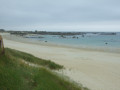
(4) Turn right, walk along Nodéven Beach, pass a small car park and continue along the seafront on the path adapted for people with reduced mobility. Walk round Ménéham (view of the famous guardhouse nestled between two imposing granite boulders) and arrive at the Pors Doun sea wall.

(5) Continue overlooking the large Ménéham Beach, pass a small car park reserved for harbour users, then reach a larger car park with an information board. Continue for a good hundred metres until you reach a signpost.

Blue markings

(6) Leave the coast and theGR®34and head for Impasse du Phare, signposted as a no-entry road except for residents. Continue along this small road which passes through the hamlet of Kerzenval (with a view to the left of Pontusval Lighthouse and Saint-Pol Chapel, located in the commune of Brignogan).

(7) As you leave the hamlet, near a beautiful stone cross, leave the road and take the path opposite, which joins a tarmac section at a place called Rohou. Continue until you reach a crossroad.

(8) First turn right then left onto a new path between the fields, then turn right towards the hamlet of Kergoloc.

(9) Follow the small road to the right and, at the next junction, turn right then left towards Keriot to reach another wayside cross.

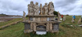
(10) Turn left onto a grassy track which leads onto a small road serving the local homes. At the Fork in the road, continue on to the Croazou Chapel. Take the time to walk all the way round it to admire the seven stone crosses that adorn it. Turn left onto the road and follow it for about a hundred metres until you reach another track.

(11) Turn right onto this farm track, which, further on, crosses a small road and continues to a street just before the cemetery, which you walk alongside.

(12) Turn right into Rue du Docteur Lemoine, then left into Rue de Saint-Brévalaire to go round the Church of Saint-Brévalaire (note the elegant 47-metre-high bell tower). Cross a street, walk past the Chapel of Sainte-Anne and return, on the left, to the town hall car park (S/E).

Waypoints

  1. S/E : mi 0 - alt. 26 ft - Car park at Kerlouan Town Hall
  2. 1 : mi 0.47 - alt. 49 ft - The hamlet of Kerroual
  3. 2 : mi 1.17 - alt. 46 ft - The hamlet of Querisquillien
  4. 3 : mi 1.69 - alt. 20 ft - Small road
  5. 4 : mi 1.91 - alt. 23 ft - Coastal path - Ménéham
  6. 5 : mi 2.6 - alt. 30 ft - Pors Doun sea wall
  7. 6 : mi 3.61 - alt. 30 ft - Signpost
  8. 7 : mi 4.13 - alt. 59 ft - Leaving the hamlet of Kerzenval
  9. 8 : mi 4.58 - alt. 46 ft - Turn left/right at the crossroads
  10. 9 : mi 4.97 - alt. 52 ft - The hamlet of Kergoloc
  11. 10 : mi 5.3 - alt. 46 ft - Waymark
  12. 11 : mi 5.91 - alt. 62 ft - Junction after the Croazou Chapel - Chapelle du Croazou
  13. 12 : mi 6.68 - alt. 36 ft - Kerlouan Cemetery
  14. S/E : mi 6.97 - alt. 26 ft - Car park at Kerlouan Town Hall

Notes

A route alternating between coastal paths, country lanes and small roads between hamlets.
Between points (4) and (5), you can walk along the beach depending on the tide, or alternate between the beach and the coastal path.

Other possible starting points are near points (4) or before point (6).

Worth a visit

Always be cautious and plan ahead when you're outdoors. Visorando and the author of this route cannot be held responsible for any accidents occurring on this route.

The GR® and PR® markings are the intellectual property of the Fédération Française de Randonnée Pédestre.

Reviews and comments

4.2 / 5
Based on 4 reviews

Reliability of the description
3.8 / 5
Ease of following the route
4.5 / 5
Route interest
4.3 / 5
Catxu
Catxu

Overall rating : 3.7 / 5

Date of your route : Aug 08, 2025
Reliability of the description : ★★★☆☆ Average
Ease of following the route : ★★★★★ Very good
Route interest : ★★★☆☆ Average
Very busy route : No

Hello, very nice walk by the sea, large rocks, turquoise sea, but as the weather was beautiful, there were lots of people on the beaches, especially at the Pontusval lighthouse. If you want to do a loop, it's true that it's interesting to go inland. But nothing exceptional. Just the little chapel at Croazou, which has the distinction of being the smallest chapel in Finistère. 😉 It dates back to 1832.

Machine-translated

Yann PLAIS
Yann PLAIS

Overall rating : 3.7 / 5

Date of your route : Dec 18, 2023
Reliability of the description : ★★★☆☆ Average
Ease of following the route : ★★★★☆ Good
Route interest : ★★★★☆ Good
Very busy route : No

Between 11 and 12, at the left-hand bend in the road you’re following, you need to turn right onto a track, which becomes a road just before the cemetery. The description in the guidebook doesn’t seem to match the reality, in my view. The map, however, appears to be correct.
The countryside doesn’t really inspire me (fields of cabbages, etc.). The highlights: the countless enormous boulders scattered everywhere, a few beautiful old houses, the coast, of course, and the village of Meneham. Unsurprisingly, the two churches in the village and the chapel at Croaziou were closed.

Machine-translated

Fabienne bzh
Fabienne bzh

Overall rating : 4.3 / 5

Date of your route : Jun 26, 2023
Reliability of the description : ★★★★☆ Good
Ease of following the route : ★★★★☆ Good
Route interest : ★★★★★ Very good
Very busy route : No

It’s always a pleasure to follow the walks on Visiorando

Machine-translated

SCHWARTZ
SCHWARTZ

Overall rating : 5 / 5

Date of your route : Sep 21, 2022
Reliability of the description : ★★★★★ Very good
Ease of following the route : ★★★★★ Very good
Route interest : ★★★★★ Very good
Very busy route : Yes

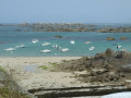
A lovely walk that alternates between country lanes winding through the fields of Léon and the coastal path, which opens out onto a splendid seaside landscape of rocks, golden sands and colourful boats. In fine weather, the water is a clear, translucent blue – it could almost make you think you’re on the islands of the Pacific!

Machine-translated

Other walks in the area

For more walks, use our search engine .

The GPS track and description are the property of this route's author. Please do not copy them without permission.