


Refine your search for walks in Bressuire
Bressuire walks


 A walk around Bressuire Castle via the green corridor
 Visorando Member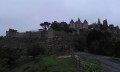
 2.55 mi
 +194 ft
 -190 ft
 1h 20
1h 20
 Easy
Easy
 Departure from Bressuire (Deux-Sèvres)
A pleasant walk suitable for children around Bressuire Castle (11th–19th centuries)
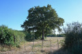
Explore the bocage countryside around the old Clessé railway station
 7.27 mi
+233 ft
-210 ft
3h 35
7.27 mi
+233 ft
-210 ft
3h 35
 Moderate
Departure from Clessé (Deux-Sèvres) (Deux-Sèvres)
Moderate
Departure from Clessé (Deux-Sèvres) (Deux-Sèvres)
This walk allows you to discover the varied landscapes of the Gâtine bocage: paths winding through hedgerows and meadows, woods and small ponds. The start and finish are on the Voie Verte, the former Parthenay–Bressuire railway line, which has been converted into a walking route. You can see the old Clessé station there, with its buildings in the typical railway style.
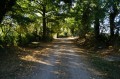
Puy-Thareau – Les Roches – Saint-Jean circular loop
 6.52 mi
+279 ft
-305 ft
3h 15
Moderate
Departure from Saint-André-sur-Sèvre (Deux-Sèvres)
6.52 mi
+279 ft
-305 ft
3h 15
Moderate
Departure from Saint-André-sur-Sèvre (Deux-Sèvres)
A discovery walk along the sunken paths of the bocage. These tracks and paths, once used to travel from one hamlet to another, were cleared some twenty years ago by local organisations and residents of the commune of Saint-André-sur-Sèvre. They have since been regularly maintained by these same people.
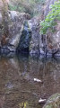
Vallée du Pressoir and Cascade de Pommiers
 5.45 mi
+200 ft
-213 ft
2h 40
Easy
Departure from Mauzé-Thouarsais (Deux-Sèvres)
5.45 mi
+200 ft
-213 ft
2h 40
Easy
Departure from Mauzé-Thouarsais (Deux-Sèvres)
The Ruisseau du Pressoir stream flows through a narrow, deep valley marked by the Cascade de Pommiers waterfall. Some steep slopes overlooking the stream from a height of around 40 metres make this wild and picturesque valley a unique natural environment in the Thouarsais region.
Forêt de l’Absie and Bois des Gâts
 Association / Club / Walk leader
 6.90 mi
+243 ft
-246 ft
3h 25
Moderate
Departure from L'Absie (Deux-Sèvres)
6.90 mi
+243 ft
-246 ft
3h 25
Moderate
Departure from L'Absie (Deux-Sèvres)
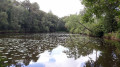
Despite a few sections on small tarmac roads, you’ll enjoy the shade and coolness of this route, which mostly follows paths and sunken lanes through forests of centuries-old trees.
Pressoir and Thouet valleys from Sainte-Radegonde
 12.41 mi
+817 ft
-794 ft
6h 25
12.41 mi
+817 ft
-794 ft
6h 25
 Difficult
Departure from Sainte-Radegonde (Deux-Sèvres) (Deux-Sèvres)
Difficult
Departure from Sainte-Radegonde (Deux-Sèvres) (Deux-Sèvres)
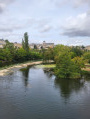
Route passing through the Vallée du Pressoir (classified as a Natura 2000 site since March 2025) then the left bank of the Thouet valley from Pommiers to Sainte-Radegonde. Pass through Saint-Jacques-de-Thouars on the left bank of the Thouet, then Saint-Jean-de-Thouars, the Cirque de Missé and return to Thouars on the right bank of the Thouet via the GR®36. The hike also offers views of the town of Thouars, with its historic monuments and rich heritage.
Left bank of the Thouet from Sainte-Radegonde to Missé
 12.03 mi
+682 ft
-663 ft
6h 10
Difficult
Departure from Sainte-Radegonde (Deux-Sèvres) (Deux-Sèvres)
12.03 mi
+682 ft
-663 ft
6h 10
Difficult
Departure from Sainte-Radegonde (Deux-Sèvres) (Deux-Sèvres)
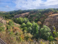
Leaving Sainte-Radegonde, you will discover the Pressoir valley, newly classified as a Natura 2000 nature reserve, then the west and south facades of Thouars, located on the promontory with the Thouet river flowing at its feet. Next, pass through Saint-Jean-de-Thouars, which overlooks the Thouet valley, the fortifications, the castle on its rocky spur, and the three large and remarkable natural meanders: Saint-Jean, Le Châtellier and Missé. Enjoy the superb valley and then enter Thouars at the foot of the castle ramparts.
The Effres Route starting from Secondigny
 4.48 mi
+135 ft
-138 ft
2h 10
Easy
Departure from Secondigny (Deux-Sèvres)
4.48 mi
+135 ft
-138 ft
2h 10
Easy
Departure from Secondigny (Deux-Sèvres)
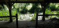
This short walk through the Secondigny countryside, along small roads and country lanes, takes you past Lac des Effres and through the Gâtine countryside, ending with a walk through the Bois de l’Aumônerie.
It is based on walk no. 7 published in a leaflet by the Parthenay Gâtine heritage department. It is partly signposted: look for the ‘Blue Circle’ signs.
Maison Neuve walking route
8.22 mi
+364 ft
-341 ft
4h 05
Moderate
Departure from Azay-sur-Thouet (Deux-Sèvres)
A walk through the Gâtinaise countryside along unpaved paths and local roads.
Idyllic route in Gâtine at Azay-sur-Thouet
6.40 mi
+285 ft
-282 ft
3h 10
Moderate
Departure from Azay-sur-Thouet (Deux-Sèvres)
A countryside walk in the Gâtine, with shaded sections through copses and a few high points offering views of the bocage landscape.
Around Azay-Sur-Thouet
6.07 mi
+302 ft
-279 ft
3h 05
Easy
Departure from Azay-sur-Thouet (Deux-Sèvres)
Shaded route using dirt tracks and a few sections of tarmaced local roads.
Lys Trail starting from La Chapelle-aux-Lys
 10.91 mi
+827 ft
-846 ft
5h 45
Moderate
Departure from La Chapelle-aux-Lys (Vendée)
10.91 mi
+827 ft
-846 ft
5h 45
Moderate
Departure from La Chapelle-aux-Lys (Vendée)
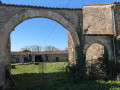
Along this route, you will discover a chapel and a wash house, and pass through the Bois des Baudonnières.
The path of the stars at La Chapelle aux Lys
 4.09 mi
+249 ft
-249 ft
2h 05
Easy
Departure from La Chapelle-aux-Lys (Vendée)
4.09 mi
+249 ft
-249 ft
2h 05
Easy
Departure from La Chapelle-aux-Lys (Vendée)
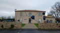
Short hike along the blue-marked Star Trail. Charming little village with everything to do with the universe, stars and planets.
La Chapelle aux Lys is a former commune that merged with two neighbouring communes on 1 January 2023 under the name of Terval.
Chemin des Pommes in Secondigny
 5.44 mi
+180 ft
-187 ft
2h 40
Easy
Departure from Secondigny (Deux-Sèvres)
5.44 mi
+180 ft
-187 ft
2h 40
Easy
Departure from Secondigny (Deux-Sèvres)
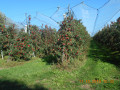
A pleasant little route through the orchards of Secondigny.
Chapelle de la Brossardière and the Tardière circular – the Rocher de Cheffois
 7.89 mi
+614 ft
-607 ft
4h 10
Moderate
Departure from La Tardière (Vendée)
7.89 mi
+614 ft
-607 ft
4h 10
Moderate
Departure from La Tardière (Vendée)
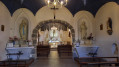
A long circular walk starting from La Tardière and ending at the Rocher de Cheffois. Discover some beautiful sites and monuments. Superb panoramic views. Paths, tracks and very narrow roads presenting no particular difficulty.
The Bois des Dortières via the Sentier des Boules in Loge-Fougereuse
 7.03 mi
+285 ft
-279 ft
3h 30
Moderate
Departure from Loge-Fougereuse (Vendée)
7.03 mi
+285 ft
-279 ft
3h 30
Moderate
Departure from Loge-Fougereuse (Vendée)
Starting from the church square, walkers will discover along the route a stunning view of the Monts de Gâtine, the Pont de la Rénardière, the Chemin de la Vigne des Boules, the Bois des Dortières, the Château de la Goujonnerie and the Chemin de l’Étang.
81 per cent of the route consists of unpaved paths or tracks.