Explore the bocage countryside around the old Clessé railway station

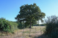
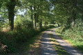
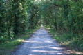
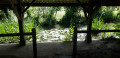
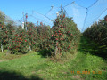
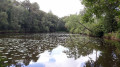
This walk allows you to discover the varied landscapes of the Gâtine bocage: paths winding through hedgerows and meadows, woods and small ponds. The start and finish are on the Voie Verte, the former Parthenay–Bressuire railway line, which has been converted into a walking route. You can see the old Clessé station there, with its buildings in the typical railway style.

Details

n°3749640
Creation:
Last update:
Last review:
  • Walking
    Activity: Walking
  • ↔
    Distance: 7.27 mi
  • ◔
    Average duration: 3h 35 
  • ▲
    Difficulty: Moderate

  • ⚐
    Back to start: Yes
  • ↗
    Ascent: + 233 ft
  • ↘
    Descent: - 210 ft

  • ▲
    Highest point: 755 ft
  • ▼
    Lowest point: 600 ft

Photos

Description of the walk

S/E: Start from the old Clessé station (private property) via the grassy path to the left of the station. After about 100 m, join the Voie Verte, the old railway line, and continue straight on towards the south-east in the same direction, passing through PN 68 and PN 67.

(1) At PN 66, turn right onto a small tarmac road.

(2) At the junction, turn left onto the D177 (second left) and follow it for about 1 km.

(3) At the next junction, turn right towards Les Glycines and La Jaunelière.

(4) At the next junction, take the path opposite, between the trees, for about 1.5 km, passing close to two bodies of water.

(5) When you reach the D143, turn right and then immediately left onto a wide path which narrows and then widens again after another pond. Carry on until you reach another path.

(6) Turn right until you reach the D19.

(7) Turn left onto the D19 (watch out for traffic) for 250 m.

(8) At the cross, turn right onto Impasse de la Maisonnette. After the last house on the right, cross the Voie Verte at PN71 and take a path (a shortcut is possible by taking the Voie Verte on the right).

(9) At the fork in the path, take the right-hand path, cross a stream and arrive at a junction.

(10) Turn right until you rejoin the D19 and the Voie Verte at kilometre marker 70.

(11) At PN70, turn left onto the Voie Verte towards Clessé station.

(12) After about 800 m, look out for a narrow path on the left (keep your eyes peeled!) which leads back to a track running parallel to the Voie Verte, taking you back to the starting point (S/E).

Waypoints

  1. S/E : mi 0 - alt. 663 ft - The former Clessé railway station
  2. 1 : mi 1.43 - alt. 745 ft - PN66 La Couaillère
  3. 2 : mi 1.67 - alt. 755 ft - D177 road
  4. 3 : mi 2.31 - alt. 699 ft - Les Glycines junction
  5. 4 : mi 2.89 - alt. 732 ft - Crossroads near La Jaunelière
  6. 5 : mi 3.75 - alt. 676 ft - Junction with the D143
  7. 6 : mi 5.03 - alt. 676 ft - Turn right
  8. 7 : mi 5.31 - alt. 702 ft - D19 road
  9. 8 : mi 5.48 - alt. 682 ft - Cross
  10. 9 : mi 6 - alt. 614 ft - Crossroads
  11. 10 : mi 6.31 - alt. 646 ft - Turn right
  12. 11 : mi 6.67 - alt. 686 ft - PN70 Greenway
  13. 12 : mi 7.14 - alt. 663 ft - A narrow path to the left
  14. S/E : mi 7.27 - alt. 663 ft - The former Clessé railway station

Notes

An easy walk with shaded sections

Worth a visit

Nearby:
The Étangs des Mottes and the Pas de la Vierge rock at the Chapelle Saint-Laurent
The Story Garden in Hérisson

Reviews and comments

4 / 5
Based on 2 reviews

Reliability of the description
4 / 5
Ease of following the route
4 / 5
Route interest
4 / 5
LATOUR
LATOUR

Overall rating : 4 / 5

Date of your route : Apr 03, 2023
Reliability of the description : ★★★★☆ Good
Ease of following the route : ★★★★☆ Good
Route interest : ★★★★☆ Good
Very busy route : No

A peaceful and very accessible route, with no difficulties. The greenway is a bit long and not particularly interesting apart from the peace and quiet. It is, however, a pleasant walk. There are numerous ponds along the route.

Machine-translated

philouis
philouis

Overall rating : 4 / 5

Date of your route : Sep 13, 2020
Reliability of the description : ★★★★☆ Good
Ease of following the route : ★★★★☆ Good
Route interest : ★★★★☆ Good
Very busy route : No

A LOVELY, EASY HIKE WITH BEAUTIFUL PATHS AND POND.
BE CAREFUL DURING THE HUNTING SEASON – WE CAME ACROSS A FEW HUNTERS WITH THEIR DOGS, BUT EVERYTHING WENT SMOOTHLY.

Machine-translated

Other walks in the area

For more walks, use our search engine .

The GPS track and description are the property of this route's author. Please do not copy them without permission.