The Effres Route starting from Secondigny

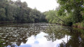
This short walk through the Secondigny countryside, along small roads and country lanes, takes you past Lac des Effres and through the Gâtine countryside, ending with a walk through the Bois de l’Aumônerie.
It is based on walk no. 7 published in a leaflet by the Parthenay Gâtine heritage department. It is partly signposted: look for the ‘Blue Circle’ signs.

Details

n°56483911
Creation:
Last update:
Last review:
  • Walking
    Activity: Walking
  • ↔
    Distance: 4.48 mi
  • ◔
    Average duration: 2h 10 
  • ▲
    Difficulty: Easy

  • ⚐
    Back to start: Yes
  • ↗
    Ascent: + 135 ft
  • ↘
    Descent: - 138 ft

  • ▲
    Highest point: 705 ft
  • ▼
    Lowest point: 564 ft
  • ⚐ Country: France
  • ⚐ City: Secondigny (79130)
  • ⚑
    Start/End: N 46.609769° / W 0.419038°
  • ❏
    IGN map(s): Ref. 1526SB
  • Hour-by-hour weather

Photos

Description of the walk

Park in the church car park.

(S/E) Walk round the church to the right via the Impasse de l’Église and you’ll reach Rue du Marché. Turn right to cross the D748 (Rue de l’Anjou) immediately at the pedestrian crossing, then head straight on towards Place du Marché. Follow Rue de la Fontaine to the right until you reach Rue du Poitou.

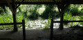
(1) Cross the road and head left until you reach Rue Georges Clemenceau, which you turn right into. Continue until you reach Rue du Lac and head straight on towards Lac des Effres, which you’ll walk along on the left-hand side. Then take the embankment on the right. At the spillway, if the water is blocking the path, head down to the left towards the small road, cross the bridge and immediately turn right to rejoin the embankment and return to the road near the toilets.

(2) Turn left towards Les Effres and La Saunerie, ignoring the first junction. Walk to the last shed at La Saunerie.

(3) Take the path on the right under the trees. At the next junction, turn right and arrive at Les Effres. Then take the first road on the left and join the D748.

(4) Cross it carefully, walk a few dozen metres to the left and turn right onto the path. Ignore the path on the left and continue to another junction.

(5) Turn right, walk alongside two ponds and reach La Pauvrelière. Continue straight on, ignoring the roads on the left, until you reach the D748 again.

(6) Cross it carefully and head straight ahead into Rue de la Mélusine. Turn right onto Chemanchère, then turn right again and head for the lake car park. Turn left onto the access road and continue to the D748.

(7) Turn right, cross the D748 carefully at the pedestrian crossing and set off along the Bois de l’Aumônerie nature trail. Follow this path until you reach the D25.

(8) Turn right. At the next junction, turn right onto Rue de la Vendée. Cross the Thouet and continue to the junction with Rue du Bosquet.

(9) Turn right onto this road and follow it to Rue des Charentes. Turn left and, at the traffic lights, turn left again to return to the car park where you started (S/E).

Waypoints

  1. S/E : mi 0 - alt. 597 ft - Church car park
  2. 1 : mi 0.2 - alt. 604 ft - Rue du Poitou
  3. 2 : mi 1.05 - alt. 574 ft - Road junction
  4. 3 : mi 1.45 - alt. 591 ft - La Saunerie, path on the right
  5. 4 : mi 2.4 - alt. 646 ft - D748
  6. 5 : mi 2.79 - alt. 705 ft - Crossroads, turn right
  7. 6 : mi 3.41 - alt. 604 ft - D748
  8. 7 : mi 3.71 - alt. 574 ft - D748
  9. 8 : mi 4.09 - alt. 577 ft - D25
  10. 9 : mi 4.3 - alt. 577 ft - Rue du Bosquet. After the Thouet (river) – a tributary of the Loire
  11. S/E : mi 4.48 - alt. 594 ft - Church car park

Notes

An easy walk, but certain sections of the route (particularly after point (3)) may be very wet in rainy weather and require suitable footwear.

You must take great care when crossing the D748 on all three occasions.

There are toilets at the start of the walk and in the car park at Lac des Effres. There are picnic tables around the lake.

In the village of Secondigny, there are all sorts of shops.

Worth a visit

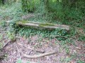
During the walk, in addition to the lake, you will come across two wash houses built on the banks of the Thouet towards the end of the route.

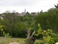
The village’s main landmark is the Church of Sainte-Eulalie, with its Breton-style porch on the south façade.

Reviews and comments

4.2 / 5
Based on 2 reviews

Reliability of the description
4 / 5
Ease of following the route
4.5 / 5
Route interest
4 / 5
User 19616880

Overall rating : 4 / 5

Date of your route : Mar 16, 2026
Reliability of the description : ★★★★☆ Good
Ease of following the route : ★★★★☆ Good
Route interest : ★★★★☆ Good
Very busy route : No

A lovely, pleasant walk in the countryside.

Machine-translated

pintaudalain170
pintaudalain170

Overall rating : 4.3 / 5

Date of your route : Aug 06, 2024
Reliability of the description : ★★★★☆ Good
Ease of following the route : ★★★★★ Very good
Route interest : ★★★★☆ Good
Very busy route : Yes

Machine-translated

Other walks in the area

For more walks, use our search engine .

The GPS track and description are the property of this route's author. Please do not copy them without permission.