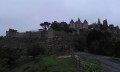
A walk around Bressuire Castle via the green corridor

A pleasant walk suitable for children around Bressuire Castle (11th–19th centuries)

Details

464276
Creation:
Last update:
Last review:
  • Walking
    Activity: Walking
  • ↔
    Distance: 2.55 mi
  • ◔
    Average duration: 1h 20 
  • ▲
    Difficulty: Easy

  • ⚐
    Back to start: Yes
  • ↗
    Ascent: + 194 ft
  • ↘
    Descent: - 190 ft

  • ▲
    Highest point: 564 ft
  • ▼
    Lowest point: 420 ft
  • ⚐ Country: France
  • ⚐ City: Bressuire (79300)
  • ⚑
    Start/End: N 46.842735° / W 0.49674°
  • ❏
    IGN map(s): Ref. 1525SB
  • Hour-by-hour weather

Photos

Description of the walk

Park near the castle entrance.

(S/E) Turn left onto Rue du Château, walk down Rue Saint Simon, then turn left onto the path that runs alongside the car park.

(1) Then take the path that passes above the old watermill and follow it to the cycle path that runs alongside Boulevard Youri Gagarine

(2) Follow this cycle path to the left for about a hundred metres and turn right onto the path that passes under the road. Follow this path to the small bridge spanning the Dolo stream.

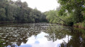
(3) As you come off the bridge, turn left and walk round the pond,

(3) Cross the small bridge again in the opposite direction, then return to the cycle path, passing under the road once more. Cross the cycle path and take the path opposite, then follow the stream to the footbridge.

(4) Cross the footbridge and walk along the southern foothills of the castle. Join Rue du Péré, then head up Rue du Bardeau towards the car park.

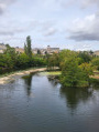
(5) Before reaching the car park, head in first to explore the castle grounds and admire the view from the castle courtyard, which overlooks the lower town, then return to the car park (S/E).

Waypoints

  1. S/E : mi 0 - alt. 561 ft - Castle car park
  2. 1 : mi 0.31 - alt. 446 ft - Path above the old mill
  3. 2 : mi 0.49 - alt. 446 ft - Cycle path on the left
  4. 3 : mi 0.73 - alt. 430 ft - Bridge over the Ruisseau le Dolo
  5. 4 : mi 1.66 - alt. 440 ft - Footbridge
  6. 5 : mi 2.06 - alt. 564 ft - A tour of the castle grounds
  7. S/E : mi 2.55 - alt. 561 ft - Castle car park

Worth a visit

Reviews and comments

4.6 / 5
Based on 3 reviews

Reliability of the description
4.7 / 5
Ease of following the route
4.3 / 5
Route interest
4.7 / 5
dd62
dd62

Overall rating : 4 / 5

Date of your route : Jun 28, 2019
Reliability of the description : ★★★★☆ Good
Ease of following the route : ★★★★☆ Good
Route interest : ★★★★☆ Good

We enjoyed this family walk

Machine-translated

MMF
MMF

Overall rating : 5 / 5

Date of your route : Sep 14, 2018
Reliability of the description : ★★★★★ Very good
Ease of following the route : ★★★★★ Very good
Route interest : ★★★★★ Very good

A varied and very enjoyable route, with the added bonus of tasting some little-known fruits in the medieval garden and a tour of the castle, where we were enchanted by the exhibition of works by Pierre-Augustin MARBOEUF.

Machine-translated

mariv
mariv
• Edited:

Overall rating : 4.7 / 5

Date of your route : Sep 03, 2018
Reliability of the description : ★★★★★ Very good
Ease of following the route : ★★★★☆ Good
Route interest : ★★★★★ Very good

I stumbled across this website by chance, and I’m really pleased with the support it’s provided!

Machine-translated

Other walks in the area

For more walks, use our search engine .

The GPS track and description are the property of this route's author. Please do not copy them without permission.