


Refine your search for walks in Armaille (ruisseau) - Affluent du Furans
Armaille (ruisseau) - Affluent du Furans walks


 Circular route via Corne Bœuf and Lac d'Armaille from Thoys
 Visorando Member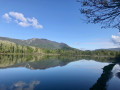
 6.05 mi
 +692 ft
 -692 ft
 3h 25
3h 25
 Easy
Easy
 Departure from Arbignieu (Ain)
This circular route goes up the Ruisseau d'Armaille, passes La Roche Percée de Corne Bœuf and runs alongside the marshes and Lacs d'Armaille, before descending through the forest. Remaining at low altitude, it can be done in any season, with only the water levels of the lakes and streams potentially complicating certain passages.
Circular walk between Le Grangeon (Thoys) and Essieux
 9.12 mi
+1,178 ft
-1,178 ft
5h 15
9.12 mi
+1,178 ft
-1,178 ft
5h 15
 Moderate
Departure from Arbignieu (Ain)
Moderate
Departure from Arbignieu (Ain)
A pleasant and refreshing route thanks to the many lakes and streams along the way. It is situated to the west of the village of Thoys, in an area of forests and marshes to the south of the Bugey. You’ll be walking through peaceful, relaxing surroundings, taking in the typical landscapes and villages of the Bugey.
Walks near Armaille (ruisseau) - Affluent du Furans
Chalet d'Arvière - Pont de La Loi
 Tourist office12.35 mi
+1,368 ft
-4,439 ft
6h 50
Tourist office12.35 mi
+1,368 ft
-4,439 ft
6h 50
 Difficult
Departure from Lochieu (Ain)
Difficult
Departure from Lochieu (Ain)
Open from 1 April to 30 November ( subject to there being no snow).
The final and sixth stage of the six-day “Grande Traversée du Jura à pied: from La Borne au Lion to Culoz” trek.
The GTJ links Mandeure (Doubs) to Culoz (Ain) in 15 to 20 days, crossing the Jura Mountains and the Haut-Jura Regional Nature Park. The route suggested here corresponds to the second half of the itinerary.
Chalet d'Arvière - Pont de La Loi
12.36 mi
+1,365 ft
-4,439 ft
6h 50
 Very difficult
Departure from Lochieu (Ain)
Very difficult
Departure from Lochieu (Ain)
Open from 1 April to 30 November – subject to snow conditions.
The section from the Chalet d’Arvière to Pont de La Loi is the sixth stage of the six-day walking tour “La GTJ from Mijoux”.
The GR®9 enters the Ain department via Mijoux, before following the spectacular ridges of the Monts-Jura, passing through the Crêt de la Neige, the highest point of the massif. It then descends towards Bellegarde-sur-Valserine, crosses the Retord plateau and then crosses the Grand Colombier. The trail continues its route to Culoz and the Rhône Valley, before leaving the Ain to reach Savoie and continuing southwards.