


Refine your search for walks in Lac d'Armaille (Saint-Germain-les-Paroisses)
Lac d'Armaille (Saint-Germain-les-Paroisses) walks


 Circular route via Corne Bœuf and Lac d'Armaille from Thoys
 Visorando Member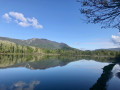
 6.05 mi
 +692 ft
 -692 ft
 3h 25
3h 25
 Easy
Easy
 Departure from Arbignieu (Ain)
This circular route goes up the Ruisseau d'Armaille, passes La Roche Percée de Corne Bœuf and runs alongside the marshes and Lacs d'Armaille, before descending through the forest. Remaining at low altitude, it can be done in any season, with only the water levels of the lakes and streams potentially complicating certain passages.
Circular walk between Le Grangeon (Thoys) and Essieux
 9.12 mi
+1,178 ft
-1,178 ft
5h 15
9.12 mi
+1,178 ft
-1,178 ft
5h 15
 Moderate
Departure from Arbignieu (Ain)
Moderate
Departure from Arbignieu (Ain)
A pleasant and refreshing route thanks to the many lakes and streams along the way. It is situated to the west of the village of Thoys, in an area of forests and marshes to the south of the Bugey. You’ll be walking through peaceful, relaxing surroundings, taking in the typical landscapes and villages of the Bugey.